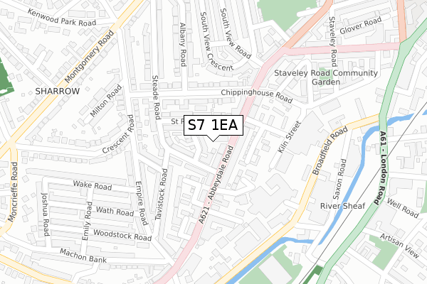
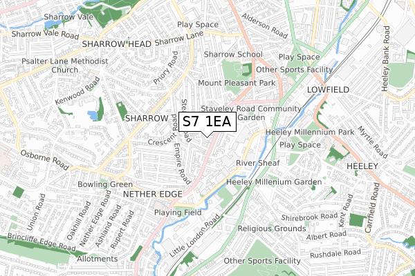
S7 1EA is located in the Nether Edge and Sharrow electoral ward, within the metropolitan district of Sheffield and the English Parliamentary constituency of Sheffield Central. The Sub Integrated Care Board (ICB) Location is NHS South Yorkshire ICB - 03N and the police force is South Yorkshire. This postcode has been in use since August 2016.


GetTheData
Source: OS Open Zoomstack (Ordnance Survey)
Licence: Open Government Licence (requires attribution)
Attribution: Contains OS data © Crown copyright and database right 2025
Source: Open Postcode Geo
Licence: Open Government Licence (requires attribution)
Attribution: Contains OS data © Crown copyright and database right 2025; Contains Royal Mail data © Royal Mail copyright and database right 2025; Source: Office for National Statistics licensed under the Open Government Licence v.3.0
| Easting | 434764 |
| Northing | 385126 |
| Latitude | 53.361889 |
| Longitude | -1.479085 |
GetTheData
Source: Open Postcode Geo
Licence: Open Government Licence
| Country | England |
| Postcode District | S7 |
➜ See where S7 is on a map ➜ Where is Sheffield? | |
GetTheData
Source: Land Registry Price Paid Data
Licence: Open Government Licence
Elevation or altitude of S7 1EA as distance above sea level:
| Metres | Feet | |
|---|---|---|
| Elevation | 80m | 262ft |
Elevation is measured from the approximate centre of the postcode, to the nearest point on an OS contour line from OS Terrain 50, which has contour spacing of ten vertical metres.
➜ How high above sea level am I? Find the elevation of your current position using your device's GPS.
GetTheData
Source: Open Postcode Elevation
Licence: Open Government Licence
| Ward | Nether Edge And Sharrow |
| Constituency | Sheffield Central |
GetTheData
Source: ONS Postcode Database
Licence: Open Government Licence
| St Ronans Road (Abbeydale Road) | Highfield | 41m |
| Chippinghouse Road (Abbeydale Road) | Highfield | 111m |
| Avenue Road (Abbeydale Road) | Nether Edge | 188m |
| Cutts Terrace (Broadfield Road) | Heeley | 249m |
| Empire Road (Abbeydale Road) | Nether Edge | 265m |
| Park Grange Croft (Sheffield Supertram) (Off Park Grange Road) | Norfolk Park | 1,646m |
| Granville Rd - Sheffield College (Supertram) (Off Granville Road) | Park Hill | 1,827m |
| Sheffield Station | 2.1km |
| Dore & Totley Station | 4.5km |
| Darnall Station | 5.1km |
GetTheData
Source: NaPTAN
Licence: Open Government Licence
| Percentage of properties with Next Generation Access | 100.0% |
| Percentage of properties with Superfast Broadband | 100.0% |
| Percentage of properties with Ultrafast Broadband | 0.0% |
| Percentage of properties with Full Fibre Broadband | 0.0% |
Superfast Broadband is between 30Mbps and 300Mbps
Ultrafast Broadband is > 300Mbps
| Percentage of properties unable to receive 2Mbps | 0.0% |
| Percentage of properties unable to receive 5Mbps | 0.0% |
| Percentage of properties unable to receive 10Mbps | 0.0% |
| Percentage of properties unable to receive 30Mbps | 0.0% |
GetTheData
Source: Ofcom
Licence: Ofcom Terms of Use (requires attribution)
GetTheData
Source: ONS Postcode Database
Licence: Open Government Licence


➜ Get more ratings from the Food Standards Agency
GetTheData
Source: Food Standards Agency
Licence: FSA terms & conditions
| Last Collection | |||
|---|---|---|---|
| Location | Mon-Fri | Sat | Distance |
| Chippinghouse Road Post Office | 17:30 | 12:30 | 136m |
| Montrose Road | 17:30 | 11:30 | 157m |
| 54 Empire Road | 17:30 | 11:00 | 208m |
GetTheData
Source: Dracos
Licence: Creative Commons Attribution-ShareAlike
The below table lists the International Territorial Level (ITL) codes (formerly Nomenclature of Territorial Units for Statistics (NUTS) codes) and Local Administrative Units (LAU) codes for S7 1EA:
| ITL 1 Code | Name |
|---|---|
| TLE | Yorkshire and The Humber |
| ITL 2 Code | Name |
| TLE3 | South Yorkshire |
| ITL 3 Code | Name |
| TLE32 | Sheffield |
| LAU 1 Code | Name |
| E08000019 | Sheffield |
GetTheData
Source: ONS Postcode Directory
Licence: Open Government Licence
The below table lists the Census Output Area (OA), Lower Layer Super Output Area (LSOA), and Middle Layer Super Output Area (MSOA) for S7 1EA:
| Code | Name | |
|---|---|---|
| OA | E00041078 | |
| LSOA | E01008112 | Sheffield 042D |
| MSOA | E02001652 | Sheffield 042 |
GetTheData
Source: ONS Postcode Directory
Licence: Open Government Licence
| S7 1FL | Abbeydale Road | 27m |
| S7 1DW | Brookfield Road | 50m |
| S7 1FJ | Abbeydale Road | 64m |
| S7 1DT | Steade Road | 73m |
| S7 1DX | St Ronans Road | 84m |
| S8 0YF | Sellers Street | 92m |
| S7 1GA | Frederick Road | 100m |
| S7 1DU | Steade Road | 104m |
| S8 0YU | Dalton Court | 104m |
| S7 1DQ | Chippinghouse Road | 115m |
GetTheData
Source: Open Postcode Geo; Land Registry Price Paid Data
Licence: Open Government Licence