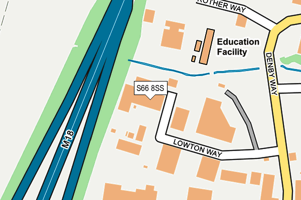
S66 8SS is located in the Hellaby & Maltby West electoral ward, within the metropolitan district of Rotherham and the English Parliamentary constituency of Rother Valley. The Sub Integrated Care Board (ICB) Location is NHS South Yorkshire ICB - 03L and the police force is South Yorkshire. This postcode has been in use since August 2008.


GetTheData
Source: OS OpenMap – Local (Ordnance Survey)
Source: OS VectorMap District (Ordnance Survey)
Licence: Open Government Licence (requires attribution)
| Easting | 450120 |
| Northing | 392472 |
| Latitude | 53.426666 |
| Longitude | -1.247196 |
GetTheData
Source: Open Postcode Geo
Licence: Open Government Licence
| Country | England |
| Postcode District | S66 |
➜ See where S66 is on a map ➜ Where is Hellaby? | |
GetTheData
Source: Land Registry Price Paid Data
Licence: Open Government Licence
Elevation or altitude of S66 8SS as distance above sea level:
| Metres | Feet | |
|---|---|---|
| Elevation | 100m | 328ft |
Elevation is measured from the approximate centre of the postcode, to the nearest point on an OS contour line from OS Terrain 50, which has contour spacing of ten vertical metres.
➜ How high above sea level am I? Find the elevation of your current position using your device's GPS.
GetTheData
Source: Open Postcode Elevation
Licence: Open Government Licence
| Ward | Hellaby & Maltby West |
| Constituency | Rother Valley |
GetTheData
Source: ONS Postcode Database
Licence: Open Government Licence
| Barbados Way (Denby Way) | Hellaby | 246m |
| Sandbeck Way (Denby Way) | Hellaby | 369m |
| Rother Way (Denby Way) | Hellaby | 375m |
| Rother Way (Denby Way) | Hellaby | 384m |
| Clifford Road (Bawtry Road) | Hellaby | 453m |
GetTheData
Source: NaPTAN
Licence: Open Government Licence
GetTheData
Source: ONS Postcode Database
Licence: Open Government Licence


➜ Get more ratings from the Food Standards Agency
GetTheData
Source: Food Standards Agency
Licence: FSA terms & conditions
| Last Collection | |||
|---|---|---|---|
| Location | Mon-Fri | Sat | Distance |
| Hellaby Industrial Estate | 16:00 | 10:45 | 316m |
| Hellaby Industrial Estate | 317m | ||
| Hellaby Hall Road | 17:00 | 11:30 | 596m |
GetTheData
Source: Dracos
Licence: Creative Commons Attribution-ShareAlike
The below table lists the International Territorial Level (ITL) codes (formerly Nomenclature of Territorial Units for Statistics (NUTS) codes) and Local Administrative Units (LAU) codes for S66 8SS:
| ITL 1 Code | Name |
|---|---|
| TLE | Yorkshire and The Humber |
| ITL 2 Code | Name |
| TLE3 | South Yorkshire |
| ITL 3 Code | Name |
| TLE31 | Barnsley, Doncaster and Rotherham |
| LAU 1 Code | Name |
| E08000018 | Rotherham |
GetTheData
Source: ONS Postcode Directory
Licence: Open Government Licence
The below table lists the Census Output Area (OA), Lower Layer Super Output Area (LSOA), and Middle Layer Super Output Area (MSOA) for S66 8SS:
| Code | Name | |
|---|---|---|
| OA | E00038920 | |
| LSOA | E01007685 | Rotherham 018A |
| MSOA | E02001595 | Rotherham 018 |
GetTheData
Source: ONS Postcode Directory
Licence: Open Government Licence
| S66 8RY | Lowton Way | 130m |
| S66 8PX | Bateman Road | 479m |
| S66 8EY | Bawtry Road | 487m |
| S66 8HA | Bateman Road | 491m |
| S66 8SN | Old Hellaby Lane | 500m |
| S66 8EZ | Clifford Road | 505m |
| S66 8PY | Ridgway Close | 507m |
| S66 8HB | Bateman Road | 602m |
| S66 2UW | Bramley Grange Way | 611m |
| S66 2TP | Bawtry Road | 621m |
GetTheData
Source: Open Postcode Geo; Land Registry Price Paid Data
Licence: Open Government Licence