S64 9AJ maps, stats, and open data
S64 9AJ is located in the Mexborough electoral ward, within the metropolitan district of Doncaster and the English Parliamentary constituency of Doncaster North. The Sub Integrated Care Board (ICB) Location is NHS South Yorkshire ICB - 02X and the police force is South Yorkshire. This postcode has been in use since January 1980.
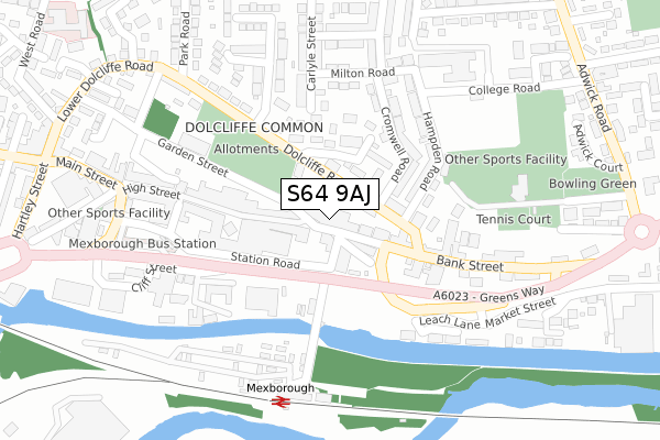
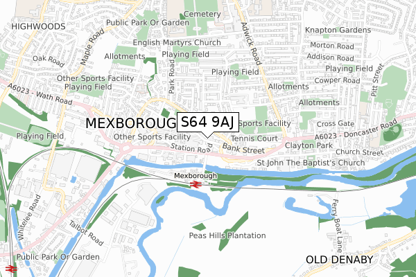
S64 9AJ maps


Licence: Open Government Licence (requires attribution)
Attribution: Contains OS data © Crown copyright and database right 2025
Source: Open Postcode Geo
Licence: Open Government Licence (requires attribution)
Attribution: Contains OS data © Crown copyright and database right 2025; Contains Royal Mail data © Royal Mail copyright and database right 2025; Source: Office for National Statistics licensed under the Open Government Licence v.3.0
S64 9AJ geodata
| Easting | 447355 |
| Northing | 399860 |
| Latitude | 53.493342 |
| Longitude | -1.287694 |
Where is S64 9AJ?
| Country | England |
| Postcode District | S64 |
S64 9AJ Elevation
Elevation or altitude of S64 9AJ as distance above sea level:
| Metres | Feet | |
|---|---|---|
| Elevation | 30m | 98ft |
Elevation is measured from the approximate centre of the postcode, to the nearest point on an OS contour line from OS Terrain 50, which has contour spacing of ten vertical metres.
➜ How high above sea level am I? Find the elevation of your current position using your device's GPS.
Politics
| Ward | Mexborough |
|---|---|
| Constituency | Doncaster North |
Transport
Nearest bus stops to S64 9AJ
| High Street (Bank Street) | Mexborough | 22m |
| Interchange (Station Road) | Mexborough | 297m |
| Doncaster Road (Adwick Road) | Mexborough | 438m |
| Hartley Street | Mexborough | 440m |
| Hartley Street | Mexborough | 443m |
Nearest railway stations to S64 9AJ
| Mexborough Station | 0.3km |
| Swinton (South Yorks) Station | 1.4km |
| Bolton-Upon-Dearne Station | 3.3km |
Deprivation
77% of English postcodes are less deprived than S64 9AJ:Food Standards Agency
Three nearest food hygiene ratings to S64 9AJ (metres)


➜ Get more ratings from the Food Standards Agency
Nearest post box to S64 9AJ
| Last Collection | |||
|---|---|---|---|
| Location | Mon-Fri | Sat | Distance |
| High Street | 16:00 | 11:00 | 22m |
| Mexborough Post Office | 16:00 | 12:15 | 338m |
| Pym Road Post Office | 16:45 | 12:00 | 448m |
S64 9AJ ITL and S64 9AJ LAU
The below table lists the International Territorial Level (ITL) codes (formerly Nomenclature of Territorial Units for Statistics (NUTS) codes) and Local Administrative Units (LAU) codes for S64 9AJ:
| ITL 1 Code | Name |
|---|---|
| TLE | Yorkshire and The Humber |
| ITL 2 Code | Name |
| TLE3 | South Yorkshire |
| ITL 3 Code | Name |
| TLE31 | Barnsley, Doncaster and Rotherham |
| LAU 1 Code | Name |
| E08000017 | Doncaster |
S64 9AJ census areas
The below table lists the Census Output Area (OA), Lower Layer Super Output Area (LSOA), and Middle Layer Super Output Area (MSOA) for S64 9AJ:
| Code | Name | |
|---|---|---|
| OA | E00038406 | |
| LSOA | E01007571 | Doncaster 031A |
| MSOA | E02001569 | Doncaster 031 |
Nearest postcodes to S64 9AJ
| S64 9AP | High Street | 38m |
| S64 9LG | Bank Street | 79m |
| S64 9AS | High Street | 96m |
| S64 9BE | West View Road | 121m |
| S64 9AZ | Dolcliffe Road | 155m |
| S64 9BA | Waddington Terrace | 157m |
| S64 9BB | Cromwell Road | 170m |
| S64 9JN | Hampden Road | 185m |
| S64 9HU | Cliff Street | 209m |
| S64 9HR | Hope Street | 221m |