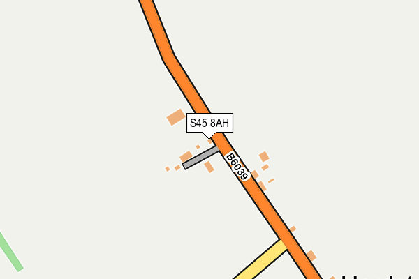
S45 8AH is in Hardstoft, Chesterfield. S45 8AH is located in the Ault Hucknall electoral ward, within the local authority district of Bolsover and the English Parliamentary constituency of Bolsover. The Sub Integrated Care Board (ICB) Location is NHS Derby and Derbyshire ICB - 15M and the police force is Derbyshire. This postcode has been in use since January 1980.


GetTheData
Source: OS OpenMap – Local (Ordnance Survey)
Source: OS VectorMap District (Ordnance Survey)
Licence: Open Government Licence (requires attribution)
| Easting | 443587 |
| Northing | 363317 |
| Latitude | 53.165196 |
| Longitude | -1.349497 |
GetTheData
Source: Open Postcode Geo
Licence: Open Government Licence
| Locality | Hardstoft |
| Town/City | Chesterfield |
| Country | England |
| Postcode District | S45 |
➜ See where S45 is on a map ➜ Where is Hardstoft? | |
GetTheData
Source: Land Registry Price Paid Data
Licence: Open Government Licence
Elevation or altitude of S45 8AH as distance above sea level:
| Metres | Feet | |
|---|---|---|
| Elevation | 180m | 591ft |
Elevation is measured from the approximate centre of the postcode, to the nearest point on an OS contour line from OS Terrain 50, which has contour spacing of ten vertical metres.
➜ How high above sea level am I? Find the elevation of your current position using your device's GPS.
GetTheData
Source: Open Postcode Elevation
Licence: Open Government Licence
| Ward | Ault Hucknall |
| Constituency | Bolsover |
GetTheData
Source: ONS Postcode Database
Licence: Open Government Licence
| Herb Garden (Chesterfield Road) | Hardstoft | 25m |
| Herb Garden (Tibshelf Road) | Hardstoft | 129m |
| Hardstoft Lane (Tibshelf Road) | Hardstoft | 209m |
| Hardstoft Lane (Tibshelf Road) | Hardstoft | 210m |
| Locko Lane (B6039 Chesterfield Road) | Hardstoft | 351m |
GetTheData
Source: NaPTAN
Licence: Open Government Licence
| Percentage of properties with Next Generation Access | 100.0% |
| Percentage of properties with Superfast Broadband | 87.5% |
| Percentage of properties with Ultrafast Broadband | 87.5% |
| Percentage of properties with Full Fibre Broadband | 87.5% |
Superfast Broadband is between 30Mbps and 300Mbps
Ultrafast Broadband is > 300Mbps
| Median download speed | 9.2Mbps |
| Average download speed | 8.8Mbps |
| Maximum download speed | 12.68Mbps |
| Median upload speed | 1.1Mbps |
| Average upload speed | 1.1Mbps |
| Maximum upload speed | 1.18Mbps |
| Percentage of properties unable to receive 2Mbps | 0.0% |
| Percentage of properties unable to receive 5Mbps | 0.0% |
| Percentage of properties unable to receive 10Mbps | 0.0% |
| Percentage of properties unable to receive 30Mbps | 12.5% |
GetTheData
Source: Ofcom
Licence: Ofcom Terms of Use (requires attribution)
GetTheData
Source: ONS Postcode Database
Licence: Open Government Licence


➜ Get more ratings from the Food Standards Agency
GetTheData
Source: Food Standards Agency
Licence: FSA terms & conditions
| Last Collection | |||
|---|---|---|---|
| Location | Mon-Fri | Sat | Distance |
| Hardstoft | 16:00 | 10:00 | 416m |
| Astwith Village | 16:00 | 10:15 | 881m |
| Station Road | 16:00 | 10:30 | 1,205m |
GetTheData
Source: Dracos
Licence: Creative Commons Attribution-ShareAlike
The below table lists the International Territorial Level (ITL) codes (formerly Nomenclature of Territorial Units for Statistics (NUTS) codes) and Local Administrative Units (LAU) codes for S45 8AH:
| ITL 1 Code | Name |
|---|---|
| TLF | East Midlands (England) |
| ITL 2 Code | Name |
| TLF1 | Derbyshire and Nottinghamshire |
| ITL 3 Code | Name |
| TLF12 | East Derbyshire |
| LAU 1 Code | Name |
| E07000033 | Bolsover |
GetTheData
Source: ONS Postcode Directory
Licence: Open Government Licence
The below table lists the Census Output Area (OA), Lower Layer Super Output Area (LSOA), and Middle Layer Super Output Area (MSOA) for S45 8AH:
| Code | Name | |
|---|---|---|
| OA | E00098724 | |
| LSOA | E01019520 | Bolsover 008C |
| MSOA | E02004052 | Bolsover 008 |
GetTheData
Source: ONS Postcode Directory
Licence: Open Government Licence
| S45 8AE | Deep Lane | 479m |
| S45 8AG | The Green | 510m |
| S45 8AW | Locko Lane | 570m |
| S45 8AU | Farm Lane | 576m |
| S45 8AX | 601m | |
| S45 8AA | Hardstoft Road | 671m |
| S45 8AJ | Astwith Common | 901m |
| S45 8AN | Astwith | 919m |
| S45 8BL | Hardstoft Road | 923m |
| S45 8BH | Station Road | 1142m |
GetTheData
Source: Open Postcode Geo; Land Registry Price Paid Data
Licence: Open Government Licence