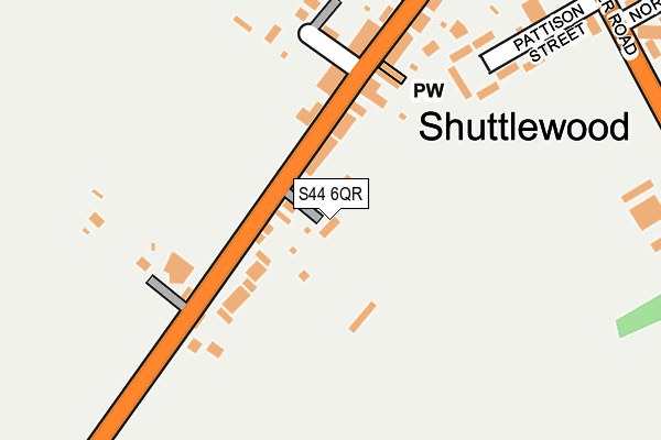
S44 6QR lies on Ellesmere Villas in Shuttlewood, Chesterfield. S44 6QR is located in the Bolsover North & Shuttlewood electoral ward, within the local authority district of Bolsover and the English Parliamentary constituency of Bolsover. The Sub Integrated Care Board (ICB) Location is NHS Derby and Derbyshire ICB - 15M and the police force is Derbyshire. This postcode has been in use since January 1980.


GetTheData
Source: OS OpenMap – Local (Ordnance Survey)
Source: OS VectorMap District (Ordnance Survey)
Licence: Open Government Licence (requires attribution)
| Easting | 446628 |
| Northing | 372617 |
| Latitude | 53.248548 |
| Longitude | -1.302658 |
GetTheData
Source: Open Postcode Geo
Licence: Open Government Licence
| Street | Ellesmere Villas |
| Locality | Shuttlewood |
| Town/City | Chesterfield |
| Country | England |
| Postcode District | S44 |
➜ See where S44 is on a map ➜ Where is Shuttlewood? | |
GetTheData
Source: Land Registry Price Paid Data
Licence: Open Government Licence
Elevation or altitude of S44 6QR as distance above sea level:
| Metres | Feet | |
|---|---|---|
| Elevation | 120m | 394ft |
Elevation is measured from the approximate centre of the postcode, to the nearest point on an OS contour line from OS Terrain 50, which has contour spacing of ten vertical metres.
➜ How high above sea level am I? Find the elevation of your current position using your device's GPS.
GetTheData
Source: Open Postcode Elevation
Licence: Open Government Licence
| Ward | Bolsover North & Shuttlewood |
| Constituency | Bolsover |
GetTheData
Source: ONS Postcode Database
Licence: Open Government Licence
| Pretoria Street (Chesterfield Road) | Shuttlewood | 95m |
| Pretoria Street (Chesterfield Road) | Shuttlewood | 132m |
| Travellers Close (Chesterfield Road) | Shuttlewood | 323m |
| Wyandotte Farm (Shuttlewood Road) | Shuttlewood | 337m |
| Vivian Street (Bolsover Road) | Shuttlewood | 346m |
GetTheData
Source: NaPTAN
Licence: Open Government Licence
| Percentage of properties with Next Generation Access | 100.0% |
| Percentage of properties with Superfast Broadband | 100.0% |
| Percentage of properties with Ultrafast Broadband | 0.0% |
| Percentage of properties with Full Fibre Broadband | 0.0% |
Superfast Broadband is between 30Mbps and 300Mbps
Ultrafast Broadband is > 300Mbps
| Percentage of properties unable to receive 2Mbps | 0.0% |
| Percentage of properties unable to receive 5Mbps | 0.0% |
| Percentage of properties unable to receive 10Mbps | 0.0% |
| Percentage of properties unable to receive 30Mbps | 0.0% |
GetTheData
Source: Ofcom
Licence: Ofcom Terms of Use (requires attribution)
GetTheData
Source: ONS Postcode Database
Licence: Open Government Licence


➜ Get more ratings from the Food Standards Agency
GetTheData
Source: Food Standards Agency
Licence: FSA terms & conditions
| Last Collection | |||
|---|---|---|---|
| Location | Mon-Fri | Sat | Distance |
| 21a Chesterfield Road | 16:00 | 10:00 | 200m |
| Shuttlewood Road | 16:00 | 10:00 | 623m |
| 2 Bentinck Road | 16:00 | 11:15 | 740m |
GetTheData
Source: Dracos
Licence: Creative Commons Attribution-ShareAlike
The below table lists the International Territorial Level (ITL) codes (formerly Nomenclature of Territorial Units for Statistics (NUTS) codes) and Local Administrative Units (LAU) codes for S44 6QR:
| ITL 1 Code | Name |
|---|---|
| TLF | East Midlands (England) |
| ITL 2 Code | Name |
| TLF1 | Derbyshire and Nottinghamshire |
| ITL 3 Code | Name |
| TLF12 | East Derbyshire |
| LAU 1 Code | Name |
| E07000033 | Bolsover |
GetTheData
Source: ONS Postcode Directory
Licence: Open Government Licence
The below table lists the Census Output Area (OA), Lower Layer Super Output Area (LSOA), and Middle Layer Super Output Area (MSOA) for S44 6QR:
| Code | Name | |
|---|---|---|
| OA | E00098536 | |
| LSOA | E01019484 | Bolsover 004B |
| MSOA | E02004048 | Bolsover 004 |
GetTheData
Source: ONS Postcode Directory
Licence: Open Government Licence
| S44 6QP | Crossfield Villas | 43m |
| S44 6QN | Chesterfield Road | 45m |
| S44 6QW | Thornfield Villas | 47m |
| S44 6QQ | Pretoria Street | 174m |
| S44 6FL | Field View | 202m |
| S44 6QT | Chesterfield Road | 242m |
| S44 6QS | Chesterfield Road | 255m |
| S44 6QU | Adin Avenue | 267m |
| S44 6QY | Vivian Street | 298m |
| S44 6QX | Bolsover Road | 322m |
GetTheData
Source: Open Postcode Geo; Land Registry Price Paid Data
Licence: Open Government Licence