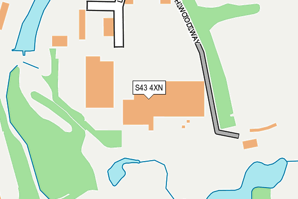
S43 4XN lies on High Wood Way in Barlborough, Chesterfield. S43 4XN is located in the Barlborough electoral ward, within the local authority district of Bolsover and the English Parliamentary constituency of Bolsover. The Sub Integrated Care Board (ICB) Location is NHS Derby and Derbyshire ICB - 15M and the police force is Derbyshire. This postcode has been in use since April 2003.


GetTheData
Source: OS OpenMap – Local (Ordnance Survey)
Source: OS VectorMap District (Ordnance Survey)
Licence: Open Government Licence (requires attribution)
| Easting | 447996 |
| Northing | 376100 |
| Latitude | 53.279734 |
| Longitude | -1.281634 |
GetTheData
Source: Open Postcode Geo
Licence: Open Government Licence
| Street | High Wood Way |
| Locality | Barlborough |
| Town/City | Chesterfield |
| Country | England |
| Postcode District | S43 |
➜ See where S43 is on a map ➜ Where is Barlborough? | |
GetTheData
Source: Land Registry Price Paid Data
Licence: Open Government Licence
Elevation or altitude of S43 4XN as distance above sea level:
| Metres | Feet | |
|---|---|---|
| Elevation | 120m | 394ft |
Elevation is measured from the approximate centre of the postcode, to the nearest point on an OS contour line from OS Terrain 50, which has contour spacing of ten vertical metres.
➜ How high above sea level am I? Find the elevation of your current position using your device's GPS.
GetTheData
Source: Open Postcode Elevation
Licence: Open Government Licence
| Ward | Barlborough |
| Constituency | Bolsover |
GetTheData
Source: ONS Postcode Database
Licence: Open Government Licence
2, HIGH WOOD WAY, BARLBOROUGH, CHESTERFIELD, S43 4XN 2015 24 JUL £425,000 |
GetTheData
Source: HM Land Registry Price Paid Data
Licence: Contains HM Land Registry data © Crown copyright and database right 2025. This data is licensed under the Open Government Licence v3.0.
| Health Treatment Centre (Oxcroft Way) | Barlborough | 349m |
| Health Treatment Centre (Oxcroft Way) | Barlborough | 356m |
| Country Park (Oxcroft Way) | Barlborough | 470m |
| Country Park (Oxcroft Way) | Barlborough | 497m |
| Boughton Lane Top (Boughton Lane) | Clowne | 641m |
| Creswell (Derbys) Station | 4.7km |
GetTheData
Source: NaPTAN
Licence: Open Government Licence
GetTheData
Source: ONS Postcode Database
Licence: Open Government Licence


➜ Get more ratings from the Food Standards Agency
GetTheData
Source: Food Standards Agency
Licence: FSA terms & conditions
| Last Collection | |||
|---|---|---|---|
| Location | Mon-Fri | Sat | Distance |
| Shunters Drift | 16:00 | 10:45 | 493m |
| Midland Way | 17:30 | 515m | |
| 93 Boughton Lane | 16:00 | 10:00 | 658m |
GetTheData
Source: Dracos
Licence: Creative Commons Attribution-ShareAlike
The below table lists the International Territorial Level (ITL) codes (formerly Nomenclature of Territorial Units for Statistics (NUTS) codes) and Local Administrative Units (LAU) codes for S43 4XN:
| ITL 1 Code | Name |
|---|---|
| TLF | East Midlands (England) |
| ITL 2 Code | Name |
| TLF1 | Derbyshire and Nottinghamshire |
| ITL 3 Code | Name |
| TLF12 | East Derbyshire |
| LAU 1 Code | Name |
| E07000033 | Bolsover |
GetTheData
Source: ONS Postcode Directory
Licence: Open Government Licence
The below table lists the Census Output Area (OA), Lower Layer Super Output Area (LSOA), and Middle Layer Super Output Area (MSOA) for S43 4XN:
| Code | Name | |
|---|---|---|
| OA | E00098513 | |
| LSOA | E01019478 | Bolsover 001A |
| MSOA | E02004045 | Bolsover 001 |
GetTheData
Source: ONS Postcode Directory
Licence: Open Government Licence
| S43 4PZ | Gander Lane | 340m |
| S43 4WE | Colliers Trek | 385m |
| S43 4WJ | Hewers Holt | 391m |
| S43 4WD | Old Quarry Close | 404m |
| S43 4WH | Winders Corner | 414m |
| S43 4WN | Clay Pit Way | 425m |
| S43 4FD | Midland Way | 432m |
| S43 4XL | Ash Close | 457m |
| S43 4WB | Limekiln Way | 458m |
| S43 4PX | Greenside Close | 470m |
GetTheData
Source: Open Postcode Geo; Land Registry Price Paid Data
Licence: Open Government Licence