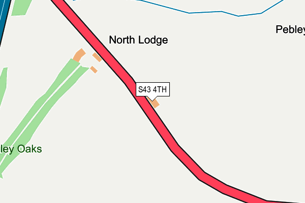
S43 4TH is in Barlborough, Chesterfield. S43 4TH is located in the Barlborough electoral ward, within the local authority district of Bolsover and the English Parliamentary constituency of Bolsover. The Sub Integrated Care Board (ICB) Location is NHS Derby and Derbyshire ICB - 15M and the police force is Derbyshire. This postcode has been in use since January 1980.


GetTheData
Source: OS OpenMap – Local (Ordnance Survey)
Source: OS VectorMap District (Ordnance Survey)
Licence: Open Government Licence (requires attribution)
| Easting | 448094 |
| Northing | 379207 |
| Latitude | 53.307630 |
| Longitude | -1.279696 |
GetTheData
Source: Open Postcode Geo
Licence: Open Government Licence
| Locality | Barlborough |
| Town/City | Chesterfield |
| Country | England |
| Postcode District | S43 |
➜ See where S43 is on a map | |
GetTheData
Source: Land Registry Price Paid Data
Licence: Open Government Licence
Elevation or altitude of S43 4TH as distance above sea level:
| Metres | Feet | |
|---|---|---|
| Elevation | 130m | 427ft |
Elevation is measured from the approximate centre of the postcode, to the nearest point on an OS contour line from OS Terrain 50, which has contour spacing of ten vertical metres.
➜ How high above sea level am I? Find the elevation of your current position using your device's GPS.
GetTheData
Source: Open Postcode Elevation
Licence: Open Government Licence
| Ward | Barlborough |
| Constituency | Bolsover |
GetTheData
Source: ONS Postcode Database
Licence: Open Government Licence
| Woodall Services | Woodall | 819m |
| Dowcarr Lane (Woodall Lane) | Woodall | 1,496m |
| Dowcarr Lane (Woodall Lane) | Woodall | 1,503m |
| Old Colliery (Hut Lane) | High Moor | 1,510m |
| Old Colliery (Hut Lane) | High Moor | 1,516m |
| Kiveton Bridge Station | 3.8km |
| Kiveton Park Station | 4.2km |
| Creswell (Derbys) Station | 6.4km |
GetTheData
Source: NaPTAN
Licence: Open Government Licence
| Percentage of properties with Next Generation Access | 0.0% |
| Percentage of properties with Superfast Broadband | 0.0% |
| Percentage of properties with Ultrafast Broadband | 0.0% |
| Percentage of properties with Full Fibre Broadband | 0.0% |
Superfast Broadband is between 30Mbps and 300Mbps
Ultrafast Broadband is > 300Mbps
| Percentage of properties unable to receive 2Mbps | 0.0% |
| Percentage of properties unable to receive 5Mbps | 100.0% |
| Percentage of properties unable to receive 10Mbps | 100.0% |
| Percentage of properties unable to receive 30Mbps | 100.0% |
GetTheData
Source: Ofcom
Licence: Ofcom Terms of Use (requires attribution)
GetTheData
Source: ONS Postcode Database
Licence: Open Government Licence


➜ Get more ratings from the Food Standards Agency
GetTheData
Source: Food Standards Agency
Licence: FSA terms & conditions
| Last Collection | |||
|---|---|---|---|
| Location | Mon-Fri | Sat | Distance |
| Woodall Service Station | 16:00 | 12:30 | 845m |
| Woodall Service Station | 16:00 | 11:45 | 894m |
| Dowcarr Lane | 16:15 | 12:15 | 1,479m |
GetTheData
Source: Dracos
Licence: Creative Commons Attribution-ShareAlike
The below table lists the International Territorial Level (ITL) codes (formerly Nomenclature of Territorial Units for Statistics (NUTS) codes) and Local Administrative Units (LAU) codes for S43 4TH:
| ITL 1 Code | Name |
|---|---|
| TLF | East Midlands (England) |
| ITL 2 Code | Name |
| TLF1 | Derbyshire and Nottinghamshire |
| ITL 3 Code | Name |
| TLF12 | East Derbyshire |
| LAU 1 Code | Name |
| E07000033 | Bolsover |
GetTheData
Source: ONS Postcode Directory
Licence: Open Government Licence
The below table lists the Census Output Area (OA), Lower Layer Super Output Area (LSOA), and Middle Layer Super Output Area (MSOA) for S43 4TH:
| Code | Name | |
|---|---|---|
| OA | E00098513 | |
| LSOA | E01019478 | Bolsover 001A |
| MSOA | E02004045 | Bolsover 001 |
GetTheData
Source: ONS Postcode Directory
Licence: Open Government Licence
| S43 4TJ | Barlborough Park | 689m |
| S43 4TQ | Rotherham Road | 1194m |
| S26 7XN | Dowcarr Lane | 1337m |
| S26 7XQ | Firvale | 1395m |
| S26 7XP | Firvale | 1459m |
| S21 1BQ | Hut Lane | 1507m |
| S26 7UA | Woodall Lane | 1524m |
| S26 7UP | Peregrine Way | 1549m |
| S26 7WG | Pryor Nook | 1558m |
| S26 7YB | Pryor Mede | 1601m |
GetTheData
Source: Open Postcode Geo; Land Registry Price Paid Data
Licence: Open Government Licence