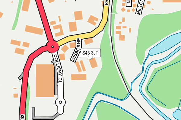
S43 3JT is located in the Staveley Central electoral ward, within the local authority district of Chesterfield and the English Parliamentary constituency of North East Derbyshire. The Sub Integrated Care Board (ICB) Location is NHS Derby and Derbyshire ICB - 15M and the police force is Derbyshire. This postcode has been in use since June 2005.


GetTheData
Source: OS OpenMap – Local (Ordnance Survey)
Source: OS VectorMap District (Ordnance Survey)
Licence: Open Government Licence (requires attribution)
| Easting | 443810 |
| Northing | 374325 |
| Latitude | 53.264141 |
| Longitude | -1.344653 |
GetTheData
Source: Open Postcode Geo
Licence: Open Government Licence
| Country | England |
| Postcode District | S43 |
➜ See where S43 is on a map ➜ Where is Staveley? | |
GetTheData
Source: Land Registry Price Paid Data
Licence: Open Government Licence
Elevation or altitude of S43 3JT as distance above sea level:
| Metres | Feet | |
|---|---|---|
| Elevation | 60m | 197ft |
Elevation is measured from the approximate centre of the postcode, to the nearest point on an OS contour line from OS Terrain 50, which has contour spacing of ten vertical metres.
➜ How high above sea level am I? Find the elevation of your current position using your device's GPS.
GetTheData
Source: Open Postcode Elevation
Licence: Open Government Licence
| Ward | Staveley Central |
| Constituency | North East Derbyshire |
GetTheData
Source: ONS Postcode Database
Licence: Open Government Licence
| Ireland Close (Fan Road) | Staveley | 79m |
| Ireland Close (Fan Road) | Staveley | 93m |
| Ireland Industrial Estate (Erin Road) | Staveley | 398m |
| Ireland Industrial Estate (Erin Road) | Staveley | 420m |
| Whitehead Street (Fan Road) | Staveley | 426m |
GetTheData
Source: NaPTAN
Licence: Open Government Licence
| Median download speed | 19.2Mbps |
| Average download speed | 19.2Mbps |
| Maximum download speed | 20.57Mbps |
| Median upload speed | 1.3Mbps |
| Average upload speed | 1.2Mbps |
| Maximum upload speed | 1.27Mbps |
GetTheData
Source: Ofcom
Licence: Ofcom Terms of Use (requires attribution)
GetTheData
Source: ONS Postcode Database
Licence: Open Government Licence


➜ Get more ratings from the Food Standards Agency
GetTheData
Source: Food Standards Agency
Licence: FSA terms & conditions
| Last Collection | |||
|---|---|---|---|
| Location | Mon-Fri | Sat | Distance |
| Netherthorpe | 16:00 | 10:30 | 468m |
| Speedwell Industrial Estate | 18:30 | 490m | |
| Lowgates Post Office | 16:00 | 11:30 | 578m |
GetTheData
Source: Dracos
Licence: Creative Commons Attribution-ShareAlike
The below table lists the International Territorial Level (ITL) codes (formerly Nomenclature of Territorial Units for Statistics (NUTS) codes) and Local Administrative Units (LAU) codes for S43 3JT:
| ITL 1 Code | Name |
|---|---|
| TLF | East Midlands (England) |
| ITL 2 Code | Name |
| TLF1 | Derbyshire and Nottinghamshire |
| ITL 3 Code | Name |
| TLF12 | East Derbyshire |
| LAU 1 Code | Name |
| E07000034 | Chesterfield |
GetTheData
Source: ONS Postcode Directory
Licence: Open Government Licence
The below table lists the Census Output Area (OA), Lower Layer Super Output Area (LSOA), and Middle Layer Super Output Area (MSOA) for S43 3JT:
| Code | Name | |
|---|---|---|
| OA | E00098941 | |
| LSOA | E01019565 | Chesterfield 002C |
| MSOA | E02004056 | Chesterfield 002 |
GetTheData
Source: ONS Postcode Directory
Licence: Open Government Licence
| S43 3PT | Fan Road | 156m |
| S43 3PX | Netherthorpe Close | 255m |
| S43 3PS | Tudor Street | 270m |
| S43 3PH | Belmont Drive | 288m |
| S43 3PZ | Milton Place | 301m |
| S43 3PR | Barrow Street | 317m |
| S43 3QD | Marshfield Grove | 333m |
| S43 3PJ | Markham Crescent | 341m |
| S43 3LN | Corner Pin Close | 344m |
| S43 3QB | Lowfields | 361m |
GetTheData
Source: Open Postcode Geo; Land Registry Price Paid Data
Licence: Open Government Licence