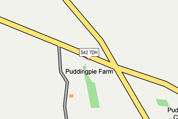
S42 7DH is in Eastmoor, Chesterfield. S42 7DH is located in the Brampton & Walton electoral ward, within the local authority district of North East Derbyshire and the English Parliamentary constituency of North East Derbyshire. The Sub Integrated Care Board (ICB) Location is NHS Derby and Derbyshire ICB - 15M and the police force is Derbyshire. This postcode has been in use since January 1980.


GetTheData
Source: OS OpenMap – Local (Ordnance Survey)
Source: OS VectorMap District (Ordnance Survey)
Licence: Open Government Licence (requires attribution)
| Easting | 430726 |
| Northing | 371868 |
| Latitude | 53.242970 |
| Longitude | -1.541038 |
GetTheData
Source: Open Postcode Geo
Licence: Open Government Licence
| Locality | Eastmoor |
| Town/City | Chesterfield |
| Country | England |
| Postcode District | S42 |
➜ See where S42 is on a map ➜ Where is Eastmoor? | |
GetTheData
Source: Land Registry Price Paid Data
Licence: Open Government Licence
Elevation or altitude of S42 7DH as distance above sea level:
| Metres | Feet | |
|---|---|---|
| Elevation | 280m | 919ft |
Elevation is measured from the approximate centre of the postcode, to the nearest point on an OS contour line from OS Terrain 50, which has contour spacing of ten vertical metres.
➜ How high above sea level am I? Find the elevation of your current position using your device's GPS.
GetTheData
Source: Open Postcode Elevation
Licence: Open Government Licence
| Ward | Brampton & Walton |
| Constituency | North East Derbyshire |
GetTheData
Source: ONS Postcode Database
Licence: Open Government Licence
| The Highwayman (Baslow Road) | Eastmoor | 519m |
| The Highwayman (Baslow Road) | Eastmoor | 527m |
| Northend Farm (Baslow Road) | Eastmoor | 650m |
| Northend Farm (Baslow Road) | Eastmoor | 689m |
| School (School Lane) | Wigley | 799m |
GetTheData
Source: NaPTAN
Licence: Open Government Licence
| Percentage of properties with Next Generation Access | 100.0% |
| Percentage of properties with Superfast Broadband | 0.0% |
| Percentage of properties with Ultrafast Broadband | 0.0% |
| Percentage of properties with Full Fibre Broadband | 0.0% |
Superfast Broadband is between 30Mbps and 300Mbps
Ultrafast Broadband is > 300Mbps
| Percentage of properties unable to receive 2Mbps | 100.0% |
| Percentage of properties unable to receive 5Mbps | 100.0% |
| Percentage of properties unable to receive 10Mbps | 100.0% |
| Percentage of properties unable to receive 30Mbps | 100.0% |
GetTheData
Source: Ofcom
Licence: Ofcom Terms of Use (requires attribution)
GetTheData
Source: ONS Postcode Database
Licence: Open Government Licence


➜ Get more ratings from the Food Standards Agency
GetTheData
Source: Food Standards Agency
Licence: FSA terms & conditions
| Last Collection | |||
|---|---|---|---|
| Location | Mon-Fri | Sat | Distance |
| School Lane | 16:00 | 09:30 | 791m |
| Wadshelf Post Office | 16:00 | 10:00 | 1,236m |
| Main Road | 16:00 | 09:00 | 2,783m |
GetTheData
Source: Dracos
Licence: Creative Commons Attribution-ShareAlike
The below table lists the International Territorial Level (ITL) codes (formerly Nomenclature of Territorial Units for Statistics (NUTS) codes) and Local Administrative Units (LAU) codes for S42 7DH:
| ITL 1 Code | Name |
|---|---|
| TLF | East Midlands (England) |
| ITL 2 Code | Name |
| TLF1 | Derbyshire and Nottinghamshire |
| ITL 3 Code | Name |
| TLF12 | East Derbyshire |
| LAU 1 Code | Name |
| E07000038 | North East Derbyshire |
GetTheData
Source: ONS Postcode Directory
Licence: Open Government Licence
The below table lists the Census Output Area (OA), Lower Layer Super Output Area (LSOA), and Middle Layer Super Output Area (MSOA) for S42 7DH:
| Code | Name | |
|---|---|---|
| OA | E00100041 | |
| LSOA | E01019771 | North East Derbyshire 008A |
| MSOA | E02004112 | North East Derbyshire 008 |
GetTheData
Source: ONS Postcode Directory
Licence: Open Government Licence
| S42 7DA | Baslow Road | 572m |
| S42 7DG | Hare Edge | 733m |
| S42 7DD | Baslow Road | 810m |
| S42 7JJ | 846m | |
| S42 7DQ | Freebirch | 1012m |
| S42 7BZ | Baslow Road | 1075m |
| S42 7BU | Bottom Row | 1121m |
| S42 7BY | School Lane | 1211m |
| S42 7BX | 1224m | |
| S42 7BG | Netherfield Lane | 1300m |
GetTheData
Source: Open Postcode Geo; Land Registry Price Paid Data
Licence: Open Government Licence