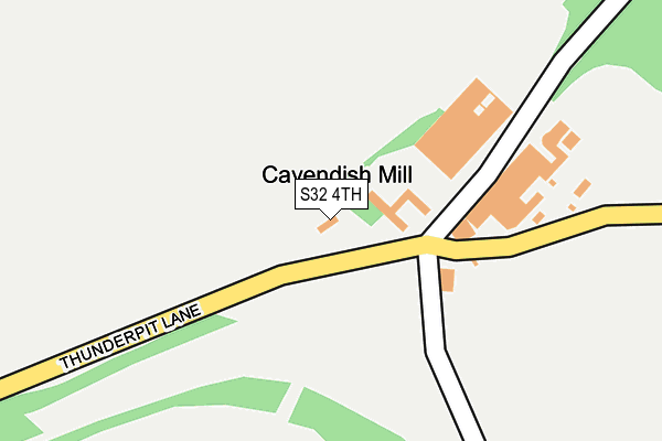
S32 4TH is located in the Hathersage electoral ward, within the local authority district of Derbyshire Dales and the English Parliamentary constituency of Derbyshire Dales. The Sub Integrated Care Board (ICB) Location is NHS Derby and Derbyshire ICB - 15M and the police force is Derbyshire. This postcode has been in use since June 1997.


GetTheData
Source: OS OpenMap – Local (Ordnance Survey)
Source: OS VectorMap District (Ordnance Survey)
Licence: Open Government Licence (requires attribution)
| Easting | 420451 |
| Northing | 375268 |
| Latitude | 53.274006 |
| Longitude | -1.694787 |
GetTheData
Source: Open Postcode Geo
Licence: Open Government Licence
| Country | England |
| Postcode District | S32 |
➜ See where S32 is on a map | |
GetTheData
Source: Land Registry Price Paid Data
Licence: Open Government Licence
Elevation or altitude of S32 4TH as distance above sea level:
| Metres | Feet | |
|---|---|---|
| Elevation | 310m | 1,017ft |
Elevation is measured from the approximate centre of the postcode, to the nearest point on an OS contour line from OS Terrain 50, which has contour spacing of ten vertical metres.
➜ How high above sea level am I? Find the elevation of your current position using your device's GPS.
GetTheData
Source: Open Postcode Elevation
Licence: Open Government Licence
| Ward | Hathersage |
| Constituency | Derbyshire Dales |
GetTheData
Source: ONS Postcode Database
Licence: Open Government Licence
| The Dale | Stoney Middleton | 1,473m |
| The Dale | Stoney Middleton | 1,476m |
| Brosterfield Farm (Foolow Road) | Housley | 1,499m |
| Brosterfield Farm (Foolow Road) | Housley | 1,513m |
| Eyam Hall (Church Street) | Eyam | 1,705m |
| Grindleford Station | 5.8km |
GetTheData
Source: NaPTAN
Licence: Open Government Licence
GetTheData
Source: ONS Postcode Database
Licence: Open Government Licence


➜ Get more ratings from the Food Standards Agency
GetTheData
Source: Food Standards Agency
Licence: FSA terms & conditions
| Last Collection | |||
|---|---|---|---|
| Location | Mon-Fri | Sat | Distance |
| Eyam Post Office | 16:00 | 11:15 | 1,739m |
| Townend | 16:00 | 10:30 | 1,946m |
| Opposite The Bulls Head | 16:00 | 08:30 | 2,024m |
GetTheData
Source: Dracos
Licence: Creative Commons Attribution-ShareAlike
The below table lists the International Territorial Level (ITL) codes (formerly Nomenclature of Territorial Units for Statistics (NUTS) codes) and Local Administrative Units (LAU) codes for S32 4TH:
| ITL 1 Code | Name |
|---|---|
| TLF | East Midlands (England) |
| ITL 2 Code | Name |
| TLF1 | Derbyshire and Nottinghamshire |
| ITL 3 Code | Name |
| TLF13 | South and West Derbyshire |
| LAU 1 Code | Name |
| E07000035 | Derbyshire Dales |
GetTheData
Source: ONS Postcode Directory
Licence: Open Government Licence
The below table lists the Census Output Area (OA), Lower Layer Super Output Area (LSOA), and Middle Layer Super Output Area (MSOA) for S32 4TH:
| Code | Name | |
|---|---|---|
| OA | E00099161 | |
| LSOA | E01019604 | Derbyshire Dales 002B |
| MSOA | E02004069 | Derbyshire Dales 002 |
GetTheData
Source: ONS Postcode Directory
Licence: Open Government Licence
| S32 5QB | 1372m | |
| S32 5RJ | Windmill Lane | 1471m |
| S32 5QL | Dunlow Lane | 1490m |
| S32 5QX | New Close | 1565m |
| S32 5RD | Tideswell Lane | 1573m |
| S32 5RW | Delph Close | 1703m |
| S32 5RE | Townhead | 1736m |
| S32 5QQ | Fern Square | 1752m |
| S32 5QW | Main Road | 1759m |
| S32 5QH | Church Street | 1785m |
GetTheData
Source: Open Postcode Geo; Land Registry Price Paid Data
Licence: Open Government Licence