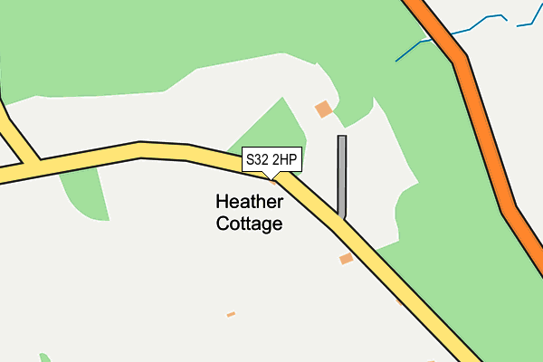
S32 2HP lies on Sir William Hill Road in Grindleford, Hope Valley. S32 2HP is located in the Hathersage electoral ward, within the local authority district of Derbyshire Dales and the English Parliamentary constituency of Derbyshire Dales. The Sub Integrated Care Board (ICB) Location is NHS Derby and Derbyshire ICB - 15M and the police force is Derbyshire. This postcode has been in use since June 1997.


GetTheData
Source: OS OpenMap – Local (Ordnance Survey)
Source: OS VectorMap District (Ordnance Survey)
Licence: Open Government Licence (requires attribution)
| Easting | 423886 |
| Northing | 378224 |
| Latitude | 53.300434 |
| Longitude | -1.643057 |
GetTheData
Source: Open Postcode Geo
Licence: Open Government Licence
| Street | Sir William Hill Road |
| Locality | Grindleford |
| Town/City | Hope Valley |
| Country | England |
| Postcode District | S32 |
➜ See where S32 is on a map | |
GetTheData
Source: Land Registry Price Paid Data
Licence: Open Government Licence
Elevation or altitude of S32 2HP as distance above sea level:
| Metres | Feet | |
|---|---|---|
| Elevation | 230m | 755ft |
Elevation is measured from the approximate centre of the postcode, to the nearest point on an OS contour line from OS Terrain 50, which has contour spacing of ten vertical metres.
➜ How high above sea level am I? Find the elevation of your current position using your device's GPS.
GetTheData
Source: Open Postcode Elevation
Licence: Open Government Licence
| Ward | Hathersage |
| Constituency | Derbyshire Dales |
GetTheData
Source: ONS Postcode Database
Licence: Open Government Licence
| Playing Field (Main Road) | Grindleford | 690m |
| Playing Field (Main Road) | Grindleford | 700m |
| Mount Pleasant (Main Road) | Grindleford | 794m |
| Mount Pleasant (Main Road) | Grindleford | 811m |
| Goatscliffe Cottages (Main Road) | Grindleford | 939m |
| Grindleford Station | 1.3km |
| Hathersage Station | 2.9km |
| Bamford Station | 5.3km |
GetTheData
Source: NaPTAN
Licence: Open Government Licence
| Percentage of properties with Next Generation Access | 33.3% |
| Percentage of properties with Superfast Broadband | 33.3% |
| Percentage of properties with Ultrafast Broadband | 0.0% |
| Percentage of properties with Full Fibre Broadband | 0.0% |
Superfast Broadband is between 30Mbps and 300Mbps
Ultrafast Broadband is > 300Mbps
| Percentage of properties unable to receive 2Mbps | 0.0% |
| Percentage of properties unable to receive 5Mbps | 0.0% |
| Percentage of properties unable to receive 10Mbps | 0.0% |
| Percentage of properties unable to receive 30Mbps | 66.7% |
GetTheData
Source: Ofcom
Licence: Ofcom Terms of Use (requires attribution)
GetTheData
Source: ONS Postcode Database
Licence: Open Government Licence


➜ Get more ratings from the Food Standards Agency
GetTheData
Source: Food Standards Agency
Licence: FSA terms & conditions
| Last Collection | |||
|---|---|---|---|
| Location | Mon-Fri | Sat | Distance |
| Grindleford Post Office | 17:20 | 11:30 | 713m |
| Main Road Grindleford | 16:30 | 11:30 | 1,103m |
| Stoke Hall | 16:45 | 11:30 | 1,232m |
GetTheData
Source: Dracos
Licence: Creative Commons Attribution-ShareAlike
The below table lists the International Territorial Level (ITL) codes (formerly Nomenclature of Territorial Units for Statistics (NUTS) codes) and Local Administrative Units (LAU) codes for S32 2HP:
| ITL 1 Code | Name |
|---|---|
| TLF | East Midlands (England) |
| ITL 2 Code | Name |
| TLF1 | Derbyshire and Nottinghamshire |
| ITL 3 Code | Name |
| TLF13 | South and West Derbyshire |
| LAU 1 Code | Name |
| E07000035 | Derbyshire Dales |
GetTheData
Source: ONS Postcode Directory
Licence: Open Government Licence
The below table lists the Census Output Area (OA), Lower Layer Super Output Area (LSOA), and Middle Layer Super Output Area (MSOA) for S32 2HP:
| Code | Name | |
|---|---|---|
| OA | E00099231 | |
| LSOA | E01019615 | Derbyshire Dales 001C |
| MSOA | E02004068 | Derbyshire Dales 001 |
GetTheData
Source: ONS Postcode Directory
Licence: Open Government Licence
| S32 2HN | Bank Top Lane | 354m |
| S32 2HU | Sir William Terrace | 378m |
| S32 2HS | Sir William Hill Road | 450m |
| S32 2HT | Adlington Lane | 458m |
| S32 2HH | The Green | 534m |
| S32 2JH | Hathersage Road | 548m |
| S32 2HA | Commercial Road | 664m |
| S32 2JJ | Red Lion Row | 692m |
| S32 2HZ | Woodland View | 695m |
| S32 2HJ | Haywood View | 701m |
GetTheData
Source: Open Postcode Geo; Land Registry Price Paid Data
Licence: Open Government Licence