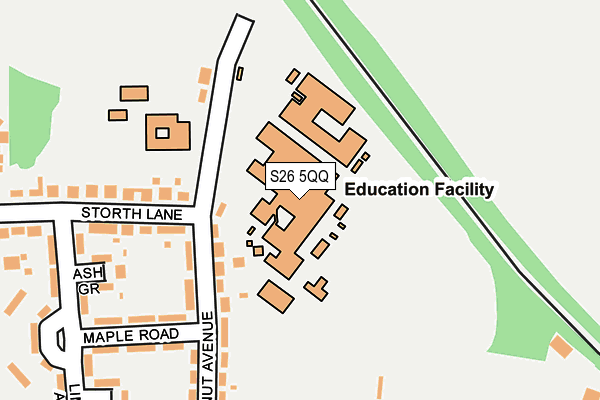
S26 5QQ is located in the Wales electoral ward, within the metropolitan district of Rotherham and the English Parliamentary constituency of Rother Valley. The Sub Integrated Care Board (ICB) Location is NHS South Yorkshire ICB - 03L and the police force is South Yorkshire. This postcode has been in use since June 1997.


GetTheData
Source: OS OpenMap – Local (Ordnance Survey)
Source: OS VectorMap District (Ordnance Survey)
Licence: Open Government Licence (requires attribution)
| Easting | 448446 |
| Northing | 383190 |
| Latitude | 53.343397 |
| Longitude | -1.273806 |
GetTheData
Source: Open Postcode Geo
Licence: Open Government Licence
| Country | England |
| Postcode District | S26 |
➜ See where S26 is on a map ➜ Where is Wales? | |
GetTheData
Source: Land Registry Price Paid Data
Licence: Open Government Licence
Elevation or altitude of S26 5QQ as distance above sea level:
| Metres | Feet | |
|---|---|---|
| Elevation | 100m | 328ft |
Elevation is measured from the approximate centre of the postcode, to the nearest point on an OS contour line from OS Terrain 50, which has contour spacing of ten vertical metres.
➜ How high above sea level am I? Find the elevation of your current position using your device's GPS.
GetTheData
Source: Open Postcode Elevation
Licence: Open Government Licence
| Ward | Wales |
| Constituency | Rother Valley |
GetTheData
Source: ONS Postcode Database
Licence: Open Government Licence
| Wales Comprehensive School (Chestnut Avenue) | Wales | 85m |
| Chestnut Avenue (Wales Road) | Wales | 266m |
| Chestnut Avenue (Wales Road) | Wales | 286m |
| Limetree Avenue (Wales Road) | Wales | 320m |
| Chapel Way (Wales Road) | Kiveton Park | 365m |
| Kiveton Bridge Station | 0.5km |
| Kiveton Park Station | 2.4km |
GetTheData
Source: NaPTAN
Licence: Open Government Licence
GetTheData
Source: ONS Postcode Database
Licence: Open Government Licence


➜ Get more ratings from the Food Standards Agency
GetTheData
Source: Food Standards Agency
Licence: FSA terms & conditions
| Last Collection | |||
|---|---|---|---|
| Location | Mon-Fri | Sat | Distance |
| 71 Wales Road | 16:30 | 11:45 | 399m |
| 81 Station Road | 16:30 | 12:00 | 584m |
| Wales Post Office | 17:15 | 11:45 | 784m |
GetTheData
Source: Dracos
Licence: Creative Commons Attribution-ShareAlike
The below table lists the International Territorial Level (ITL) codes (formerly Nomenclature of Territorial Units for Statistics (NUTS) codes) and Local Administrative Units (LAU) codes for S26 5QQ:
| ITL 1 Code | Name |
|---|---|
| TLE | Yorkshire and The Humber |
| ITL 2 Code | Name |
| TLE3 | South Yorkshire |
| ITL 3 Code | Name |
| TLE31 | Barnsley, Doncaster and Rotherham |
| LAU 1 Code | Name |
| E08000018 | Rotherham |
GetTheData
Source: ONS Postcode Directory
Licence: Open Government Licence
The below table lists the Census Output Area (OA), Lower Layer Super Output Area (LSOA), and Middle Layer Super Output Area (MSOA) for S26 5QQ:
| Code | Name | |
|---|---|---|
| OA | E00039254 | |
| LSOA | E01007747 | Rotherham 031C |
| MSOA | E02001608 | Rotherham 031 |
GetTheData
Source: ONS Postcode Directory
Licence: Open Government Licence
| S26 5LN | Chestnut Avenue | 156m |
| S26 5LE | Ash Grove | 196m |
| S26 5PH | Maple Road | 202m |
| S26 6RE | Wales Road | 259m |
| S26 5QT | Storth Lane | 289m |
| S26 5NY | Lime Tree Avenue | 303m |
| S26 5QS | Storth Lane | 324m |
| S26 5LH | Cedar Nook | 332m |
| S26 6RB | Wales Road | 336m |
| S26 6RD | Wales Road | 344m |
GetTheData
Source: Open Postcode Geo; Land Registry Price Paid Data
Licence: Open Government Licence