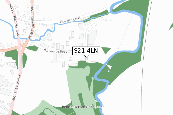
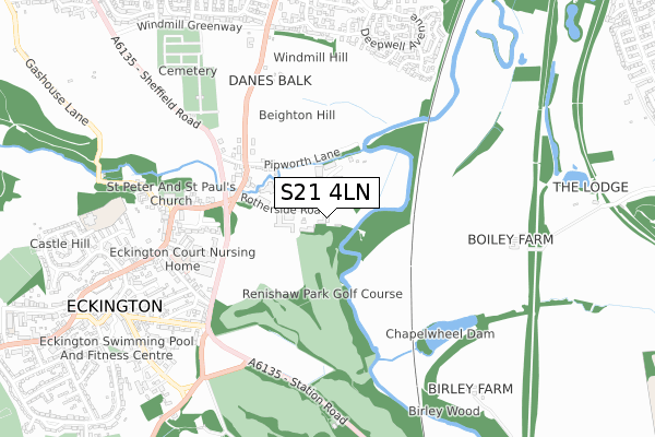
S21 4LN is located in the Eckington North electoral ward, within the local authority district of North East Derbyshire and the English Parliamentary constituency of North East Derbyshire. The Sub Integrated Care Board (ICB) Location is NHS Derby and Derbyshire ICB - 15M and the police force is Derbyshire. This postcode has been in use since October 2019.


GetTheData
Source: OS Open Zoomstack (Ordnance Survey)
Licence: Open Government Licence (requires attribution)
Attribution: Contains OS data © Crown copyright and database right 2024
Source: Open Postcode Geo
Licence: Open Government Licence (requires attribution)
Attribution: Contains OS data © Crown copyright and database right 2024; Contains Royal Mail data © Royal Mail copyright and database right 2024; Source: Office for National Statistics licensed under the Open Government Licence v.3.0
| Easting | 443853 |
| Northing | 379690 |
| Latitude | 53.312358 |
| Longitude | -1.343271 |
GetTheData
Source: Open Postcode Geo
Licence: Open Government Licence
| Country | England |
| Postcode District | S21 |
| ➜ S21 open data dashboard ➜ See where S21 is on a map ➜ Where is Eckington? | |
GetTheData
Source: Land Registry Price Paid Data
Licence: Open Government Licence
| Ward | Eckington North |
| Constituency | North East Derbyshire |
GetTheData
Source: ONS Postcode Database
Licence: Open Government Licence
| June 2022 | Violence and sexual offences | On or near Pipworth Lane | 266m |
| June 2022 | Public order | On or near Rotherham Road | 430m |
| June 2022 | Theft from the person | On or near Littlemoor | 479m |
| ➜ Get more crime data in our Crime section | |||
GetTheData
Source: data.police.uk
Licence: Open Government Licence
| Pipworth Lane (Rotherham Road) | Eckington | 396m |
| Pipworth Lane (Rotherham Road) | Eckington | 435m |
| The Mossbrook (Sheffield Road) | Eckington | 466m |
| The Mossbrook (Sheffield Road) | Eckington | 477m |
| Business Centre (Littlemoor) | Eckington | 504m |
GetTheData
Source: NaPTAN
Licence: Open Government Licence
GetTheData
Source: ONS Postcode Database
Licence: Open Government Licence


➜ Get more ratings from the Food Standards Agency
GetTheData
Source: Food Standards Agency
Licence: FSA terms & conditions
| Last Collection | |||
|---|---|---|---|
| Location | Mon-Fri | Sat | Distance |
| Rectory Road | 16:00 | 08:30 | 650m |
| Deepwell Avenue | 17:15 | 11:15 | 785m |
| Eckington Post Office | 17:30 | 09:00 | 902m |
GetTheData
Source: Dracos
Licence: Creative Commons Attribution-ShareAlike
| Facility | Distance |
|---|---|
| Camms C Of E Primary School Camms Close, Eckington, Sheffield Grass Pitches | 955m |
| Eckington Civic Centre Market Street, Eckington, Sheffield Sports Hall | 957m |
| Eckington Swimming Pool Gosber Street, Eckington, Sheffield Swimming Pool, Health and Fitness Gym, Studio | 982m |
GetTheData
Source: Active Places
Licence: Open Government Licence
| School | Phase of Education | Distance |
|---|---|---|
| Landmarks Littlemoor House, Littlemoor, Eckington, Sheffield, S21 4EF | Not applicable | 483m |
| Camms CofE (Aided) Primary School Camms Close, Castle Hill, Eckington, Chesterfield, S21 4AU | Primary | 955m |
| Eckington Junior School School Street, Eckington, Sheffield, S21 4FL | Primary | 1.3km |
GetTheData
Source: Edubase
Licence: Open Government Licence
| Risk of S21 4LN flooding from rivers and sea | High |
| ➜ S21 4LN flood map | |
GetTheData
Source: Open Flood Risk by Postcode
Licence: Open Government Licence
The below table lists the International Territorial Level (ITL) codes (formerly Nomenclature of Territorial Units for Statistics (NUTS) codes) and Local Administrative Units (LAU) codes for S21 4LN:
| ITL 1 Code | Name |
|---|---|
| TLF | East Midlands (England) |
| ITL 2 Code | Name |
| TLF1 | Derbyshire and Nottinghamshire |
| ITL 3 Code | Name |
| TLF12 | East Derbyshire |
| LAU 1 Code | Name |
| E07000038 | North East Derbyshire |
GetTheData
Source: ONS Postcode Directory
Licence: Open Government Licence
The below table lists the Census Output Area (OA), Lower Layer Super Output Area (LSOA), and Middle Layer Super Output Area (MSOA) for S21 4LN:
| Code | Name | |
|---|---|---|
| OA | E00100157 | |
| LSOA | E01019791 | North East Derbyshire 014A |
| MSOA | E02006804 | North East Derbyshire 014 |
GetTheData
Source: ONS Postcode Directory
Licence: Open Government Licence
| S21 4EY | Pipworth Lane | 371m |
| S21 4FH | Rotherham Road | 444m |
| S21 4EF | Littlemoor | 540m |
| S21 4FP | Sheffield Road | 547m |
| S21 4GL | Rectory Close | 555m |
| S21 4BF | Penny Engine Lane | 610m |
| S21 4LF | Littlemoor | 640m |
| S21 4EW | Peveril Road | 648m |
| S21 4JB | Kings Mews | 656m |
| S21 4BH | Church Street | 662m |
GetTheData
Source: Open Postcode Geo; Land Registry Price Paid Data
Licence: Open Government Licence