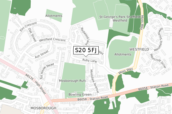
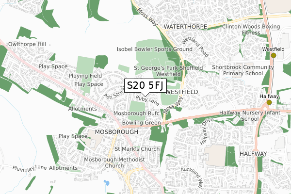
S20 5FJ is located in the Mosborough electoral ward, within the metropolitan district of Sheffield and the English Parliamentary constituency of Sheffield South East. The Sub Integrated Care Board (ICB) Location is NHS South Yorkshire ICB - 03N and the police force is South Yorkshire. This postcode has been in use since August 2017.


GetTheData
Source: OS Open Zoomstack (Ordnance Survey)
Licence: Open Government Licence (requires attribution)
Attribution: Contains OS data © Crown copyright and database right 2024
Source: Open Postcode Geo
Licence: Open Government Licence (requires attribution)
Attribution: Contains OS data © Crown copyright and database right 2024; Contains Royal Mail data © Royal Mail copyright and database right 2024; Source: Office for National Statistics licensed under the Open Government Licence v.3.0
| Easting | 442696 |
| Northing | 381505 |
| Latitude | 53.328765 |
| Longitude | -1.360391 |
GetTheData
Source: Open Postcode Geo
Licence: Open Government Licence
| Country | England |
| Postcode District | S20 |
| ➜ S20 open data dashboard ➜ See where S20 is on a map ➜ Where is Sheffield? | |
GetTheData
Source: Land Registry Price Paid Data
Licence: Open Government Licence
| Ward | Mosborough |
| Constituency | Sheffield South East |
GetTheData
Source: ONS Postcode Database
Licence: Open Government Licence
32, RUBY LANE, MOSBOROUGH, SHEFFIELD, S20 5FJ 2023 3 NOV £310,000 |
34, RUBY LANE, MOSBOROUGH, SHEFFIELD, S20 5FJ 2023 15 SEP £330,000 |
2022 16 JUN £280,000 |
2022 25 MAR £390,000 |
2019 4 APR £315,000 |
38, RUBY LANE, MOSBOROUGH, SHEFFIELD, S20 5FJ 2018 12 NOV £223,000 |
34, RUBY LANE, MOSBOROUGH, SHEFFIELD, S20 5FJ 2018 29 OCT £241,500 |
36, RUBY LANE, MOSBOROUGH, SHEFFIELD, S20 5FJ 2018 29 OCT £241,500 |
2018 19 OCT £223,000 |
40, RUBY LANE, MOSBOROUGH, SHEFFIELD, S20 5FJ 2018 18 OCT £295,000 |
GetTheData
Source: HM Land Registry Price Paid Data
Licence: Contains HM Land Registry data © Crown copyright and database right 2024. This data is licensed under the Open Government Licence v3.0.
| December 2023 | Anti-social behaviour | On or near High Street | 366m |
| December 2023 | Burglary | On or near High Street | 366m |
| November 2023 | Violence and sexual offences | On or near Elm Crescent | 383m |
| ➜ Get more crime data in our Crime section | |||
GetTheData
Source: data.police.uk
Licence: Open Government Licence
| Westfield Crescent (Elm Crescent) | Mosborough | 219m |
| School Street (Station Road) | Mosborough | 240m |
| School Street (Station Road) | Mosborough | 256m |
| High Street (Station Road) | Mosborough | 277m |
| Oak Street (Westfield Crescent) | Mosborough | 305m |
| Halfway (Sheffield Supertram) (Eckington Way) | Halfway Tram Stop | 1,070m |
| Westfield (Sheffield Supertram) (Eckington Way) | Westfield | 1,156m |
| Waterthorpe (Sheffield Supertram) (Eckington Way) | Waterthorpe | 1,335m |
| Crystal Peaks (Sheffield Supertram) (Ochre Dike Lane) | Crystal Peaks Shopping Centre | 1,467m |
| Moss Way (Sheffield Supertram) (Moss Way) | Waterthorpe | 1,501m |
| Woodhouse Station | 3.9km |
GetTheData
Source: NaPTAN
Licence: Open Government Licence
| Percentage of properties with Next Generation Access | 100.0% |
| Percentage of properties with Superfast Broadband | 100.0% |
| Percentage of properties with Ultrafast Broadband | 100.0% |
| Percentage of properties with Full Fibre Broadband | 100.0% |
Superfast Broadband is between 30Mbps and 300Mbps
Ultrafast Broadband is > 300Mbps
| Percentage of properties unable to receive 2Mbps | 0.0% |
| Percentage of properties unable to receive 5Mbps | 0.0% |
| Percentage of properties unable to receive 10Mbps | 0.0% |
| Percentage of properties unable to receive 30Mbps | 0.0% |
GetTheData
Source: Ofcom
Licence: Ofcom Terms of Use (requires attribution)
GetTheData
Source: ONS Postcode Database
Licence: Open Government Licence


➜ Get more ratings from the Food Standards Agency
GetTheData
Source: Food Standards Agency
Licence: FSA terms & conditions
| Last Collection | |||
|---|---|---|---|
| Location | Mon-Fri | Sat | Distance |
| Mossdale Avenue | 16:15 | 10:00 | 222m |
| 9 Westfield Crescent | 16:00 | 10:00 | 376m |
| Mosborough Post Office | 17:00 | 11:15 | 381m |
GetTheData
Source: Dracos
Licence: Creative Commons Attribution-ShareAlike
| Facility | Distance |
|---|---|
| Westfield Sports Centre (Closed) Westfield Crescent, Mosborough, Sheffield Sports Hall, Swimming Pool, Health and Fitness Gym, Athletics, Squash Courts | 71m |
| Mosborough Miners Welfare Station Road, Mosborough, Sheffield Grass Pitches | 226m |
| Mosborough Rufc (New Pitches) Redwood Lane, Mosborough, Sheffield Grass Pitches | 255m |
GetTheData
Source: Active Places
Licence: Open Government Licence
| School | Phase of Education | Distance |
|---|---|---|
| Mosborough Primary School New School Road, Mosborough, Sheffield, S20 5ES | Primary | 604m |
| Halfway Junior School Halfway Centre, Halfway, Sheffield, S20 4TA | Primary | 731m |
| Shortbrook Primary School Westfield Northway, Westfield, Sheffield, S20 8FB | Primary | 813m |
GetTheData
Source: Edubase
Licence: Open Government Licence
The below table lists the International Territorial Level (ITL) codes (formerly Nomenclature of Territorial Units for Statistics (NUTS) codes) and Local Administrative Units (LAU) codes for S20 5FJ:
| ITL 1 Code | Name |
|---|---|
| TLE | Yorkshire and The Humber |
| ITL 2 Code | Name |
| TLE3 | South Yorkshire |
| ITL 3 Code | Name |
| TLE32 | Sheffield |
| LAU 1 Code | Name |
| E08000019 | Sheffield |
GetTheData
Source: ONS Postcode Directory
Licence: Open Government Licence
The below table lists the Census Output Area (OA), Lower Layer Super Output Area (LSOA), and Middle Layer Super Output Area (MSOA) for S20 5FJ:
| Code | Name | |
|---|---|---|
| OA | E00040635 | |
| LSOA | E01008024 | Sheffield 072C |
| MSOA | E02006803 | Sheffield 072 |
GetTheData
Source: ONS Postcode Directory
Licence: Open Government Licence
| S20 5DS | Cragdale Grove | 127m |
| S20 5DT | Kildale Gardens | 141m |
| S20 5DR | Baysdale Croft | 170m |
| S20 5DW | Stonesdale Close | 192m |
| S20 5EL | Toll House Mead | 204m |
| S20 5EN | Toll House Mead | 234m |
| S20 5AR | Ash Street | 267m |
| S20 5AD | Station Road | 272m |
| S20 5AQ | Westfield Crescent | 287m |
| S20 5FE | Vine Grove Court | 303m |
GetTheData
Source: Open Postcode Geo; Land Registry Price Paid Data
Licence: Open Government Licence