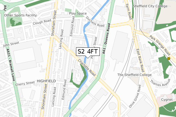
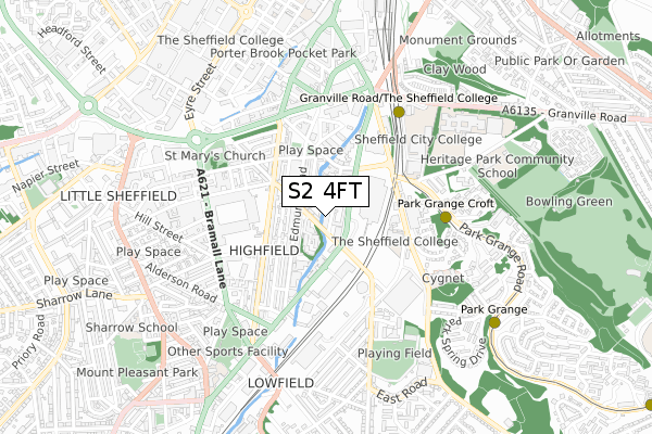
S2 4FT is located in the City electoral ward, within the metropolitan district of Sheffield and the English Parliamentary constituency of Sheffield Central. The Sub Integrated Care Board (ICB) Location is NHS South Yorkshire ICB - 03N and the police force is South Yorkshire. This postcode has been in use since July 2019.


GetTheData
Source: OS Open Zoomstack (Ordnance Survey)
Licence: Open Government Licence (requires attribution)
Attribution: Contains OS data © Crown copyright and database right 2025
Source: Open Postcode Geo
Licence: Open Government Licence (requires attribution)
Attribution: Contains OS data © Crown copyright and database right 2025; Contains Royal Mail data © Royal Mail copyright and database right 2025; Source: Office for National Statistics licensed under the Open Government Licence v.3.0
| Easting | 435666 |
| Northing | 386050 |
| Latitude | 53.370134 |
| Longitude | -1.465428 |
GetTheData
Source: Open Postcode Geo
Licence: Open Government Licence
| Country | England |
| Postcode District | S2 |
➜ See where S2 is on a map ➜ Where is Sheffield? | |
GetTheData
Source: Land Registry Price Paid Data
Licence: Open Government Licence
| Ward | City |
| Constituency | Sheffield Central |
GetTheData
Source: ONS Postcode Database
Licence: Open Government Licence
| Priestley Street (Charlotte Road) | Highfield | 47m |
| Charlotte Road (Queens Road) | Highfield | 73m |
| Edmund Road (Charlotte Road) | Highfield | 81m |
| Cream Street (Queens Road) | Highfield | 131m |
| Queens Road (Charlotte Road) | Highfield | 174m |
| Park Grange Croft (Sheffield Supertram) (Off Park Grange Road) | Norfolk Park | 444m |
| Granville Rd - Sheffield College (Supertram) (Off Granville Road) | Park Hill | 548m |
| Park Grange (Sheffield Supertram) (Park Grange Road) | Norfolk Park | 769m |
| Sheffield Stn - Hallam Uni (Supertram) (Off Sheaf Street) | Sheffield Centre | 902m |
| Arbourthorne Road (Sheffield Supertram) (Park Grange Road) | Norfolk Park | 1,378m |
| Sheffield Station | 0.9km |
| Darnall Station | 3.9km |
| Dore & Totley Station | 5.8km |
GetTheData
Source: NaPTAN
Licence: Open Government Licence
| Percentage of properties with Next Generation Access | 100.0% |
| Percentage of properties with Superfast Broadband | 100.0% |
| Percentage of properties with Ultrafast Broadband | 100.0% |
| Percentage of properties with Full Fibre Broadband | 0.0% |
Superfast Broadband is between 30Mbps and 300Mbps
Ultrafast Broadband is > 300Mbps
| Percentage of properties unable to receive 2Mbps | 0.0% |
| Percentage of properties unable to receive 5Mbps | 0.0% |
| Percentage of properties unable to receive 10Mbps | 0.0% |
| Percentage of properties unable to receive 30Mbps | 0.0% |
GetTheData
Source: Ofcom
Licence: Ofcom Terms of Use (requires attribution)
GetTheData
Source: ONS Postcode Database
Licence: Open Government Licence


➜ Get more ratings from the Food Standards Agency
GetTheData
Source: Food Standards Agency
Licence: FSA terms & conditions
| Last Collection | |||
|---|---|---|---|
| Location | Mon-Fri | Sat | Distance |
| Queens Road | 17:30 | 09:00 | 100m |
| East Bank Road | 17:30 | 10:00 | 273m |
| Shoreham Street Post Office | 18:30 | 12:00 | 341m |
GetTheData
Source: Dracos
Licence: Creative Commons Attribution-ShareAlike
| Risk of S2 4FT flooding from rivers and sea | High |
| ➜ S2 4FT flood map | |
GetTheData
Source: Open Flood Risk by Postcode
Licence: Open Government Licence
The below table lists the International Territorial Level (ITL) codes (formerly Nomenclature of Territorial Units for Statistics (NUTS) codes) and Local Administrative Units (LAU) codes for S2 4FT:
| ITL 1 Code | Name |
|---|---|
| TLE | Yorkshire and The Humber |
| ITL 2 Code | Name |
| TLE3 | South Yorkshire |
| ITL 3 Code | Name |
| TLE32 | Sheffield |
| LAU 1 Code | Name |
| E08000019 | Sheffield |
GetTheData
Source: ONS Postcode Directory
Licence: Open Government Licence
The below table lists the Census Output Area (OA), Lower Layer Super Output Area (LSOA), and Middle Layer Super Output Area (MSOA) for S2 4FT:
| Code | Name | |
|---|---|---|
| OA | E00172448 | |
| LSOA | E01033273 | Sheffield 042F |
| MSOA | E02001652 | Sheffield 042 |
GetTheData
Source: ONS Postcode Directory
Licence: Open Government Licence
| S2 4DB | Cream Street | 99m |
| S2 4DP | Edmund Court | 106m |
| S2 4EG | Edmund Road | 119m |
| S2 4DJ | Edmund Court | 120m |
| S2 4DD | Priestley Street | 126m |
| S2 4DH | Queens Road | 127m |
| S2 4DE | Edmund Court | 139m |
| S2 4BQ | Rowsley Street | 141m |
| S2 4EH | Edmund Road | 142m |
| S2 4EQ | Charlotte Road | 144m |
GetTheData
Source: Open Postcode Geo; Land Registry Price Paid Data
Licence: Open Government Licence