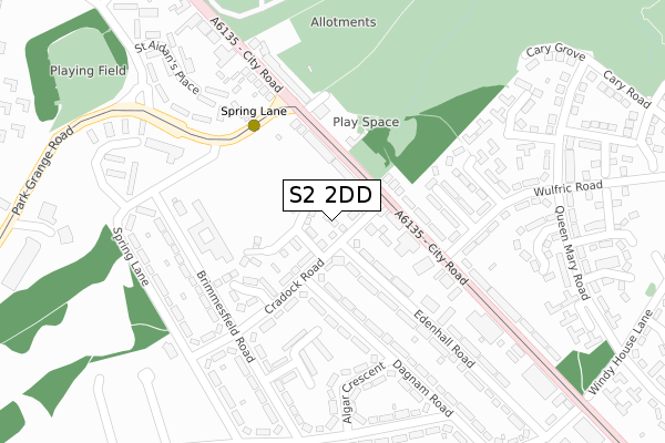
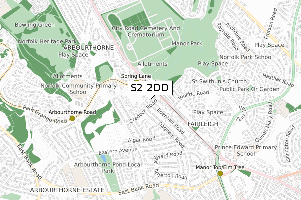
S2 2DD is located in the Park and Arbourthorne electoral ward, within the metropolitan district of Sheffield and the English Parliamentary constituency of Sheffield, Heeley. The Sub Integrated Care Board (ICB) Location is NHS South Yorkshire ICB - 03N and the police force is South Yorkshire. This postcode has been in use since January 2020.


GetTheData
Source: OS Open Zoomstack (Ordnance Survey)
Licence: Open Government Licence (requires attribution)
Attribution: Contains OS data © Crown copyright and database right 2025
Source: Open Postcode Geo
Licence: Open Government Licence (requires attribution)
Attribution: Contains OS data © Crown copyright and database right 2025; Contains Royal Mail data © Royal Mail copyright and database right 2025; Source: Office for National Statistics licensed under the Open Government Licence v.3.0
| Easting | 437505 |
| Northing | 385559 |
| Latitude | 53.365595 |
| Longitude | -1.437849 |
GetTheData
Source: Open Postcode Geo
Licence: Open Government Licence
| Country | England |
| Postcode District | S2 |
➜ See where S2 is on a map ➜ Where is Sheffield? | |
GetTheData
Source: Land Registry Price Paid Data
Licence: Open Government Licence
| Ward | Park And Arbourthorne |
| Constituency | Sheffield, Heeley |
GetTheData
Source: ONS Postcode Database
Licence: Open Government Licence
2024 29 JAN £222,000 |
2023 10 NOV £210,000 |
2023 31 JUL £207,000 |
2023 30 JUN £225,000 |
2023 31 MAY £210,000 |
38, STROUTS WAY, SHEFFIELD, S2 2DD 2022 30 JUN £212,995 |
2021 21 JUN £173,995 |
23, STROUTS WAY, SHEFFIELD, S2 2DD 2021 28 MAY £174,995 |
17, STROUTS WAY, SHEFFIELD, S2 2DD 2021 31 MAR £170,995 |
28, STROUTS WAY, SHEFFIELD, S2 2DD 2020 18 DEC £186,995 |
GetTheData
Source: HM Land Registry Price Paid Data
Licence: Contains HM Land Registry data © Crown copyright and database right 2025. This data is licensed under the Open Government Licence v3.0.
| Park Grange Road (City Road) | Manor | 87m |
| Spring Lane (Park Grange Road) | Norfolk Park | 197m |
| St Aidans Road (Park Grange Road) | Norfolk Park | 204m |
| Park Grange Road (City Road) | Manor | 218m |
| Wulfric Road (City Road) | Manor | 240m |
| Spring Lane (Sheffield Supertram) (Park Grange Road) | Fairleigh | 98m |
| Arbourthorne Road (Sheffield Supertram) (Park Grange Road) | Norfolk Park | 717m |
| Manor Top - Elm Tree (Sheffield Supertram) (Off Ridgeway Road) | Manor Top | 895m |
| Park Grange (Sheffield Supertram) (Park Grange Road) | Norfolk Park | 1,155m |
| Park Grange Croft (Sheffield Supertram) (Off Park Grange Road) | Norfolk Park | 1,488m |
| Sheffield Station | 2.1km |
| Darnall Station | 2.7km |
GetTheData
Source: NaPTAN
Licence: Open Government Licence
GetTheData
Source: ONS Postcode Database
Licence: Open Government Licence


➜ Get more ratings from the Food Standards Agency
GetTheData
Source: Food Standards Agency
Licence: FSA terms & conditions
| Last Collection | |||
|---|---|---|---|
| Location | Mon-Fri | Sat | Distance |
| 510 City Road | 17:30 | 12:20 | 446m |
| Guildford Avenue | 17:00 | 10:00 | 477m |
| Manor Post Office | 15:00 | 12:00 | 619m |
GetTheData
Source: Dracos
Licence: Creative Commons Attribution-ShareAlike
The below table lists the International Territorial Level (ITL) codes (formerly Nomenclature of Territorial Units for Statistics (NUTS) codes) and Local Administrative Units (LAU) codes for S2 2DD:
| ITL 1 Code | Name |
|---|---|
| TLE | Yorkshire and The Humber |
| ITL 2 Code | Name |
| TLE3 | South Yorkshire |
| ITL 3 Code | Name |
| TLE32 | Sheffield |
| LAU 1 Code | Name |
| E08000019 | Sheffield |
GetTheData
Source: ONS Postcode Directory
Licence: Open Government Licence
The below table lists the Census Output Area (OA), Lower Layer Super Output Area (LSOA), and Middle Layer Super Output Area (MSOA) for S2 2DD:
| Code | Name | |
|---|---|---|
| OA | E00041060 | |
| LSOA | E01008097 | Sheffield 043C |
| MSOA | E02001653 | Sheffield 043 |
GetTheData
Source: ONS Postcode Directory
Licence: Open Government Licence
| S2 1GH | City Road | 62m |
| S2 1GF | City Road | 138m |
| S2 1GG | City Road | 147m |
| S2 2NB | Park Grange Road | 154m |
| S2 2JW | Cradock Road | 177m |
| S2 1GJ | City Road | 177m |
| S2 1GL | City Road | 183m |
| S2 2JQ | Spring Lane | 190m |
| S2 2JR | Brimmesfield Road | 219m |
| S2 2LA | Dagnam Road | 225m |
GetTheData
Source: Open Postcode Geo; Land Registry Price Paid Data
Licence: Open Government Licence