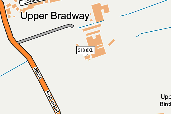
S18 8XL is located in the Dronfield Woodhouse electoral ward, within the local authority district of North East Derbyshire and the English Parliamentary constituency of North East Derbyshire. The Sub Integrated Care Board (ICB) Location is NHS Derby and Derbyshire ICB - 15M and the police force is Derbyshire. This postcode has been in use since June 1997.


GetTheData
Source: OS OpenMap – Local (Ordnance Survey)
Source: OS VectorMap District (Ordnance Survey)
Licence: Open Government Licence (requires attribution)
| Easting | 433006 |
| Northing | 379877 |
| Latitude | 53.314822 |
| Longitude | -1.506046 |
GetTheData
Source: Open Postcode Geo
Licence: Open Government Licence
| Country | England |
| Postcode District | S18 |
➜ See where S18 is on a map | |
GetTheData
Source: Land Registry Price Paid Data
Licence: Open Government Licence
Elevation or altitude of S18 8XL as distance above sea level:
| Metres | Feet | |
|---|---|---|
| Elevation | 200m | 656ft |
Elevation is measured from the approximate centre of the postcode, to the nearest point on an OS contour line from OS Terrain 50, which has contour spacing of ten vertical metres.
➜ How high above sea level am I? Find the elevation of your current position using your device's GPS.
GetTheData
Source: Open Postcode Elevation
Licence: Open Government Licence
| Ward | Dronfield Woodhouse |
| Constituency | North East Derbyshire |
GetTheData
Source: ONS Postcode Database
Licence: Open Government Licence
| Bradway Road | Bradway | 332m |
| Bradway Road | Bradway | 335m |
| Bradway Grange Road (Bradway Road) | Bradway | 336m |
| Prospect Road (Bradway Road) | Bradway | 394m |
| Prospect Road (Bradway Road) | Bradway | 398m |
| Dore & Totley Station | 1.6km |
| Dronfield Station | 2.9km |
GetTheData
Source: NaPTAN
Licence: Open Government Licence
| Percentage of properties with Next Generation Access | 100.0% |
| Percentage of properties with Superfast Broadband | 33.3% |
| Percentage of properties with Ultrafast Broadband | 0.0% |
| Percentage of properties with Full Fibre Broadband | 0.0% |
Superfast Broadband is between 30Mbps and 300Mbps
Ultrafast Broadband is > 300Mbps
| Percentage of properties unable to receive 2Mbps | 0.0% |
| Percentage of properties unable to receive 5Mbps | 0.0% |
| Percentage of properties unable to receive 10Mbps | 0.0% |
| Percentage of properties unable to receive 30Mbps | 66.7% |
GetTheData
Source: Ofcom
Licence: Ofcom Terms of Use (requires attribution)
GetTheData
Source: ONS Postcode Database
Licence: Open Government Licence


➜ Get more ratings from the Food Standards Agency
GetTheData
Source: Food Standards Agency
Licence: FSA terms & conditions
| Last Collection | |||
|---|---|---|---|
| Location | Mon-Fri | Sat | Distance |
| Bradway Post Office | 17:05 | 12:00 | 432m |
| 105 Prospect Road | 16:00 | 10:30 | 493m |
| 13 Twentywell Road | 16:00 | 09:30 | 717m |
GetTheData
Source: Dracos
Licence: Creative Commons Attribution-ShareAlike
The below table lists the International Territorial Level (ITL) codes (formerly Nomenclature of Territorial Units for Statistics (NUTS) codes) and Local Administrative Units (LAU) codes for S18 8XL:
| ITL 1 Code | Name |
|---|---|
| TLF | East Midlands (England) |
| ITL 2 Code | Name |
| TLF1 | Derbyshire and Nottinghamshire |
| ITL 3 Code | Name |
| TLF12 | East Derbyshire |
| LAU 1 Code | Name |
| E07000038 | North East Derbyshire |
GetTheData
Source: ONS Postcode Directory
Licence: Open Government Licence
The below table lists the Census Output Area (OA), Lower Layer Super Output Area (LSOA), and Middle Layer Super Output Area (MSOA) for S18 8XL:
| Code | Name | |
|---|---|---|
| OA | E00100133 | |
| LSOA | E01019787 | North East Derbyshire 005B |
| MSOA | E02004109 | North East Derbyshire 005 |
GetTheData
Source: ONS Postcode Directory
Licence: Open Government Licence
| S17 4PG | Conalan Avenue | 250m |
| S17 4PH | Bradway Grange Road | 268m |
| S17 4PF | Bradway Road | 323m |
| S17 4PE | Bradway Road | 358m |
| S17 4PJ | Kenwell Drive | 411m |
| S17 4QL | Birchitt Place | 414m |
| S17 4QZ | Bradway Road | 417m |
| S17 4QH | Twentywell Lane | 419m |
| S17 4QS | Bradway Road | 438m |
| S17 4QJ | Birchitt Close | 441m |
GetTheData
Source: Open Postcode Geo; Land Registry Price Paid Data
Licence: Open Government Licence