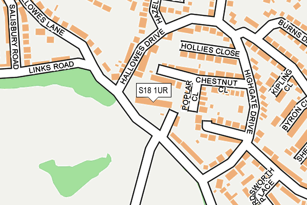
S18 1UR is located in the Dronfield South electoral ward, within the local authority district of North East Derbyshire and the English Parliamentary constituency of North East Derbyshire. The Sub Integrated Care Board (ICB) Location is NHS Derby and Derbyshire ICB - 15M and the police force is Derbyshire. This postcode has been in use since June 1997.


GetTheData
Source: OS OpenMap – Local (Ordnance Survey)
Source: OS VectorMap District (Ordnance Survey)
Licence: Open Government Licence (requires attribution)
| Easting | 435987 |
| Northing | 377461 |
| Latitude | 53.292894 |
| Longitude | -1.461577 |
GetTheData
Source: Open Postcode Geo
Licence: Open Government Licence
| Country | England |
| Postcode District | S18 |
➜ See where S18 is on a map ➜ Where is Dronfield? | |
GetTheData
Source: Land Registry Price Paid Data
Licence: Open Government Licence
Elevation or altitude of S18 1UR as distance above sea level:
| Metres | Feet | |
|---|---|---|
| Elevation | 190m | 623ft |
Elevation is measured from the approximate centre of the postcode, to the nearest point on an OS contour line from OS Terrain 50, which has contour spacing of ten vertical metres.
➜ How high above sea level am I? Find the elevation of your current position using your device's GPS.
GetTheData
Source: Open Postcode Elevation
Licence: Open Government Licence
| Ward | Dronfield South |
| Constituency | North East Derbyshire |
GetTheData
Source: ONS Postcode Database
Licence: Open Government Licence
| Highgate Drive | Hallowes | 193m |
| Shakespeare Crescent | Hallowes | 214m |
| Burns Drive (Shakespeare Crescent) | Hallowes | 227m |
| Burns Drive (Shakespeare Crescent) | Hallowes | 231m |
| Eastfield Road (Hallowes Rise) | Hallowes | 304m |
| Dronfield Station | 1.1km |
| Dore & Totley Station | 5.3km |
GetTheData
Source: NaPTAN
Licence: Open Government Licence
GetTheData
Source: ONS Postcode Database
Licence: Open Government Licence


➜ Get more ratings from the Food Standards Agency
GetTheData
Source: Food Standards Agency
Licence: FSA terms & conditions
| Last Collection | |||
|---|---|---|---|
| Location | Mon-Fri | Sat | Distance |
| Highgate Drive | 17:30 | 12:00 | 37m |
| 90 Cemetery Road | 17:30 | 12:00 | 476m |
| Hill Top Road Post Office | 17:30 | 12:00 | 485m |
GetTheData
Source: Dracos
Licence: Creative Commons Attribution-ShareAlike
The below table lists the International Territorial Level (ITL) codes (formerly Nomenclature of Territorial Units for Statistics (NUTS) codes) and Local Administrative Units (LAU) codes for S18 1UR:
| ITL 1 Code | Name |
|---|---|
| TLF | East Midlands (England) |
| ITL 2 Code | Name |
| TLF1 | Derbyshire and Nottinghamshire |
| ITL 3 Code | Name |
| TLF12 | East Derbyshire |
| LAU 1 Code | Name |
| E07000038 | North East Derbyshire |
GetTheData
Source: ONS Postcode Directory
Licence: Open Government Licence
The below table lists the Census Output Area (OA), Lower Layer Super Output Area (LSOA), and Middle Layer Super Output Area (MSOA) for S18 1UR:
| Code | Name | |
|---|---|---|
| OA | E00100126 | |
| LSOA | E01019785 | North East Derbyshire 006C |
| MSOA | E02004110 | North East Derbyshire 006 |
GetTheData
Source: ONS Postcode Directory
Licence: Open Government Licence
| S18 1TX | Poplar Close | 65m |
| S18 1WF | Chestnut Close | 108m |
| S18 1YH | Hallowes Drive | 127m |
| S18 1TY | Hollies Close | 138m |
| S18 1WE | Greenacres Close | 146m |
| S18 1UD | Highgate Drive | 170m |
| S18 1TW | Hazel Court | 206m |
| S18 1UB | Highgate Lane | 206m |
| S18 1UE | Links Road | 225m |
| S18 1TZ | Hazel Close | 226m |
GetTheData
Source: Open Postcode Geo; Land Registry Price Paid Data
Licence: Open Government Licence