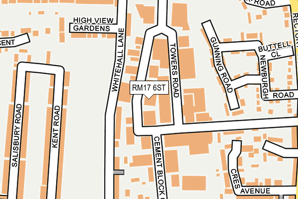
RM17 6ST lies on Globe Industrial Estate in Grays. RM17 6ST is located in the Little Thurrock Rectory electoral ward, within the unitary authority of Thurrock and the English Parliamentary constituency of Thurrock. The Sub Integrated Care Board (ICB) Location is NHS Mid and South Essex ICB - 07G and the police force is Essex. This postcode has been in use since January 1980.


GetTheData
Source: OS OpenMap – Local (Ordnance Survey)
Source: OS VectorMap District (Ordnance Survey)
Licence: Open Government Licence (requires attribution)
| Easting | 562409 |
| Northing | 178140 |
| Latitude | 51.478906 |
| Longitude | 0.337392 |
GetTheData
Source: Open Postcode Geo
Licence: Open Government Licence
| Street | Globe Industrial Estate |
| Town/City | Grays |
| Country | England |
| Postcode District | RM17 |
➜ See where RM17 is on a map ➜ Where is Grays? | |
GetTheData
Source: Land Registry Price Paid Data
Licence: Open Government Licence
Elevation or altitude of RM17 6ST as distance above sea level:
| Metres | Feet | |
|---|---|---|
| Elevation | 10m | 33ft |
Elevation is measured from the approximate centre of the postcode, to the nearest point on an OS contour line from OS Terrain 50, which has contour spacing of ten vertical metres.
➜ How high above sea level am I? Find the elevation of your current position using your device's GPS.
GetTheData
Source: Open Postcode Elevation
Licence: Open Government Licence
| Ward | Little Thurrock Rectory |
| Constituency | Thurrock |
GetTheData
Source: ONS Postcode Database
Licence: Open Government Licence
| Broadway | Little Thurrock | 303m |
| Broadway (Whitehall Lane) | Little Thurrock | 309m |
| Kent Road (East Thurrock Road) | Grays | 369m |
| Kent Road (East Thurrock Road) | Grays | 377m |
| Tyrells Hall (Dock Road) | Grays | 382m |
| Grays Station | 1.1km |
| Tilbury Town Station | 2.2km |
| Chafford Hundred Station | 3.5km |
GetTheData
Source: NaPTAN
Licence: Open Government Licence
| Median download speed | 46.3Mbps |
| Average download speed | 47.3Mbps |
| Maximum download speed | 80.00Mbps |
| Median upload speed | 12.1Mbps |
| Average upload speed | 11.4Mbps |
| Maximum upload speed | 20.00Mbps |
GetTheData
Source: Ofcom
Licence: Ofcom Terms of Use (requires attribution)
Estimated total energy consumption in RM17 6ST by fuel type, 2015.
| Consumption (kWh) | 139,348 |
|---|---|
| Meter count | 13 |
| Mean (kWh/meter) | 10,719 |
| Median (kWh/meter) | 1,118 |
GetTheData
Source: Postcode level gas estimates: 2015 (experimental)
Source: Postcode level electricity estimates: 2015 (experimental)
Licence: Open Government Licence
GetTheData
Source: ONS Postcode Database
Licence: Open Government Licence


➜ Get more ratings from the Food Standards Agency
GetTheData
Source: Food Standards Agency
Licence: FSA terms & conditions
| Last Collection | |||
|---|---|---|---|
| Location | Mon-Fri | Sat | Distance |
| Gipsy Lane | 17:00 | 12:00 | 341m |
| Southend Road | 17:30 | 12:00 | 602m |
| Dell Road | 17:45 | 12:00 | 692m |
GetTheData
Source: Dracos
Licence: Creative Commons Attribution-ShareAlike
The below table lists the International Territorial Level (ITL) codes (formerly Nomenclature of Territorial Units for Statistics (NUTS) codes) and Local Administrative Units (LAU) codes for RM17 6ST:
| ITL 1 Code | Name |
|---|---|
| TLH | East |
| ITL 2 Code | Name |
| TLH3 | Essex |
| ITL 3 Code | Name |
| TLH32 | Thurrock |
| LAU 1 Code | Name |
| E06000034 | Thurrock |
GetTheData
Source: ONS Postcode Directory
Licence: Open Government Licence
The below table lists the Census Output Area (OA), Lower Layer Super Output Area (LSOA), and Middle Layer Super Output Area (MSOA) for RM17 6ST:
| Code | Name | |
|---|---|---|
| OA | E00080736 | |
| LSOA | E01015968 | Thurrock 014C |
| MSOA | E02003309 | Thurrock 014 |
GetTheData
Source: ONS Postcode Directory
Licence: Open Government Licence
| RM17 6UQ | Gunning Road | 118m |
| RM17 6SH | Whitehall Lane | 141m |
| RM17 6UW | Hawkridge Drive | 173m |
| RM17 6LJ | Crescent Court | 193m |
| RM17 6UG | Newburgh Road | 199m |
| RM17 6TD | High View Gardens | 201m |
| RM17 6RX | High View Avenue | 222m |
| RM17 6SS | Whitehall Lane | 230m |
| RM17 6DF | Kent Road | 231m |
| RM17 6BF | Overcliff Road | 244m |
GetTheData
Source: Open Postcode Geo; Land Registry Price Paid Data
Licence: Open Government Licence