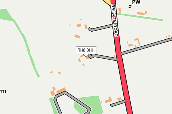
RH6 0HH lies on Reigate Road in Hookwood, Horley. RH6 0HH is located in the Capel, Leigh, Newdigate & Charlwood electoral ward, within the local authority district of Mole Valley and the English Parliamentary constituency of Mole Valley. The Sub Integrated Care Board (ICB) Location is NHS Surrey Heartlands ICB - 92A and the police force is Surrey. This postcode has been in use since January 1980.


GetTheData
Source: OS OpenMap – Local (Ordnance Survey)
Source: OS VectorMap District (Ordnance Survey)
Licence: Open Government Licence (requires attribution)
| Easting | 526148 |
| Northing | 143670 |
| Latitude | 51.178357 |
| Longitude | -0.196684 |
GetTheData
Source: Open Postcode Geo
Licence: Open Government Licence
| Street | Reigate Road |
| Locality | Hookwood |
| Town/City | Horley |
| Country | England |
| Postcode District | RH6 |
➜ See where RH6 is on a map | |
GetTheData
Source: Land Registry Price Paid Data
Licence: Open Government Licence
Elevation or altitude of RH6 0HH as distance above sea level:
| Metres | Feet | |
|---|---|---|
| Elevation | 60m | 197ft |
Elevation is measured from the approximate centre of the postcode, to the nearest point on an OS contour line from OS Terrain 50, which has contour spacing of ten vertical metres.
➜ How high above sea level am I? Find the elevation of your current position using your device's GPS.
GetTheData
Source: Open Postcode Elevation
Licence: Open Government Licence
| Ward | Capel, Leigh, Newdigate & Charlwood |
| Constituency | Mole Valley |
GetTheData
Source: ONS Postcode Database
Licence: Open Government Licence
| Ranch House Rest (Reigate Road) | Wrays | 166m |
| Ranch House Rest (Reigate Road) | Wrays | 167m |
| Dagmer Cottages (Reigate Road) | Wrays | 647m |
| Dagmer Cottages (Reigate Road) | Wrays | 659m |
| Black Horse (Mill Lane) | Hookwood | 711m |
| Horley Station | 2.7km |
| Gatwick Airport Station | 3.5km |
| Salfords (Surrey) Station | 3.5km |
GetTheData
Source: NaPTAN
Licence: Open Government Licence
| Percentage of properties with Next Generation Access | 100.0% |
| Percentage of properties with Superfast Broadband | 100.0% |
| Percentage of properties with Ultrafast Broadband | 0.0% |
| Percentage of properties with Full Fibre Broadband | 0.0% |
Superfast Broadband is between 30Mbps and 300Mbps
Ultrafast Broadband is > 300Mbps
| Percentage of properties unable to receive 2Mbps | 0.0% |
| Percentage of properties unable to receive 5Mbps | 0.0% |
| Percentage of properties unable to receive 10Mbps | 0.0% |
| Percentage of properties unable to receive 30Mbps | 0.0% |
GetTheData
Source: Ofcom
Licence: Ofcom Terms of Use (requires attribution)
GetTheData
Source: ONS Postcode Database
Licence: Open Government Licence


➜ Get more ratings from the Food Standards Agency
GetTheData
Source: Food Standards Agency
Licence: FSA terms & conditions
| Last Collection | |||
|---|---|---|---|
| Location | Mon-Fri | Sat | Distance |
| Crutchfield Lane | 16:30 | 07:00 | 244m |
| Blackhorse | 16:30 | 07:00 | 711m |
| The Mill | 17:15 | 12:00 | 1,027m |
GetTheData
Source: Dracos
Licence: Creative Commons Attribution-ShareAlike
The below table lists the International Territorial Level (ITL) codes (formerly Nomenclature of Territorial Units for Statistics (NUTS) codes) and Local Administrative Units (LAU) codes for RH6 0HH:
| ITL 1 Code | Name |
|---|---|
| TLJ | South East (England) |
| ITL 2 Code | Name |
| TLJ2 | Surrey, East and West Sussex |
| ITL 3 Code | Name |
| TLJ26 | East Surrey |
| LAU 1 Code | Name |
| E07000210 | Mole Valley |
GetTheData
Source: ONS Postcode Directory
Licence: Open Government Licence
The below table lists the Census Output Area (OA), Lower Layer Super Output Area (LSOA), and Middle Layer Super Output Area (MSOA) for RH6 0HH:
| Code | Name | |
|---|---|---|
| OA | E00155715 | |
| LSOA | E01030531 | Mole Valley 013D |
| MSOA | E02006374 | Mole Valley 013 |
GetTheData
Source: ONS Postcode Directory
Licence: Open Government Licence
| RH6 0HN | Horsehill | 518m |
| RH6 0HT | Crutchfield Lane | 606m |
| RH6 0HL | Reigate Road | 670m |
| RH6 0HX | Mill Lane | 745m |
| RH6 0HJ | Reigate Road | 784m |
| RH6 0RB | Horsehill | 891m |
| RH6 0HQ | Reigate Road | 920m |
| RH6 8HE | Lee Street | 953m |
| RH6 8JQ | Bullfinch Close | 978m |
| RH6 8DG | Charm Close | 989m |
GetTheData
Source: Open Postcode Geo; Land Registry Price Paid Data
Licence: Open Government Licence