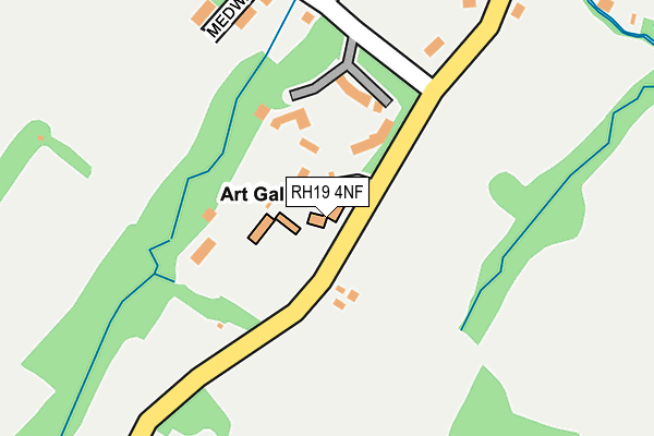
RH19 4NF lies on West Hoathly Road in East Grinstead. RH19 4NF is located in the Ashurst Wood & East Grinstead South electoral ward, within the local authority district of Mid Sussex and the English Parliamentary constituency of Mid Sussex. The Sub Integrated Care Board (ICB) Location is NHS Sussex ICB - 70F and the police force is Sussex. This postcode has been in use since January 1980.


GetTheData
Source: OS OpenMap – Local (Ordnance Survey)
Source: OS VectorMap District (Ordnance Survey)
Licence: Open Government Licence (requires attribution)
| Easting | 539080 |
| Northing | 136606 |
| Latitude | 51.111876 |
| Longitude | -0.014488 |
GetTheData
Source: Open Postcode Geo
Licence: Open Government Licence
| Street | West Hoathly Road |
| Town/City | East Grinstead |
| Country | England |
| Postcode District | RH19 |
➜ See where RH19 is on a map ➜ Where is East Grinstead? | |
GetTheData
Source: Land Registry Price Paid Data
Licence: Open Government Licence
Elevation or altitude of RH19 4NF as distance above sea level:
| Metres | Feet | |
|---|---|---|
| Elevation | 90m | 295ft |
Elevation is measured from the approximate centre of the postcode, to the nearest point on an OS contour line from OS Terrain 50, which has contour spacing of ten vertical metres.
➜ How high above sea level am I? Find the elevation of your current position using your device's GPS.
GetTheData
Source: Open Postcode Elevation
Licence: Open Government Licence
| Ward | Ashurst Wood & East Grinstead South |
| Constituency | Mid Sussex |
GetTheData
Source: ONS Postcode Database
Licence: Open Government Licence
| Old Dunnings Mill Ph (Dunnings Road) | East Grinstead | 337m |
| Old Dunnings Mill Ph (Dunnings Road) | East Grinstead | 398m |
| Coronation Road (Dunnings Road) | East Grinstead | 489m |
| Coronation Road (Dunnings Road) | East Grinstead | 543m |
| Standen House Nt Entrance (West Hoathly Road) | Saint Hill Green | 594m |
| East Grinstead Station | 1.6km |
| Dormans Station | 4.9km |
GetTheData
Source: NaPTAN
Licence: Open Government Licence
GetTheData
Source: ONS Postcode Database
Licence: Open Government Licence


➜ Get more ratings from the Food Standards Agency
GetTheData
Source: Food Standards Agency
Licence: FSA terms & conditions
| Last Collection | |||
|---|---|---|---|
| Location | Mon-Fri | Sat | Distance |
| Hurst Farm Road East | 17:00 | 12:15 | 1,120m |
| Safeways | 17:30 | 12:15 | 1,359m |
| Lloyds Bank High Street | 17:15 | 12:00 | 1,436m |
GetTheData
Source: Dracos
Licence: Creative Commons Attribution-ShareAlike
The below table lists the International Territorial Level (ITL) codes (formerly Nomenclature of Territorial Units for Statistics (NUTS) codes) and Local Administrative Units (LAU) codes for RH19 4NF:
| ITL 1 Code | Name |
|---|---|
| TLJ | South East (England) |
| ITL 2 Code | Name |
| TLJ2 | Surrey, East and West Sussex |
| ITL 3 Code | Name |
| TLJ28 | West Sussex (North East) |
| LAU 1 Code | Name |
| E07000228 | Mid Sussex |
GetTheData
Source: ONS Postcode Directory
Licence: Open Government Licence
The below table lists the Census Output Area (OA), Lower Layer Super Output Area (LSOA), and Middle Layer Super Output Area (MSOA) for RH19 4NF:
| Code | Name | |
|---|---|---|
| OA | E00161828 | |
| LSOA | E01031736 | Mid Sussex 004A |
| MSOA | E02006607 | Mid Sussex 004 |
GetTheData
Source: ONS Postcode Directory
Licence: Open Government Licence
| RH19 4NB | Medway Drive | 195m |
| RH19 4RQ | Streatfield Place | 247m |
| RH19 4LZ | Coombe Hill Road | 278m |
| RH19 4AS | Dunnings Road | 361m |
| RH19 4AU | Stockwell Road | 410m |
| RH19 4QW | Sunnyside Close | 413m |
| RH19 4AT | Dunning Road | 414m |
| RH19 4BD | Stockwell Road | 441m |
| RH19 4AN | Mill Cottages | 466m |
| RH19 4AZ | Lister Avenue | 473m |
GetTheData
Source: Open Postcode Geo; Land Registry Price Paid Data
Licence: Open Government Licence