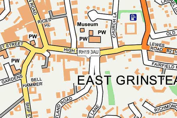
RH19 3AU is located in the East Grinstead Herontye electoral ward, within the local authority district of Mid Sussex and the English Parliamentary constituency of Mid Sussex. The Sub Integrated Care Board (ICB) Location is NHS Sussex ICB - 70F and the police force is Sussex. This postcode has been in use since January 1980.


GetTheData
Source: OS OpenMap – Local (Ordnance Survey)
Source: OS VectorMap District (Ordnance Survey)
Licence: Open Government Licence (requires attribution)
| Easting | 539626 |
| Northing | 137933 |
| Latitude | 51.123672 |
| Longitude | -0.006207 |
GetTheData
Source: Open Postcode Geo
Licence: Open Government Licence
| Country | England |
| Postcode District | RH19 |
➜ See where RH19 is on a map ➜ Where is East Grinstead? | |
GetTheData
Source: Land Registry Price Paid Data
Licence: Open Government Licence
Elevation or altitude of RH19 3AU as distance above sea level:
| Metres | Feet | |
|---|---|---|
| Elevation | 130m | 427ft |
Elevation is measured from the approximate centre of the postcode, to the nearest point on an OS contour line from OS Terrain 50, which has contour spacing of ten vertical metres.
➜ How high above sea level am I? Find the elevation of your current position using your device's GPS.
GetTheData
Source: Open Postcode Elevation
Licence: Open Government Licence
| Ward | East Grinstead Herontye |
| Constituency | Mid Sussex |
GetTheData
Source: ONS Postcode Database
Licence: Open Government Licence
| War Memorial (High Street) | East Grinstead | 99m |
| Sackville College (High Street) | East Grinstead | 121m |
| War Memorial (High Street) | East Grinstead | 130m |
| Sackville College (High Street) | East Grinstead | 146m |
| Bell Hammer (Ship Street) | East Grinstead | 231m |
| East Grinstead Station | 0.9km |
| Dormans Station | 3.6km |
GetTheData
Source: NaPTAN
Licence: Open Government Licence
GetTheData
Source: ONS Postcode Database
Licence: Open Government Licence


➜ Get more ratings from the Food Standards Agency
GetTheData
Source: Food Standards Agency
Licence: FSA terms & conditions
| Last Collection | |||
|---|---|---|---|
| Location | Mon-Fri | Sat | Distance |
| High Street P O | 17:00 | 12:00 | 108m |
| Lloyds Bank High Street | 17:15 | 12:00 | 116m |
| Safeways | 17:30 | 12:15 | 322m |
GetTheData
Source: Dracos
Licence: Creative Commons Attribution-ShareAlike
The below table lists the International Territorial Level (ITL) codes (formerly Nomenclature of Territorial Units for Statistics (NUTS) codes) and Local Administrative Units (LAU) codes for RH19 3AU:
| ITL 1 Code | Name |
|---|---|
| TLJ | South East (England) |
| ITL 2 Code | Name |
| TLJ2 | Surrey, East and West Sussex |
| ITL 3 Code | Name |
| TLJ28 | West Sussex (North East) |
| LAU 1 Code | Name |
| E07000228 | Mid Sussex |
GetTheData
Source: ONS Postcode Directory
Licence: Open Government Licence
The below table lists the Census Output Area (OA), Lower Layer Super Output Area (LSOA), and Middle Layer Super Output Area (MSOA) for RH19 3AU:
| Code | Name | |
|---|---|---|
| OA | E00161855 | |
| LSOA | E01031742 | Mid Sussex 001F |
| MSOA | E02006604 | Mid Sussex 001 |
GetTheData
Source: ONS Postcode Directory
Licence: Open Government Licence
| RH19 3AX | Middle Row | 17m |
| RH19 3AS | High Street | 27m |
| RH19 4EZ | Portland Road | 67m |
| RH19 3DE | High Street | 70m |
| RH19 3AF | High Street | 76m |
| RH19 3DD | High Street | 88m |
| RH19 3BF | Cantelupe Road | 89m |
| RH19 4EA | Portland Road | 113m |
| RH19 3AW | High Street | 117m |
| RH19 3AA | High Street | 157m |
GetTheData
Source: Open Postcode Geo; Land Registry Price Paid Data
Licence: Open Government Licence