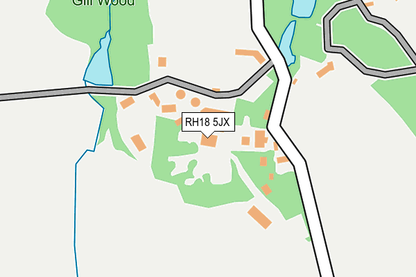
RH18 5JX is in Forest Row. RH18 5JX is located in the Hartfield electoral ward, within the local authority district of Wealden and the English Parliamentary constituency of Wealden. The Sub Integrated Care Board (ICB) Location is NHS Sussex ICB - 97R and the police force is Sussex. This postcode has been in use since January 1980.


GetTheData
Source: OS OpenMap – Local (Ordnance Survey)
Source: OS VectorMap District (Ordnance Survey)
Licence: Open Government Licence (requires attribution)
| Easting | 543745 |
| Northing | 135417 |
| Latitude | 51.100045 |
| Longitude | 0.051609 |
GetTheData
Source: Open Postcode Geo
Licence: Open Government Licence
| Town/City | Forest Row |
| Country | England |
| Postcode District | RH18 |
➜ See where RH18 is on a map | |
GetTheData
Source: Land Registry Price Paid Data
Licence: Open Government Licence
Elevation or altitude of RH18 5JX as distance above sea level:
| Metres | Feet | |
|---|---|---|
| Elevation | 80m | 262ft |
Elevation is measured from the approximate centre of the postcode, to the nearest point on an OS contour line from OS Terrain 50, which has contour spacing of ten vertical metres.
➜ How high above sea level am I? Find the elevation of your current position using your device's GPS.
GetTheData
Source: Open Postcode Elevation
Licence: Open Government Licence
| Ward | Hartfield |
| Constituency | Wealden |
GetTheData
Source: ONS Postcode Database
Licence: Open Government Licence
| Post Horn Lane (Hartfield Road) | Forest Row | 672m |
| Post Horn Lane (Hartfield Road) | Forest Row | 693m |
| Forest Road (Hartfield Road) | Forest Row | 739m |
| Forest Road (Hartfield Road) | Forest Row | 763m |
| Park Crescent (Hartfield Road) | Forest Row | 840m |
| East Grinstead Station | 5.7km |
GetTheData
Source: NaPTAN
Licence: Open Government Licence
GetTheData
Source: ONS Postcode Database
Licence: Open Government Licence


➜ Get more ratings from the Food Standards Agency
GetTheData
Source: Food Standards Agency
Licence: FSA terms & conditions
| Last Collection | |||
|---|---|---|---|
| Location | Mon-Fri | Sat | Distance |
| Post Horn Lane | 16:00 | 12:00 | 667m |
| Hartfield Road Parade | 16:45 | 12:00 | 1,144m |
| Forest Row Po | 17:15 | 12:15 | 1,240m |
GetTheData
Source: Dracos
Licence: Creative Commons Attribution-ShareAlike
The below table lists the International Territorial Level (ITL) codes (formerly Nomenclature of Territorial Units for Statistics (NUTS) codes) and Local Administrative Units (LAU) codes for RH18 5JX:
| ITL 1 Code | Name |
|---|---|
| TLJ | South East (England) |
| ITL 2 Code | Name |
| TLJ2 | Surrey, East and West Sussex |
| ITL 3 Code | Name |
| TLJ22 | East Sussex CC |
| LAU 1 Code | Name |
| E07000065 | Wealden |
GetTheData
Source: ONS Postcode Directory
Licence: Open Government Licence
The below table lists the Census Output Area (OA), Lower Layer Super Output Area (LSOA), and Middle Layer Super Output Area (MSOA) for RH18 5JX:
| Code | Name | |
|---|---|---|
| OA | E00107542 | |
| LSOA | E01021169 | Wealden 001C |
| MSOA | E02004403 | Wealden 001 |
GetTheData
Source: ONS Postcode Directory
Licence: Open Government Licence
| RH18 5NT | Medway Drive | 633m |
| RH18 5DB | Stonedene Close | 645m |
| RH18 5JZ | Hartfield Road | 673m |
| RH18 5LU | Hartfield Road | 675m |
| RH18 5JT | Hartfield Road | 698m |
| RH18 5LY | Hartfield Road | 704m |
| RH18 5BZ | Hartfield Road | 711m |
| RH18 5NX | Medway Drive | 719m |
| RH18 5DG | Stonepark Drive | 723m |
| RH18 5LZ | Hartfield Road | 726m |
GetTheData
Source: Open Postcode Geo; Land Registry Price Paid Data
Licence: Open Government Licence