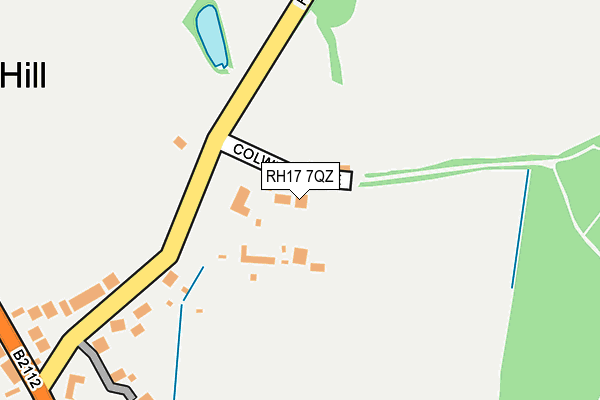
RH17 7QZ lies on Colwell Lane in Haywards Heath. RH17 7QZ is located in the Haywards Heath Franklands electoral ward, within the local authority district of Mid Sussex and the English Parliamentary constituency of Mid Sussex. The Sub Integrated Care Board (ICB) Location is NHS Sussex ICB - 70F and the police force is Sussex. This postcode has been in use since December 1999.


GetTheData
Source: OS OpenMap – Local (Ordnance Survey)
Source: OS VectorMap District (Ordnance Survey)
Licence: Open Government Licence (requires attribution)
| Easting | 533988 |
| Northing | 122091 |
| Latitude | 50.982643 |
| Longitude | -0.092581 |
GetTheData
Source: Open Postcode Geo
Licence: Open Government Licence
| Street | Colwell Lane |
| Town/City | Haywards Heath |
| Country | England |
| Postcode District | RH17 |
➜ See where RH17 is on a map ➜ Where is Haywards Heath? | |
GetTheData
Source: Land Registry Price Paid Data
Licence: Open Government Licence
Elevation or altitude of RH17 7QZ as distance above sea level:
| Metres | Feet | |
|---|---|---|
| Elevation | 40m | 131ft |
Elevation is measured from the approximate centre of the postcode, to the nearest point on an OS contour line from OS Terrain 50, which has contour spacing of ten vertical metres.
➜ How high above sea level am I? Find the elevation of your current position using your device's GPS.
GetTheData
Source: Open Postcode Elevation
Licence: Open Government Licence
| Ward | Haywards Heath Franklands |
| Constituency | Mid Sussex |
GetTheData
Source: ONS Postcode Database
Licence: Open Government Licence
SERENE COTTAGE, COLWELL LANE, HAYWARDS HEATH, RH17 7QZ 2015 23 JAN £700,000 |
WILLOW COTTAGE, COLWELL LANE, HAYWARDS HEATH, RH17 7QZ 2005 18 JUL £525,000 |
WILLOW COTTAGE, COLWELL LANE, HAYWARDS HEATH, RH17 7QZ 2000 4 MAY £212,000 |
GetTheData
Source: HM Land Registry Price Paid Data
Licence: Contains HM Land Registry data © Crown copyright and database right 2025. This data is licensed under the Open Government Licence v3.0.
| Fox And Hounds (Fox Hill) | Haywards Heath | 318m |
| Weald Rise (Fox Hill) | Haywards Heath | 483m |
| Rocky Lane (Fox Hill) | Haywards Heath | 767m |
| Rocky Lane (Wivelsfield Road) | Haywards Heath | 864m |
| Colwell Gardens (Colwell Road) | Haywards Heath | 941m |
| Haywards Heath Station | 2.7km |
| Wivelsfield Station | 2.8km |
| Burgess Hill Station | 4km |
GetTheData
Source: NaPTAN
Licence: Open Government Licence
| Percentage of properties with Next Generation Access | 100.0% |
| Percentage of properties with Superfast Broadband | 0.0% |
| Percentage of properties with Ultrafast Broadband | 0.0% |
| Percentage of properties with Full Fibre Broadband | 0.0% |
Superfast Broadband is between 30Mbps and 300Mbps
Ultrafast Broadband is > 300Mbps
| Median download speed | 20.0Mbps |
| Average download speed | 19.7Mbps |
| Maximum download speed | 24.22Mbps |
| Median upload speed | 1.5Mbps |
| Average upload speed | 1.8Mbps |
| Maximum upload speed | 3.08Mbps |
| Percentage of properties unable to receive 2Mbps | 0.0% |
| Percentage of properties unable to receive 5Mbps | 0.0% |
| Percentage of properties unable to receive 10Mbps | 0.0% |
| Percentage of properties unable to receive 30Mbps | 100.0% |
GetTheData
Source: Ofcom
Licence: Ofcom Terms of Use (requires attribution)
GetTheData
Source: ONS Postcode Database
Licence: Open Government Licence


➜ Get more ratings from the Food Standards Agency
GetTheData
Source: Food Standards Agency
Licence: FSA terms & conditions
| Last Collection | |||
|---|---|---|---|
| Location | Mon-Fri | Sat | Distance |
| Priory Way | 17:15 | 12:00 | 910m |
| Southdowns Park | 17:00 | 11:30 | 922m |
| Wivelsfield Road | 17:00 | 11:30 | 1,035m |
GetTheData
Source: Dracos
Licence: Creative Commons Attribution-ShareAlike
The below table lists the International Territorial Level (ITL) codes (formerly Nomenclature of Territorial Units for Statistics (NUTS) codes) and Local Administrative Units (LAU) codes for RH17 7QZ:
| ITL 1 Code | Name |
|---|---|
| TLJ | South East (England) |
| ITL 2 Code | Name |
| TLJ2 | Surrey, East and West Sussex |
| ITL 3 Code | Name |
| TLJ28 | West Sussex (North East) |
| LAU 1 Code | Name |
| E07000228 | Mid Sussex |
GetTheData
Source: ONS Postcode Directory
Licence: Open Government Licence
The below table lists the Census Output Area (OA), Lower Layer Super Output Area (LSOA), and Middle Layer Super Output Area (MSOA) for RH17 7QZ:
| Code | Name | |
|---|---|---|
| OA | E00161931 | |
| LSOA | E01031756 | Mid Sussex 011E |
| MSOA | E02006614 | Mid Sussex 011 |
GetTheData
Source: ONS Postcode Directory
Licence: Open Government Licence
| RH17 7QY | Hurstwood Lane | 211m |
| RH16 4QY | Foxhill | 363m |
| RH17 7QX | Hurstwood Lane | 380m |
| RH16 4QZ | Fox Hill Village | 478m |
| RH16 4RA | Fox Hill Close | 483m |
| RH17 7BY | Hawkins Road | 545m |
| RH17 7EN | Lewin Twitten | 560m |
| RH16 4RB | Weald Rise | 564m |
| RH17 7BW | Gwynne Way | 570m |
| RH16 4UE | Cheney Crescent | 613m |
GetTheData
Source: Open Postcode Geo; Land Registry Price Paid Data
Licence: Open Government Licence