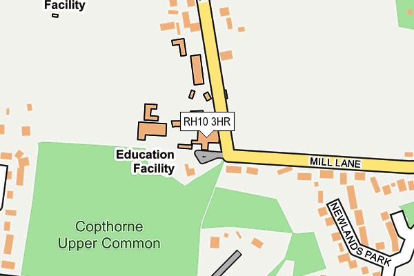
RH10 3HR is located in the Burstow, Horne and Outwood electoral ward, within the local authority district of Tandridge and the English Parliamentary constituency of East Surrey. The Sub Integrated Care Board (ICB) Location is NHS Surrey Heartlands ICB - 92A and the police force is Surrey. This postcode has been in use since January 1980.


GetTheData
Source: OS OpenMap – Local (Ordnance Survey)
Source: OS VectorMap District (Ordnance Survey)
Licence: Open Government Licence (requires attribution)
| Easting | 533158 |
| Northing | 139449 |
| Latitude | 51.138835 |
| Longitude | -0.098016 |
GetTheData
Source: Open Postcode Geo
Licence: Open Government Licence
| Country | England |
| Postcode District | RH10 |
➜ See where RH10 is on a map ➜ Where is Copthorne? | |
GetTheData
Source: Land Registry Price Paid Data
Licence: Open Government Licence
Elevation or altitude of RH10 3HR as distance above sea level:
| Metres | Feet | |
|---|---|---|
| Elevation | 100m | 328ft |
Elevation is measured from the approximate centre of the postcode, to the nearest point on an OS contour line from OS Terrain 50, which has contour spacing of ten vertical metres.
➜ How high above sea level am I? Find the elevation of your current position using your device's GPS.
GetTheData
Source: Open Postcode Elevation
Licence: Open Government Licence
| Ward | Burstow, Horne And Outwood |
| Constituency | East Surrey |
GetTheData
Source: ONS Postcode Database
Licence: Open Government Licence
| Cottage Place (Copthorne Common Road) | Copthorne | 258m |
| Cottage Place (Copthorne Common Road) | Copthorne | 261m |
| Abergavenny Gardens (A264 Copthorne Common Road) | Copthorne | 313m |
| Duke's Head (Copthorne Common Road) | Copthorne | 399m |
| Abergavenny Gardens (A264 Copthorne Common Road) | Copthorne | 429m |
| Gatwick Airport Station | 4.8km |
| Three Bridges Station | 5km |
| Horley Station | 5.5km |
GetTheData
Source: NaPTAN
Licence: Open Government Licence
GetTheData
Source: ONS Postcode Database
Licence: Open Government Licence


➜ Get more ratings from the Food Standards Agency
GetTheData
Source: Food Standards Agency
Licence: FSA terms & conditions
| Last Collection | |||
|---|---|---|---|
| Location | Mon-Fri | Sat | Distance |
| Borers Arms Road | 16:00 | 08:00 | 889m |
| Copthorne Bank P O | 16:45 | 11:30 | 1,812m |
| Keepers Corner | 16:30 | 08:45 | 1,881m |
GetTheData
Source: Dracos
Licence: Creative Commons Attribution-ShareAlike
The below table lists the International Territorial Level (ITL) codes (formerly Nomenclature of Territorial Units for Statistics (NUTS) codes) and Local Administrative Units (LAU) codes for RH10 3HR:
| ITL 1 Code | Name |
|---|---|
| TLJ | South East (England) |
| ITL 2 Code | Name |
| TLJ2 | Surrey, East and West Sussex |
| ITL 3 Code | Name |
| TLJ26 | East Surrey |
| LAU 1 Code | Name |
| E07000215 | Tandridge |
GetTheData
Source: ONS Postcode Directory
Licence: Open Government Licence
The below table lists the Census Output Area (OA), Lower Layer Super Output Area (LSOA), and Middle Layer Super Output Area (MSOA) for RH10 3HR:
| Code | Name | |
|---|---|---|
| OA | E00157125 | |
| LSOA | E01030819 | Tandridge 011D |
| MSOA | E02006438 | Tandridge 011 |
GetTheData
Source: ONS Postcode Directory
Licence: Open Government Licence
| RH10 3HW | Mill Lane | 178m |
| RH10 3LG | Copthorne Common | 265m |
| RH10 3LB | Copthorne Common | 278m |
| RH10 3EW | Newlands Park | 294m |
| RH10 3LD | Roundabout Road | 302m |
| RH10 3EP | Turners Hill Road | 327m |
| RH10 3HP | Effingham Lane | 334m |
| RH10 3XU | Southview Close | 351m |
| RH10 3LF | Copthorne Common | 353m |
| RH10 3RU | Abergavenny Gardens | 354m |
GetTheData
Source: Open Postcode Geo; Land Registry Price Paid Data
Licence: Open Government Licence