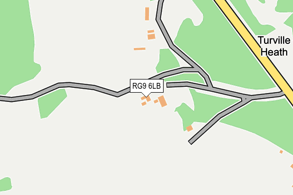
RG9 6LB is in Turville Heath, Henley-on-thames. RG9 6LB is located in the Chiltern Villages electoral ward, within the unitary authority of Buckinghamshire and the English Parliamentary constituency of Wycombe. The Sub Integrated Care Board (ICB) Location is NHS Buckinghamshire, Oxfordshire and Berkshire West ICB - 14Y and the police force is Thames Valley. This postcode has been in use since January 1980.


GetTheData
Source: OS OpenMap – Local (Ordnance Survey)
Source: OS VectorMap District (Ordnance Survey)
Licence: Open Government Licence (requires attribution)
| Easting | 473965 |
| Northing | 191092 |
| Latitude | 51.613807 |
| Longitude | -0.933168 |
GetTheData
Source: Open Postcode Geo
Licence: Open Government Licence
| Locality | Turville Heath |
| Town/City | Henley-on-thames |
| Country | England |
| Postcode District | RG9 |
➜ See where RG9 is on a map ➜ Where is Turville Heath? | |
GetTheData
Source: Land Registry Price Paid Data
Licence: Open Government Licence
Elevation or altitude of RG9 6LB as distance above sea level:
| Metres | Feet | |
|---|---|---|
| Elevation | 180m | 591ft |
Elevation is measured from the approximate centre of the postcode, to the nearest point on an OS contour line from OS Terrain 50, which has contour spacing of ten vertical metres.
➜ How high above sea level am I? Find the elevation of your current position using your device's GPS.
GetTheData
Source: Open Postcode Elevation
Licence: Open Government Licence
| Ward | Chiltern Villages |
| Constituency | Wycombe |
GetTheData
Source: ONS Postcode Database
Licence: Open Government Licence
| Bus Shelter (Balham's Lane) | Turville Heath | 378m |
| Bus Shelter (Balham's Lane) | Turville Heath | 401m |
| Holloway Link | Northend | 1,452m |
| Holloway Link | Northend | 1,455m |
| Drovers Lane | Southend | 1,814m |
GetTheData
Source: NaPTAN
Licence: Open Government Licence
| Percentage of properties with Next Generation Access | 100.0% |
| Percentage of properties with Superfast Broadband | 100.0% |
| Percentage of properties with Ultrafast Broadband | 0.0% |
| Percentage of properties with Full Fibre Broadband | 0.0% |
Superfast Broadband is between 30Mbps and 300Mbps
Ultrafast Broadband is > 300Mbps
| Percentage of properties unable to receive 2Mbps | 0.0% |
| Percentage of properties unable to receive 5Mbps | 0.0% |
| Percentage of properties unable to receive 10Mbps | 0.0% |
| Percentage of properties unable to receive 30Mbps | 0.0% |
GetTheData
Source: Ofcom
Licence: Ofcom Terms of Use (requires attribution)
GetTheData
Source: ONS Postcode Database
Licence: Open Government Licence


➜ Get more ratings from the Food Standards Agency
GetTheData
Source: Food Standards Agency
Licence: FSA terms & conditions
| Last Collection | |||
|---|---|---|---|
| Location | Mon-Fri | Sat | Distance |
| Pishill Village | 16:15 | 07:00 | 1,564m |
| Southend | 16:30 | 07:00 | 1,797m |
| Ibstone Village | 16:00 | 09:30 | 2,440m |
GetTheData
Source: Dracos
Licence: Creative Commons Attribution-ShareAlike
The below table lists the International Territorial Level (ITL) codes (formerly Nomenclature of Territorial Units for Statistics (NUTS) codes) and Local Administrative Units (LAU) codes for RG9 6LB:
| ITL 1 Code | Name |
|---|---|
| TLJ | South East (England) |
| ITL 2 Code | Name |
| TLJ1 | Berkshire, Buckinghamshire and Oxfordshire |
| ITL 3 Code | Name |
| TLJ13 | Buckinghamshire |
| LAU 1 Code | Name |
| E06000060 | Buckinghamshire |
GetTheData
Source: ONS Postcode Directory
Licence: Open Government Licence
The below table lists the Census Output Area (OA), Lower Layer Super Output Area (LSOA), and Middle Layer Super Output Area (MSOA) for RG9 6LB:
| Code | Name | |
|---|---|---|
| OA | E00090201 | |
| LSOA | E01017878 | Wycombe 007D |
| MSOA | E02003702 | Wycombe 007 |
GetTheData
Source: ONS Postcode Directory
Licence: Open Government Licence
| RG9 6JY | 467m | |
| RG9 6JU | 819m | |
| RG9 6JS | 931m | |
| RG9 6LE | 1200m | |
| RG9 6LF | 1386m | |
| RG9 6JT | 1589m | |
| RG9 6LH | 1679m | |
| RG9 6LJ | 1702m | |
| RG9 6HG | 1790m | |
| RG9 6JN | 1904m |
GetTheData
Source: Open Postcode Geo; Land Registry Price Paid Data
Licence: Open Government Licence