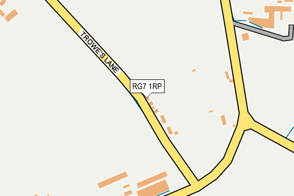
RG7 1RP lies on Trowes Lane in Swallowfield, Reading. RG7 1RP is located in the Swallowfield electoral ward, within the unitary authority of Wokingham and the English Parliamentary constituency of Wokingham. The Sub Integrated Care Board (ICB) Location is NHS Buckinghamshire, Oxfordshire and Berkshire West ICB - 15A and the police force is Thames Valley. This postcode has been in use since January 1980.


GetTheData
Source: OS OpenMap – Local (Ordnance Survey)
Source: OS VectorMap District (Ordnance Survey)
Licence: Open Government Licence (requires attribution)
| Easting | 472930 |
| Northing | 163655 |
| Latitude | 51.367284 |
| Longitude | -0.953773 |
GetTheData
Source: Open Postcode Geo
Licence: Open Government Licence
| Street | Trowes Lane |
| Locality | Swallowfield |
| Town/City | Reading |
| Country | England |
| Postcode District | RG7 |
➜ See where RG7 is on a map ➜ Where is Riseley? | |
GetTheData
Source: Land Registry Price Paid Data
Licence: Open Government Licence
Elevation or altitude of RG7 1RP as distance above sea level:
| Metres | Feet | |
|---|---|---|
| Elevation | 50m | 164ft |
Elevation is measured from the approximate centre of the postcode, to the nearest point on an OS contour line from OS Terrain 50, which has contour spacing of ten vertical metres.
➜ How high above sea level am I? Find the elevation of your current position using your device's GPS.
GetTheData
Source: Open Postcode Elevation
Licence: Open Government Licence
| Ward | Swallowfield |
| Constituency | Wokingham |
GetTheData
Source: ONS Postcode Database
Licence: Open Government Licence
2014 29 AUG £300,000 |
4, BEEHIVE COTTAGES, TROWES LANE, SWALLOWFIELD, READING, RG7 1RP 2005 29 APR £215,000 |
THE HAVEN, TROWES LANE, SWALLOWFIELD, READING, RG7 1RP 1999 15 JUL £138,000 |
1998 16 OCT £132,500 |
1997 16 MAY £100,950 |
GetTheData
Source: HM Land Registry Price Paid Data
Licence: Contains HM Land Registry data © Crown copyright and database right 2025. This data is licensed under the Open Government Licence v3.0.
| Maythorne Stores (Basingstoke Road) | Riseley | 827m |
| The Bull (Odiham Road) | Riseley | 850m |
| Maythorne Stores (Basingstoke Road) | Riseley | 853m |
| The Bull (Basingstoke Road) | Riseley | 891m |
| The Bull (Basingstoke Road) | Riseley | 910m |
GetTheData
Source: NaPTAN
Licence: Open Government Licence
| Percentage of properties with Next Generation Access | 100.0% |
| Percentage of properties with Superfast Broadband | 0.0% |
| Percentage of properties with Ultrafast Broadband | 0.0% |
| Percentage of properties with Full Fibre Broadband | 0.0% |
Superfast Broadband is between 30Mbps and 300Mbps
Ultrafast Broadband is > 300Mbps
| Percentage of properties unable to receive 2Mbps | 0.0% |
| Percentage of properties unable to receive 5Mbps | 0.0% |
| Percentage of properties unable to receive 10Mbps | 0.0% |
| Percentage of properties unable to receive 30Mbps | 100.0% |
GetTheData
Source: Ofcom
Licence: Ofcom Terms of Use (requires attribution)
GetTheData
Source: ONS Postcode Database
Licence: Open Government Licence


➜ Get more ratings from the Food Standards Agency
GetTheData
Source: Food Standards Agency
Licence: FSA terms & conditions
| Last Collection | |||
|---|---|---|---|
| Location | Mon-Fri | Sat | Distance |
| Park Lane | 16:00 | 09:00 | 216m |
| Swallowfield Post Office | 17:00 | 09:15 | 1,255m |
| Arborfield | 17:00 | 09:15 | 2,737m |
GetTheData
Source: Dracos
Licence: Creative Commons Attribution-ShareAlike
The below table lists the International Territorial Level (ITL) codes (formerly Nomenclature of Territorial Units for Statistics (NUTS) codes) and Local Administrative Units (LAU) codes for RG7 1RP:
| ITL 1 Code | Name |
|---|---|
| TLJ | South East (England) |
| ITL 2 Code | Name |
| TLJ1 | Berkshire, Buckinghamshire and Oxfordshire |
| ITL 3 Code | Name |
| TLJ11 | Berkshire |
| LAU 1 Code | Name |
| E06000041 | Wokingham |
GetTheData
Source: ONS Postcode Directory
Licence: Open Government Licence
The below table lists the Census Output Area (OA), Lower Layer Super Output Area (LSOA), and Middle Layer Super Output Area (MSOA) for RG7 1RP:
| Code | Name | |
|---|---|---|
| OA | E00084238 | |
| LSOA | E01016691 | Wokingham 017D |
| MSOA | E02003455 | Wokingham 017 |
GetTheData
Source: ONS Postcode Directory
Licence: Open Government Licence
| RG7 1RS | Trowes Lane | 59m |
| RG7 1RU | Part Lane | 412m |
| RG7 1TB | Part Lane | 417m |
| RG7 1TD | Part Lane | 433m |
| RG7 1XN | School Road | 519m |
| RG7 1XT | School Lane | 546m |
| RG7 1XP | School Road | 558m |
| RG7 1RY | Benham Lane | 584m |
| RG7 1XS | Devils Highway | 590m |
| RG7 1XR | Devils Highway | 689m |
GetTheData
Source: Open Postcode Geo; Land Registry Price Paid Data
Licence: Open Government Licence