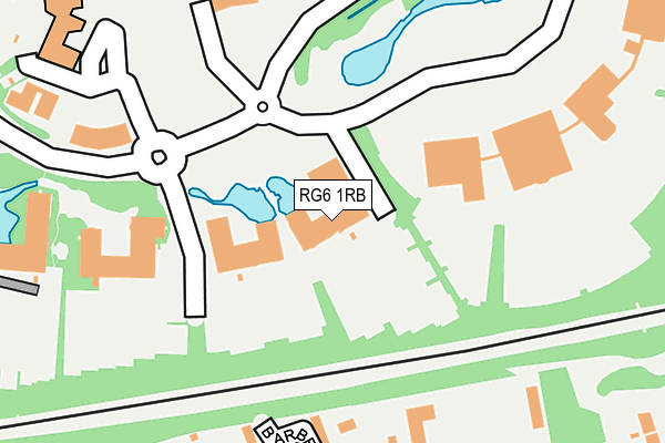
RG6 1RB is located in the Sonning electoral ward, within the unitary authority of Wokingham and the English Parliamentary constituency of Maidenhead. The Sub Integrated Care Board (ICB) Location is NHS Buckinghamshire, Oxfordshire and Berkshire West ICB - 15A and the police force is Thames Valley. This postcode has been in use since December 2005.


GetTheData
Source: OS OpenMap – Local (Ordnance Survey)
Source: OS VectorMap District (Ordnance Survey)
Licence: Open Government Licence (requires attribution)
| Easting | 474815 |
| Northing | 174260 |
| Latitude | 51.462380 |
| Longitude | -0.924447 |
GetTheData
Source: Open Postcode Geo
Licence: Open Government Licence
| Country | England |
| Postcode District | RG6 |
➜ See where RG6 is on a map ➜ Where is Reading? | |
GetTheData
Source: Land Registry Price Paid Data
Licence: Open Government Licence
Elevation or altitude of RG6 1RB as distance above sea level:
| Metres | Feet | |
|---|---|---|
| Elevation | 40m | 131ft |
Elevation is measured from the approximate centre of the postcode, to the nearest point on an OS contour line from OS Terrain 50, which has contour spacing of ten vertical metres.
➜ How high above sea level am I? Find the elevation of your current position using your device's GPS.
GetTheData
Source: Open Postcode Elevation
Licence: Open Government Licence
| Ward | Sonning |
| Constituency | Maidenhead |
GetTheData
Source: ONS Postcode Database
Licence: Open Government Licence
| Microsoft Building 5 (Microsoft Campus) | Thames Valley Park | 111m |
| Microsoft (Microsoft Campus) | Thames Valley Park | 204m |
| Bg (Thames Valley Park Drive) | Thames Valley Park | 212m |
| Shepherds Hill Top (Shepherds Hill) | North Earley | 388m |
| Shepherds Hill Top (London Road) | North Earley | 475m |
| Earley Station | 2.4km |
| Reading Station | 3.3km |
| Winnersh Triangle Station | 3.7km |
GetTheData
Source: NaPTAN
Licence: Open Government Licence
GetTheData
Source: ONS Postcode Database
Licence: Open Government Licence


➜ Get more ratings from the Food Standards Agency
GetTheData
Source: Food Standards Agency
Licence: FSA terms & conditions
| Last Collection | |||
|---|---|---|---|
| Location | Mon-Fri | Sat | Distance |
| Shepherds Hill Post Office | 17:00 | 12:00 | 493m |
| Rosedale Cresent | 16:00 | 10:30 | 672m |
| Holme Park Reading | 16:45 | 08:30 | 720m |
GetTheData
Source: Dracos
Licence: Creative Commons Attribution-ShareAlike
The below table lists the International Territorial Level (ITL) codes (formerly Nomenclature of Territorial Units for Statistics (NUTS) codes) and Local Administrative Units (LAU) codes for RG6 1RB:
| ITL 1 Code | Name |
|---|---|
| TLJ | South East (England) |
| ITL 2 Code | Name |
| TLJ1 | Berkshire, Buckinghamshire and Oxfordshire |
| ITL 3 Code | Name |
| TLJ11 | Berkshire |
| LAU 1 Code | Name |
| E06000041 | Wokingham |
GetTheData
Source: ONS Postcode Directory
Licence: Open Government Licence
The below table lists the Census Output Area (OA), Lower Layer Super Output Area (LSOA), and Middle Layer Super Output Area (MSOA) for RG6 1RB:
| Code | Name | |
|---|---|---|
| OA | E00084208 | |
| LSOA | E01016685 | Wokingham 003E |
| MSOA | E02003441 | Wokingham 003 |
GetTheData
Source: ONS Postcode Directory
Licence: Open Government Licence
| RG6 1AY | Shepherds Avenue | 386m |
| RG6 1BQ | London Road | 408m |
| RG6 1BB | Shepherds Hill | 411m |
| RG6 1AU | London Road | 441m |
| RG6 1BA | London Road | 465m |
| RG4 6XB | Sonning Meadows | 528m |
| RG4 6GB | South Drive | 540m |
| RG6 1AR | London Road | 557m |
| RG4 6SX | Holme Park Farm Lane | 560m |
| RG6 1BS | Shepherds Walk | 562m |
GetTheData
Source: Open Postcode Geo; Land Registry Price Paid Data
Licence: Open Government Licence