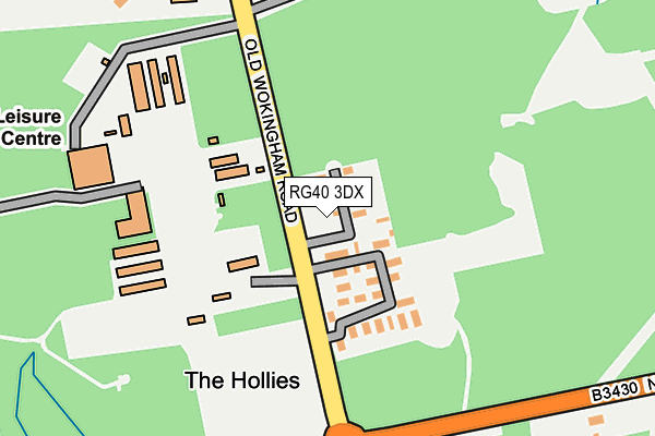
RG40 3DX is located in the Great Hollands electoral ward, within the unitary authority of Bracknell Forest and the English Parliamentary constituency of Bracknell. The Sub Integrated Care Board (ICB) Location is NHS Frimley ICB - D4U1Y and the police force is Thames Valley. This postcode has been in use since July 1995.


GetTheData
Source: OS OpenMap – Local (Ordnance Survey)
Source: OS VectorMap District (Ordnance Survey)
Licence: Open Government Licence (requires attribution)
| Easting | 484099 |
| Northing | 165967 |
| Latitude | 51.386527 |
| Longitude | -0.792807 |
GetTheData
Source: Open Postcode Geo
Licence: Open Government Licence
| Country | England |
| Postcode District | RG40 |
➜ See where RG40 is on a map | |
GetTheData
Source: Land Registry Price Paid Data
Licence: Open Government Licence
Elevation or altitude of RG40 3DX as distance above sea level:
| Metres | Feet | |
|---|---|---|
| Elevation | 70m | 230ft |
Elevation is measured from the approximate centre of the postcode, to the nearest point on an OS contour line from OS Terrain 50, which has contour spacing of ten vertical metres.
➜ How high above sea level am I? Find the elevation of your current position using your device's GPS.
GetTheData
Source: Open Postcode Elevation
Licence: Open Government Licence
| Ward | Great Hollands |
| Constituency | Bracknell |
GetTheData
Source: ONS Postcode Database
Licence: Open Government Licence
| Easthampstead Mobile Home Park (Old Wokingham Road) | Pinewood | 78m |
| Easthampstead Mobile Home Park (Old Wokingham Road) | Pinewood | 109m |
| Pinewood Crossroads (Nine Mile Ride) | Crowthorne | 201m |
| Pinewood Crossroads (Old Wokingham Road) | Crowthorne | 255m |
| Trl Northern Entrance (Nine Mile Ride) | Transport Research Laboratory | 572m |
| Crowthorne Station | 2.9km |
| Bracknell Station | 4.1km |
| Wokingham Station | 4.4km |
GetTheData
Source: NaPTAN
Licence: Open Government Licence
| Percentage of properties with Next Generation Access | 100.0% |
| Percentage of properties with Superfast Broadband | 0.0% |
| Percentage of properties with Ultrafast Broadband | 0.0% |
| Percentage of properties with Full Fibre Broadband | 0.0% |
Superfast Broadband is between 30Mbps and 300Mbps
Ultrafast Broadband is > 300Mbps
| Median download speed | 15.4Mbps |
| Average download speed | 13.8Mbps |
| Maximum download speed | 19.67Mbps |
| Median upload speed | 1.2Mbps |
| Average upload speed | 1.2Mbps |
| Maximum upload speed | 1.21Mbps |
| Percentage of properties unable to receive 2Mbps | 0.0% |
| Percentage of properties unable to receive 5Mbps | 0.0% |
| Percentage of properties unable to receive 10Mbps | 0.0% |
| Percentage of properties unable to receive 30Mbps | 100.0% |
GetTheData
Source: Ofcom
Licence: Ofcom Terms of Use (requires attribution)
Estimated total energy consumption in RG40 3DX by fuel type, 2015.
| Consumption (kWh) | 106,893 |
|---|---|
| Meter count | 13 |
| Mean (kWh/meter) | 8,223 |
| Median (kWh/meter) | 7,381 |
GetTheData
Source: Postcode level gas estimates: 2015 (experimental)
Source: Postcode level electricity estimates: 2015 (experimental)
Licence: Open Government Licence
GetTheData
Source: ONS Postcode Database
Licence: Open Government Licence


➜ Get more ratings from the Food Standards Agency
GetTheData
Source: Food Standards Agency
Licence: FSA terms & conditions
| Last Collection | |||
|---|---|---|---|
| Location | Mon-Fri | Sat | Distance |
| The Conifers | 16:00 | 11:00 | 1,079m |
| Greenwood Road | 17:00 | 11:00 | 1,167m |
| Pinewood Avenue | 16:00 | 11:00 | 1,493m |
GetTheData
Source: Dracos
Licence: Creative Commons Attribution-ShareAlike
The below table lists the International Territorial Level (ITL) codes (formerly Nomenclature of Territorial Units for Statistics (NUTS) codes) and Local Administrative Units (LAU) codes for RG40 3DX:
| ITL 1 Code | Name |
|---|---|
| TLJ | South East (England) |
| ITL 2 Code | Name |
| TLJ1 | Berkshire, Buckinghamshire and Oxfordshire |
| ITL 3 Code | Name |
| TLJ11 | Berkshire |
| LAU 1 Code | Name |
| E06000036 | Bracknell Forest |
GetTheData
Source: ONS Postcode Directory
Licence: Open Government Licence
The below table lists the Census Output Area (OA), Lower Layer Super Output Area (LSOA), and Middle Layer Super Output Area (MSOA) for RG40 3DX:
| Code | Name | |
|---|---|---|
| OA | E00081925 | |
| LSOA | E01016213 | Bracknell Forest 009D |
| MSOA | E02003360 | Bracknell Forest 009 |
GetTheData
Source: ONS Postcode Directory
Licence: Open Government Licence
| RG40 3EH | Pinewood Villas | 261m |
| RG40 3BT | Old Wokingham Road | 410m |
| RG40 3DU | St Michaels Cottages | 455m |
| RG45 6UR | Lupin Ride | 535m |
| RG45 6UY | Geranium Close | 546m |
| RG45 6UZ | Polyanthus Way | 569m |
| RG45 6US | Lupin Ride | 580m |
| RG45 6UX | Carnation Close | 605m |
| RG40 3DY | Nine Mile Ride | 627m |
| RG45 6LR | Duchess Close | 682m |
GetTheData
Source: Open Postcode Geo; Land Registry Price Paid Data
Licence: Open Government Licence