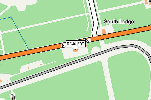
RG40 3DT lies on Nine Mile Ride in Wokingham. RG40 3DT is located in the Crowthorne electoral ward, within the unitary authority of Bracknell Forest and the English Parliamentary constituency of Bracknell. The Sub Integrated Care Board (ICB) Location is NHS Frimley ICB - D4U1Y and the police force is Thames Valley. This postcode has been in use since July 1995.


GetTheData
Source: OS OpenMap – Local (Ordnance Survey)
Source: OS VectorMap District (Ordnance Survey)
Licence: Open Government Licence (requires attribution)
| Easting | 485070 |
| Northing | 165921 |
| Latitude | 51.385969 |
| Longitude | -0.778868 |
GetTheData
Source: Open Postcode Geo
Licence: Open Government Licence
| Street | Nine Mile Ride |
| Town/City | Wokingham |
| Country | England |
| Postcode District | RG40 |
➜ See where RG40 is on a map | |
GetTheData
Source: Land Registry Price Paid Data
Licence: Open Government Licence
Elevation or altitude of RG40 3DT as distance above sea level:
| Metres | Feet | |
|---|---|---|
| Elevation | 80m | 262ft |
Elevation is measured from the approximate centre of the postcode, to the nearest point on an OS contour line from OS Terrain 50, which has contour spacing of ten vertical metres.
➜ How high above sea level am I? Find the elevation of your current position using your device's GPS.
GetTheData
Source: Open Postcode Elevation
Licence: Open Government Licence
| Ward | Crowthorne |
| Constituency | Bracknell |
GetTheData
Source: ONS Postcode Database
Licence: Open Government Licence
| Crematorium (Nine Mile Ride) | Easthampstead Park | 41m |
| Crematorium (Nine Mile Ride) | Easthampstead Park | 69m |
| Forresters Way - Vintage Inn (Nine Mile Ride) | Easthampstead Park | 298m |
| Forresters Way - Vintage Inn (Nine Mile Ride) | Easthampstead Park | 365m |
| Trl Northern Entrance (Nine Mile Ride) | Transport Research Laboratory | 379m |
| Crowthorne Station | 3.5km |
| Bracknell Station | 3.6km |
| Martins Heron Station | 4.5km |
GetTheData
Source: NaPTAN
Licence: Open Government Licence
| Percentage of properties with Next Generation Access | 80.0% |
| Percentage of properties with Superfast Broadband | 0.0% |
| Percentage of properties with Ultrafast Broadband | 0.0% |
| Percentage of properties with Full Fibre Broadband | 0.0% |
Superfast Broadband is between 30Mbps and 300Mbps
Ultrafast Broadband is > 300Mbps
| Percentage of properties unable to receive 2Mbps | 0.0% |
| Percentage of properties unable to receive 5Mbps | 0.0% |
| Percentage of properties unable to receive 10Mbps | 20.0% |
| Percentage of properties unable to receive 30Mbps | 80.0% |
GetTheData
Source: Ofcom
Licence: Ofcom Terms of Use (requires attribution)
GetTheData
Source: ONS Postcode Database
Licence: Open Government Licence


➜ Get more ratings from the Food Standards Agency
GetTheData
Source: Food Standards Agency
Licence: FSA terms & conditions
| Last Collection | |||
|---|---|---|---|
| Location | Mon-Fri | Sat | Distance |
| Pinewood Avenue | 16:00 | 11:00 | 1,716m |
| Greenwood Road | 17:00 | 11:00 | 1,777m |
| Appledore | 16:00 | 11:45 | 1,835m |
GetTheData
Source: Dracos
Licence: Creative Commons Attribution-ShareAlike
The below table lists the International Territorial Level (ITL) codes (formerly Nomenclature of Territorial Units for Statistics (NUTS) codes) and Local Administrative Units (LAU) codes for RG40 3DT:
| ITL 1 Code | Name |
|---|---|
| TLJ | South East (England) |
| ITL 2 Code | Name |
| TLJ1 | Berkshire, Buckinghamshire and Oxfordshire |
| ITL 3 Code | Name |
| TLJ11 | Berkshire |
| LAU 1 Code | Name |
| E06000036 | Bracknell Forest |
GetTheData
Source: ONS Postcode Directory
Licence: Open Government Licence
The below table lists the Census Output Area (OA), Lower Layer Super Output Area (LSOA), and Middle Layer Super Output Area (MSOA) for RG40 3DT:
| Code | Name | |
|---|---|---|
| OA | E00081899 | |
| LSOA | E01016207 | Bracknell Forest 013A |
| MSOA | E02003364 | Bracknell Forest 013 |
GetTheData
Source: ONS Postcode Directory
Licence: Open Government Licence
| RG12 8WT | Stratfield | 396m |
| RG12 8XZ | Sarum | 521m |
| RG12 8WU | Silwood | 565m |
| RG12 8XY | Southwold | 621m |
| RG12 8XA | Spinis | 718m |
| RG12 7QQ | Quintilis | 768m |
| RG12 8DB | Staplehurst | 772m |
| RG12 8YU | Tawfield | 816m |
| RG12 8DD | Staplehurst | 825m |
| RG12 8XX | Sylvanus | 848m |
GetTheData
Source: Open Postcode Geo; Land Registry Price Paid Data
Licence: Open Government Licence