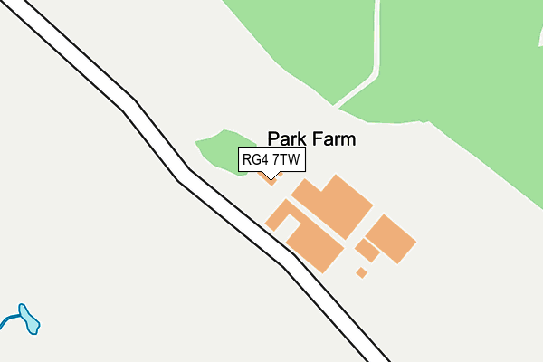
RG4 7TW is located in the Kidmore End & Whitchurch electoral ward, within the local authority district of South Oxfordshire and the English Parliamentary constituency of Henley. The Sub Integrated Care Board (ICB) Location is NHS Buckinghamshire, Oxfordshire and Berkshire West ICB - 10Q and the police force is Thames Valley. This postcode has been in use since January 1980.


GetTheData
Source: OS OpenMap – Local (Ordnance Survey)
Source: OS VectorMap District (Ordnance Survey)
Licence: Open Government Licence (requires attribution)
| Easting | 467639 |
| Northing | 176385 |
| Latitude | 51.482386 |
| Longitude | -1.027318 |
GetTheData
Source: Open Postcode Geo
Licence: Open Government Licence
| Country | England |
| Postcode District | RG4 |
➜ See where RG4 is on a map | |
GetTheData
Source: Land Registry Price Paid Data
Licence: Open Government Licence
Elevation or altitude of RG4 7TW as distance above sea level:
| Metres | Feet | |
|---|---|---|
| Elevation | 40m | 131ft |
Elevation is measured from the approximate centre of the postcode, to the nearest point on an OS contour line from OS Terrain 50, which has contour spacing of ten vertical metres.
➜ How high above sea level am I? Find the elevation of your current position using your device's GPS.
GetTheData
Source: Open Postcode Elevation
Licence: Open Government Licence
| Ward | Kidmore End & Whitchurch |
| Constituency | Henley |
GetTheData
Source: ONS Postcode Database
Licence: Open Government Licence
| Chestnut Grove | Purley On Thames | 826m |
| Wintringham Way | Purley On Thames | 963m |
| Brading Way | Purley On Thames | 1,025m |
| Roebuck Hotel (A329 Oxford Road) | Kentwood | 1,107m |
| Roebuck Hotel (A329 Oxford Road) | Kentwood | 1,110m |
| Tilehurst Station | 1.2km |
| Reading West Station | 4km |
| Pangbourne Station | 4.4km |
GetTheData
Source: NaPTAN
Licence: Open Government Licence
| Percentage of properties with Next Generation Access | 100.0% |
| Percentage of properties with Superfast Broadband | 0.0% |
| Percentage of properties with Ultrafast Broadband | 0.0% |
| Percentage of properties with Full Fibre Broadband | 0.0% |
Superfast Broadband is between 30Mbps and 300Mbps
Ultrafast Broadband is > 300Mbps
| Percentage of properties unable to receive 2Mbps | 0.0% |
| Percentage of properties unable to receive 5Mbps | 100.0% |
| Percentage of properties unable to receive 10Mbps | 100.0% |
| Percentage of properties unable to receive 30Mbps | 100.0% |
GetTheData
Source: Ofcom
Licence: Ofcom Terms of Use (requires attribution)
GetTheData
Source: ONS Postcode Database
Licence: Open Government Licence


➜ Get more ratings from the Food Standards Agency
GetTheData
Source: Food Standards Agency
Licence: FSA terms & conditions
| Last Collection | |||
|---|---|---|---|
| Location | Mon-Fri | Sat | Distance |
| Mapledurham | 16:45 | 09:00 | 709m |
| Elsley Road | 16:00 | 14:00 | 1,129m |
| Purley River Estate | 17:15 | 09:00 | 1,149m |
GetTheData
Source: Dracos
Licence: Creative Commons Attribution-ShareAlike
The below table lists the International Territorial Level (ITL) codes (formerly Nomenclature of Territorial Units for Statistics (NUTS) codes) and Local Administrative Units (LAU) codes for RG4 7TW:
| ITL 1 Code | Name |
|---|---|
| TLJ | South East (England) |
| ITL 2 Code | Name |
| TLJ1 | Berkshire, Buckinghamshire and Oxfordshire |
| ITL 3 Code | Name |
| TLJ14 | Oxfordshire CC |
| LAU 1 Code | Name |
| E07000179 | South Oxfordshire |
GetTheData
Source: ONS Postcode Directory
Licence: Open Government Licence
The below table lists the Census Output Area (OA), Lower Layer Super Output Area (LSOA), and Middle Layer Super Output Area (MSOA) for RG4 7TW:
| Code | Name | |
|---|---|---|
| OA | E00145985 | |
| LSOA | E01028659 | South Oxfordshire 020A |
| MSOA | E02005977 | South Oxfordshire 020 |
GetTheData
Source: ONS Postcode Directory
Licence: Open Government Licence
| RG8 8BX | River Gardens | 794m |
| RG8 8BU | Chestnut Grove | 831m |
| RG8 8AQ | Waterside Drive | 914m |
| RG8 8BG | Wintringham Way | 921m |
| RG8 8BH | Wintringham Way | 941m |
| RG8 8AG | Church Mews | 950m |
| RG8 8BS | Brading Way | 964m |
| RG8 8BT | Park Walk | 1013m |
| RG8 8BP | The Short | 1052m |
| RG8 8BL | Colyton Way | 1072m |
GetTheData
Source: Open Postcode Geo; Land Registry Price Paid Data
Licence: Open Government Licence