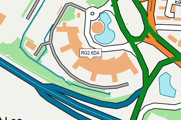
RG2 6DA is located in the Whitley electoral ward, within the unitary authority of Reading and the English Parliamentary constituency of Reading West. The Sub Integrated Care Board (ICB) Location is NHS Buckinghamshire, Oxfordshire and Berkshire West ICB - 15A and the police force is Thames Valley. This postcode has been in use since December 2000.


GetTheData
Source: OS OpenMap – Local (Ordnance Survey)
Source: OS VectorMap District (Ordnance Survey)
Licence: Open Government Licence (requires attribution)
| Easting | 471364 |
| Northing | 168911 |
| Latitude | 51.414736 |
| Longitude | -0.975210 |
GetTheData
Source: Open Postcode Geo
Licence: Open Government Licence
| Country | England |
| Postcode District | RG2 |
➜ See where RG2 is on a map ➜ Where is Reading? | |
GetTheData
Source: Land Registry Price Paid Data
Licence: Open Government Licence
Elevation or altitude of RG2 6DA as distance above sea level:
| Metres | Feet | |
|---|---|---|
| Elevation | 50m | 164ft |
Elevation is measured from the approximate centre of the postcode, to the nearest point on an OS contour line from OS Terrain 50, which has contour spacing of ten vertical metres.
➜ How high above sea level am I? Find the elevation of your current position using your device's GPS.
GetTheData
Source: Open Postcode Elevation
Licence: Open Government Licence
| Ward | Whitley |
| Constituency | Reading West |
GetTheData
Source: ONS Postcode Database
Licence: Open Government Licence
| Verizon Building (Ribp) | Reading International Business Park | 41m |
| Tesco Distribution Centre (A33) | Worton Grange | 356m |
| Imperial Way | Worton Grange | 506m |
| The Maying (Swallowfield Drive) | Whitley Wood | 511m |
| Imperial Way | Worton Grange | 525m |
| Reading West Station | 4.7km |
| Reading Station | 4.9km |
| Earley Station | 4.9km |
GetTheData
Source: NaPTAN
Licence: Open Government Licence
GetTheData
Source: ONS Postcode Database
Licence: Open Government Licence


➜ Get more ratings from the Food Standards Agency
GetTheData
Source: Food Standards Agency
Licence: FSA terms & conditions
| Last Collection | |||
|---|---|---|---|
| Location | Mon-Fri | Sat | Distance |
| Engineers | 16:45 | 13:15 | 777m |
| Post House | 17:15 | 13:15 | 798m |
| Lower Basingstoke Road | 17:00 | 13:15 | 807m |
GetTheData
Source: Dracos
Licence: Creative Commons Attribution-ShareAlike
The below table lists the International Territorial Level (ITL) codes (formerly Nomenclature of Territorial Units for Statistics (NUTS) codes) and Local Administrative Units (LAU) codes for RG2 6DA:
| ITL 1 Code | Name |
|---|---|
| TLJ | South East (England) |
| ITL 2 Code | Name |
| TLJ1 | Berkshire, Buckinghamshire and Oxfordshire |
| ITL 3 Code | Name |
| TLJ11 | Berkshire |
| LAU 1 Code | Name |
| E06000038 | Reading |
GetTheData
Source: ONS Postcode Directory
Licence: Open Government Licence
The below table lists the Census Output Area (OA), Lower Layer Super Output Area (LSOA), and Middle Layer Super Output Area (MSOA) for RG2 6DA:
| Code | Name | |
|---|---|---|
| OA | E00083030 | |
| LSOA | E01016439 | Reading 018C |
| MSOA | E02003406 | Reading 018 |
GetTheData
Source: ONS Postcode Directory
Licence: Open Government Licence
| RG7 1NS | Hartley Court Road | 284m |
| RG2 8TX | Kingsley Close | 375m |
| RG2 8TU | Kingsley Close | 404m |
| RG7 1NU | Great Lea | 488m |
| RG2 8TS | Vernon Crescent | 507m |
| RG2 8TY | Heroes Walk | 532m |
| RG2 8PF | Harness Close | 545m |
| RG2 8PE | Village Close | 564m |
| RG2 8TN | Spencer Road | 575m |
| RG2 8TZ | St Elizabeth Close | 577m |
GetTheData
Source: Open Postcode Geo; Land Registry Price Paid Data
Licence: Open Government Licence