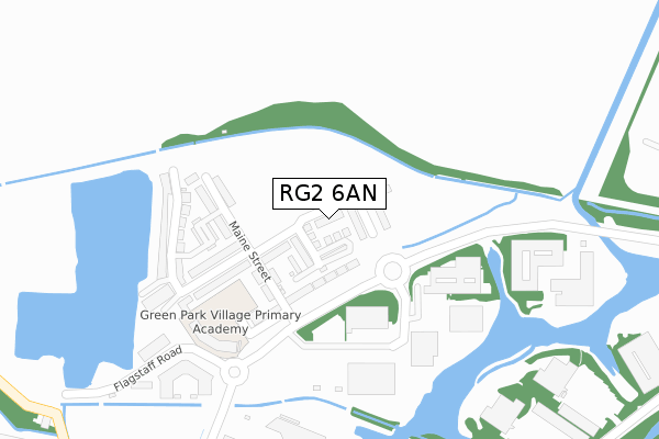
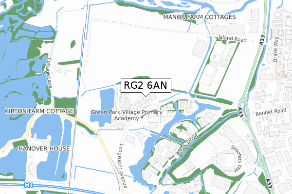
RG2 6AN is located in the Whitley electoral ward, within the unitary authority of Reading and the English Parliamentary constituency of Reading West. The Sub Integrated Care Board (ICB) Location is NHS Buckinghamshire, Oxfordshire and Berkshire West ICB - 15A and the police force is Thames Valley. This postcode has been in use since August 2018.


GetTheData
Source: OS Open Zoomstack (Ordnance Survey)
Licence: Open Government Licence (requires attribution)
Attribution: Contains OS data © Crown copyright and database right 2024
Source: Open Postcode Geo
Licence: Open Government Licence (requires attribution)
Attribution: Contains OS data © Crown copyright and database right 2024; Contains Royal Mail data © Royal Mail copyright and database right 2024; Source: Office for National Statistics licensed under the Open Government Licence v.3.0
| Easting | 470107 |
| Northing | 170291 |
| Latitude | 51.427300 |
| Longitude | -0.992988 |
GetTheData
Source: Open Postcode Geo
Licence: Open Government Licence
| Country | England |
| Postcode District | RG2 |
| ➜ RG2 open data dashboard ➜ See where RG2 is on a map ➜ Where is Reading? | |
GetTheData
Source: Land Registry Price Paid Data
Licence: Open Government Licence
| Ward | Whitley |
| Constituency | Reading West |
GetTheData
Source: ONS Postcode Database
Licence: Open Government Licence
| June 2022 | Violence and sexual offences | On or near Smallmead Road | 309m |
| June 2022 | Anti-social behaviour | On or near Smallmead Road | 309m |
| June 2022 | Public order | On or near Smallmead Road | 309m |
| ➜ Get more crime data in our Crime section | |||
GetTheData
Source: data.police.uk
Licence: Open Government Licence
| 300 Longwater Avenue (Longwater Avenue) | Greenpark | 186m |
| 300 Longwater Avenue (Longwater Avenue) | Greenpark | 221m |
| 100 Longwater Avenue (Longwater Avenue) | Greenpark | 309m |
| 100 Longwater Avenue (Longwater Avenue) | Greenpark | 337m |
| 350 Brook Drive (Brook Drive) | Greenpark | 527m |
| Reading West Station | 3.1km |
| Reading Station | 3.8km |
| Tilehurst Station | 5.5km |
GetTheData
Source: NaPTAN
Licence: Open Government Licence
| Percentage of properties with Next Generation Access | 100.0% |
| Percentage of properties with Superfast Broadband | 100.0% |
| Percentage of properties with Ultrafast Broadband | 16.9% |
| Percentage of properties with Full Fibre Broadband | 16.9% |
Superfast Broadband is between 30Mbps and 300Mbps
Ultrafast Broadband is > 300Mbps
| Percentage of properties unable to receive 2Mbps | 0.0% |
| Percentage of properties unable to receive 5Mbps | 0.0% |
| Percentage of properties unable to receive 10Mbps | 0.0% |
| Percentage of properties unable to receive 30Mbps | 0.0% |
GetTheData
Source: Ofcom
Licence: Ofcom Terms of Use (requires attribution)
GetTheData
Source: ONS Postcode Database
Licence: Open Government Licence


➜ Get more ratings from the Food Standards Agency
GetTheData
Source: Food Standards Agency
Licence: FSA terms & conditions
| Last Collection | |||
|---|---|---|---|
| Location | Mon-Fri | Sat | Distance |
| Lindisfarne Way | 17:30 | 12:00 | 1,293m |
| Manor Farm | 17:00 | 13:00 | 1,691m |
| Post House | 17:15 | 13:15 | 1,713m |
GetTheData
Source: Dracos
Licence: Creative Commons Attribution-ShareAlike
| Facility | Distance |
|---|---|
| Green Park Village Primary Academy Flagstaff Road, Flagstaff Road, Reading Artificial Grass Pitch | 250m |
| Nuffield Health (Reading) South Oak Way, Reading Swimming Pool, Health and Fitness Gym, Studio | 902m |
| Le Club Reading (Voco Hotel) Reading Health and Fitness Gym, Swimming Pool | 906m |
GetTheData
Source: Active Places
Licence: Open Government Licence
| School | Phase of Education | Distance |
|---|---|---|
| Green Park Village Primary Academy 2 Flagstaff Road, Green Park, Reading, RG2 6AX | Primary | 250m |
| Southcote Primary School Silchester Road, Southcote, Reading, RG30 3EJ | Primary | 1.8km |
| Whitley Park Primary and Nursery School Brixham Road, Reading, RG2 7RB | Primary | 1.9km |
GetTheData
Source: Edubase
Licence: Open Government Licence
| Risk of RG2 6AN flooding from rivers and sea | Medium |
| ➜ RG2 6AN flood map | |
GetTheData
Source: Open Flood Risk by Postcode
Licence: Open Government Licence
The below table lists the International Territorial Level (ITL) codes (formerly Nomenclature of Territorial Units for Statistics (NUTS) codes) and Local Administrative Units (LAU) codes for RG2 6AN:
| ITL 1 Code | Name |
|---|---|
| TLJ | South East (England) |
| ITL 2 Code | Name |
| TLJ1 | Berkshire, Buckinghamshire and Oxfordshire |
| ITL 3 Code | Name |
| TLJ11 | Berkshire |
| LAU 1 Code | Name |
| E06000038 | Reading |
GetTheData
Source: ONS Postcode Directory
Licence: Open Government Licence
The below table lists the Census Output Area (OA), Lower Layer Super Output Area (LSOA), and Middle Layer Super Output Area (MSOA) for RG2 6AN:
| Code | Name | |
|---|---|---|
| OA | E00174532 | |
| LSOA | E01016442 | Reading 017E |
| MSOA | E02003405 | Reading 017 |
GetTheData
Source: ONS Postcode Directory
Licence: Open Government Licence
| RG2 0RP | Island Road | 813m |
| RG2 0FL | 862m | |
| RG30 3UW | Kirtons Farm Cottages | 913m |
| RG30 3UN | 1106m | |
| RG2 0RJ | Mayfield Trade Centre | 1116m |
| RG2 0SU | Acre Road | 1130m |
| RG2 0GZ | Drake Way | 1184m |
| RG2 0GQ | Drake Way | 1209m |
| RG2 0GR | Drake Way | 1216m |
| RG2 0QX | Bennet Road | 1230m |
GetTheData
Source: Open Postcode Geo; Land Registry Price Paid Data
Licence: Open Government Licence