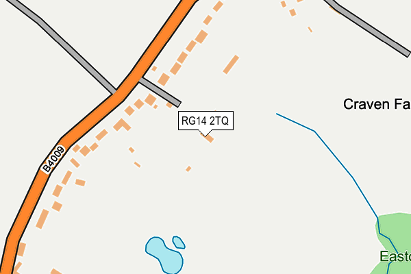
RG14 2TQ is located in the Newbury Speen electoral ward, within the unitary authority of West Berkshire and the English Parliamentary constituency of Newbury. The Sub Integrated Care Board (ICB) Location is NHS Buckinghamshire, Oxfordshire and Berkshire West ICB - 15A and the police force is Thames Valley. This postcode has been in use since July 1995.


GetTheData
Source: OS OpenMap – Local (Ordnance Survey)
Source: OS VectorMap District (Ordnance Survey)
Licence: Open Government Licence (requires attribution)
| Easting | 449120 |
| Northing | 169860 |
| Latitude | 51.425627 |
| Longitude | -1.294904 |
GetTheData
Source: Open Postcode Geo
Licence: Open Government Licence
| Country | England |
| Postcode District | RG14 |
➜ See where RG14 is on a map | |
GetTheData
Source: Land Registry Price Paid Data
Licence: Open Government Licence
Elevation or altitude of RG14 2TQ as distance above sea level:
| Metres | Feet | |
|---|---|---|
| Elevation | 90m | 295ft |
Elevation is measured from the approximate centre of the postcode, to the nearest point on an OS contour line from OS Terrain 50, which has contour spacing of ten vertical metres.
➜ How high above sea level am I? Find the elevation of your current position using your device's GPS.
GetTheData
Source: Open Postcode Elevation
Licence: Open Government Licence
| Ward | Newbury Speen |
| Constituency | Newbury |
GetTheData
Source: ONS Postcode Database
Licence: Open Government Licence
| Grange Farm (Long Lane) | Longlane | 128m |
| Grange Farm (Long Lane) | Longlane | 139m |
| Dymond Farm (Long Lane) | Longlane | 294m |
| Dymond Farm (Long Lane) | Longlane | 297m |
| Fishers Lane (B4009 Long Lane) | Longlane | 976m |
| Newbury Racecourse Station | 3.2km |
| Newbury Station | 3.7km |
| Thatcham Station | 5km |
GetTheData
Source: NaPTAN
Licence: Open Government Licence
| Percentage of properties with Next Generation Access | 100.0% |
| Percentage of properties with Superfast Broadband | 100.0% |
| Percentage of properties with Ultrafast Broadband | 100.0% |
| Percentage of properties with Full Fibre Broadband | 100.0% |
Superfast Broadband is between 30Mbps and 300Mbps
Ultrafast Broadband is > 300Mbps
| Percentage of properties unable to receive 2Mbps | 0.0% |
| Percentage of properties unable to receive 5Mbps | 0.0% |
| Percentage of properties unable to receive 10Mbps | 0.0% |
| Percentage of properties unable to receive 30Mbps | 0.0% |
GetTheData
Source: Ofcom
Licence: Ofcom Terms of Use (requires attribution)
GetTheData
Source: ONS Postcode Database
Licence: Open Government Licence


➜ Get more ratings from the Food Standards Agency
GetTheData
Source: Food Standards Agency
Licence: FSA terms & conditions
| Last Collection | |||
|---|---|---|---|
| Location | Mon-Fri | Sat | Distance |
| Cold Ash Post Office | 16:30 | 11:15 | 2,167m |
| Gaywood Drive Post Office | 17:30 | 12:00 | 2,268m |
| Southdown Road | 17:30 | 10:30 | 2,390m |
GetTheData
Source: Dracos
Licence: Creative Commons Attribution-ShareAlike
The below table lists the International Territorial Level (ITL) codes (formerly Nomenclature of Territorial Units for Statistics (NUTS) codes) and Local Administrative Units (LAU) codes for RG14 2TQ:
| ITL 1 Code | Name |
|---|---|
| TLJ | South East (England) |
| ITL 2 Code | Name |
| TLJ1 | Berkshire, Buckinghamshire and Oxfordshire |
| ITL 3 Code | Name |
| TLJ11 | Berkshire |
| LAU 1 Code | Name |
| E06000037 | West Berkshire |
GetTheData
Source: ONS Postcode Directory
Licence: Open Government Licence
The below table lists the Census Output Area (OA), Lower Layer Super Output Area (LSOA), and Middle Layer Super Output Area (MSOA) for RG14 2TQ:
| Code | Name | |
|---|---|---|
| OA | E00082459 | |
| LSOA | E01016324 | West Berkshire 012D |
| MSOA | E02003378 | West Berkshire 012 |
GetTheData
Source: ONS Postcode Directory
Licence: Open Government Licence
| RG14 2TA | Long Lane | 218m |
| RG14 2TH | Long Lane | 219m |
| RG14 2TD | Long Lane | 451m |
| RG14 2TE | Long Lane | 515m |
| RG18 9HF | Stoney Lane | 728m |
| RG18 9HQ | Stoney Lane | 852m |
| RG18 9ND | Fishers Lane | 981m |
| RG14 2TF | Long Lane | 991m |
| RG18 9NE | Fishers Lane | 1077m |
| RG18 9NF | Fishers Lane | 1111m |
GetTheData
Source: Open Postcode Geo; Land Registry Price Paid Data
Licence: Open Government Licence