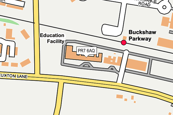
PR7 6AQ is located in the Euxton electoral ward, within the local authority district of Chorley and the English Parliamentary constituency of Chorley. The Sub Integrated Care Board (ICB) Location is NHS Lancashire and South Cumbria ICB - 00X and the police force is Lancashire. This postcode has been in use since February 2004.


GetTheData
Source: OS OpenMap – Local (Ordnance Survey)
Source: OS VectorMap District (Ordnance Survey)
Licence: Open Government Licence (requires attribution)
| Easting | 356437 |
| Northing | 419754 |
| Latitude | 53.672448 |
| Longitude | -2.660873 |
GetTheData
Source: Open Postcode Geo
Licence: Open Government Licence
| Country | England |
| Postcode District | PR7 |
➜ See where PR7 is on a map ➜ Where is Euxton? | |
GetTheData
Source: Land Registry Price Paid Data
Licence: Open Government Licence
Elevation or altitude of PR7 6AQ as distance above sea level:
| Metres | Feet | |
|---|---|---|
| Elevation | 60m | 197ft |
Elevation is measured from the approximate centre of the postcode, to the nearest point on an OS contour line from OS Terrain 50, which has contour spacing of ten vertical metres.
➜ How high above sea level am I? Find the elevation of your current position using your device's GPS.
GetTheData
Source: Open Postcode Elevation
Licence: Open Government Licence
| Ward | Euxton |
| Constituency | Chorley |
GetTheData
Source: ONS Postcode Database
Licence: Open Government Licence
| East Terrace (Euxton Lane) | Euxton | 102m |
| Parkway (Station Approach) | Buckshaw Village | 136m |
| Runshaw College (Euxton Lane) | Euxton | 179m |
| Tesco (Townsend Drive) | Buckshaw Village | 216m |
| Tesco (Townsend Drive) | Buckshaw Village | 233m |
| Buckshaw Parkway Station | 0.1km |
| Euxton Balshaw Lane Station | 1.5km |
| Chorley Station | 3.2km |
GetTheData
Source: NaPTAN
Licence: Open Government Licence
GetTheData
Source: ONS Postcode Database
Licence: Open Government Licence


➜ Get more ratings from the Food Standards Agency
GetTheData
Source: Food Standards Agency
Licence: FSA terms & conditions
| Last Collection | |||
|---|---|---|---|
| Location | Mon-Fri | Sat | Distance |
| Euxton Post Office | 17:15 | 11:00 | 1,196m |
| Highways Post Office | 17:00 | 11:00 | 1,360m |
| 139 Wigan Road, Euxton | 16:15 | 11:00 | 1,451m |
GetTheData
Source: Dracos
Licence: Creative Commons Attribution-ShareAlike
The below table lists the International Territorial Level (ITL) codes (formerly Nomenclature of Territorial Units for Statistics (NUTS) codes) and Local Administrative Units (LAU) codes for PR7 6AQ:
| ITL 1 Code | Name |
|---|---|
| TLD | North West (England) |
| ITL 2 Code | Name |
| TLD4 | Lancashire |
| ITL 3 Code | Name |
| TLD47 | Chorley and West Lancashire |
| LAU 1 Code | Name |
| E07000118 | Chorley |
GetTheData
Source: ONS Postcode Directory
Licence: Open Government Licence
The below table lists the Census Output Area (OA), Lower Layer Super Output Area (LSOA), and Middle Layer Super Output Area (MSOA) for PR7 6AQ:
| Code | Name | |
|---|---|---|
| OA | E00170511 | |
| LSOA | E01024919 | Chorley 008A |
| MSOA | E02005196 | Chorley 008 |
GetTheData
Source: ONS Postcode Directory
Licence: Open Government Licence
| PR7 6DS | Whinney Lane | 258m |
| PR7 7HW | Knight Avenue | 283m |
| PR7 7HR | Hopgood Close | 304m |
| PR7 7EZ | Ordnance Road | 313m |
| PR7 7HF | Shannon Close | 319m |
| PR7 7JF | Ordnance Road | 338m |
| PR7 7HY | Gibson Drive | 375m |
| PR7 6DL | Euxton Lane | 387m |
| PR7 7JA | Barnes Wallis Way | 394m |
| PR7 7JG | Barlow Close | 400m |
GetTheData
Source: Open Postcode Geo; Land Registry Price Paid Data
Licence: Open Government Licence