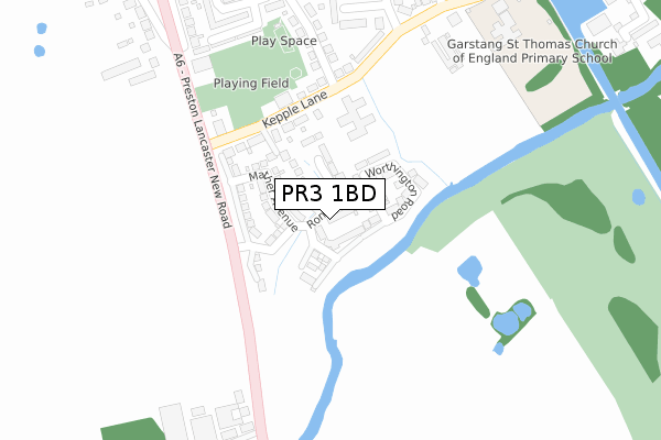
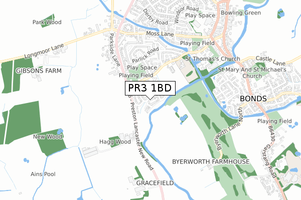
PR3 1BD is located in the Garstang electoral ward, within the local authority district of Wyre and the English Parliamentary constituency of Wyre and Preston North. The Sub Integrated Care Board (ICB) Location is NHS Lancashire and South Cumbria ICB - 02M and the police force is Lancashire. This postcode has been in use since September 2017.


GetTheData
Source: OS Open Zoomstack (Ordnance Survey)
Licence: Open Government Licence (requires attribution)
Attribution: Contains OS data © Crown copyright and database right 2024
Source: Open Postcode Geo
Licence: Open Government Licence (requires attribution)
Attribution: Contains OS data © Crown copyright and database right 2024; Contains Royal Mail data © Royal Mail copyright and database right 2024; Source: Office for National Statistics licensed under the Open Government Licence v.3.0
| Easting | 348607 |
| Northing | 444621 |
| Latitude | 53.895216 |
| Longitude | -2.783536 |
GetTheData
Source: Open Postcode Geo
Licence: Open Government Licence
| Country | England |
| Postcode District | PR3 |
| ➜ PR3 open data dashboard ➜ See where PR3 is on a map ➜ Where is Garstang? | |
GetTheData
Source: Land Registry Price Paid Data
Licence: Open Government Licence
| Ward | Garstang |
| Constituency | Wyre And Preston North |
GetTheData
Source: ONS Postcode Database
Licence: Open Government Licence
1, RONSON DRIVE, GARSTANG, PRESTON, PR3 1BD 2021 22 JAN £263,995 |
2020 20 NOV £275,000 |
10, RONSON DRIVE, GARSTANG, PRESTON, PR3 1BD 2020 26 JUN £299,995 |
8, RONSON DRIVE, GARSTANG, PRESTON, PR3 1BD 2019 4 DEC £287,995 |
15, RONSON DRIVE, GARSTANG, PRESTON, PR3 1BD 2019 27 JUN £251,995 |
17, RONSON DRIVE, GARSTANG, PRESTON, PR3 1BD 2019 14 JUN £251,995 |
6, RONSON DRIVE, GARSTANG, PRESTON, PR3 1BD 2018 25 OCT £270,746 |
4, RONSON DRIVE, GARSTANG, PRESTON, PR3 1BD 2018 29 JUN £337,246 |
11, RONSON DRIVE, GARSTANG, PRESTON, PR3 1BD 2018 28 JUN £261,196 |
2, RONSON DRIVE, GARSTANG, PRESTON, PR3 1BD 2018 28 JUN £265,196 |
GetTheData
Source: HM Land Registry Price Paid Data
Licence: Contains HM Land Registry data © Crown copyright and database right 2024. This data is licensed under the Open Government Licence v3.0.
| June 2022 | Violence and sexual offences | On or near Sports/Recreation Area | 266m |
| June 2022 | Bicycle theft | On or near Grizedale Avenue | 444m |
| June 2022 | Violence and sexual offences | On or near Grizedale Avenue | 444m |
| ➜ Get more crime data in our Crime section | |||
GetTheData
Source: data.police.uk
Licence: Open Government Licence
| Health Centre (Kepple Lane) | Garstang | 192m |
| Health Centre (Kepple Lane) | Garstang | 200m |
| St Thomas School (Kepple Lane) | Garstang | 404m |
| Pennine Gardens (Moss Lane) | Garstang | 565m |
| Pennine Gardens (Moss Lane) | Garstang | 567m |
GetTheData
Source: NaPTAN
Licence: Open Government Licence
➜ Broadband speed and availability dashboard for PR3 1BD
| Percentage of properties with Next Generation Access | 7.1% |
| Percentage of properties with Superfast Broadband | 7.1% |
| Percentage of properties with Ultrafast Broadband | 7.1% |
| Percentage of properties with Full Fibre Broadband | 0.0% |
Superfast Broadband is between 30Mbps and 300Mbps
Ultrafast Broadband is > 300Mbps
| Median download speed | 15.9Mbps |
| Average download speed | 20.4Mbps |
| Maximum download speed | 53.80Mbps |
| Median upload speed | 1.1Mbps |
| Average upload speed | 3.5Mbps |
| Maximum upload speed | 20.00Mbps |
| Percentage of properties unable to receive 2Mbps | 0.0% |
| Percentage of properties unable to receive 5Mbps | 0.0% |
| Percentage of properties unable to receive 10Mbps | 0.0% |
| Percentage of properties unable to receive 30Mbps | 92.9% |
➜ Broadband speed and availability dashboard for PR3 1BD
GetTheData
Source: Ofcom
Licence: Ofcom Terms of Use (requires attribution)
GetTheData
Source: ONS Postcode Database
Licence: Open Government Licence


➜ Get more ratings from the Food Standards Agency
GetTheData
Source: Food Standards Agency
Licence: FSA terms & conditions
| Last Collection | |||
|---|---|---|---|
| Location | Mon-Fri | Sat | Distance |
| Windsor Road | 15:30 | 11:00 | 686m |
| Garstang Delivery Office | 18:00 | 12:15 | 702m |
| Garstang Post Office | 17:30 | 11:45 | 807m |
GetTheData
Source: Dracos
Licence: Creative Commons Attribution-ShareAlike
| Facility | Distance |
|---|---|
| Kepple Lane Playing Fields (Closed) Kepple Lane, Garstang, Preston Grass Pitches | 275m |
| Garstang St Thomas C Of E Primary School Kepple Lane, Garstang, Preston Grass Pitches | 389m |
| Moss Lane Park Moss Lane, Garstang, Preston Grass Pitches | 569m |
GetTheData
Source: Active Places
Licence: Open Government Licence
| School | Phase of Education | Distance |
|---|---|---|
| Garstang St Thomas' Church of England Primary School Kepple Lane, Garstang, Preston, PR3 1PB | Primary | 251m |
| St Mary and Michael Catholic Primary School Castle Lane, Garstang, Preston, PR3 1RB | Primary | 878m |
| Garstang Community Academy Bowgreave, Garstang, Preston, PR3 1YE | Secondary | 1.3km |
GetTheData
Source: Edubase
Licence: Open Government Licence
| Risk of PR3 1BD flooding from rivers and sea | Low |
| ➜ PR3 1BD flood map | |
GetTheData
Source: Open Flood Risk by Postcode
Licence: Open Government Licence
The below table lists the International Territorial Level (ITL) codes (formerly Nomenclature of Territorial Units for Statistics (NUTS) codes) and Local Administrative Units (LAU) codes for PR3 1BD:
| ITL 1 Code | Name |
|---|---|
| TLD | North West (England) |
| ITL 2 Code | Name |
| TLD4 | Lancashire |
| ITL 3 Code | Name |
| TLD44 | Lancaster and Wyre |
| LAU 1 Code | Name |
| E07000128 | Wyre |
GetTheData
Source: ONS Postcode Directory
Licence: Open Government Licence
The below table lists the Census Output Area (OA), Lower Layer Super Output Area (LSOA), and Middle Layer Super Output Area (MSOA) for PR3 1BD:
| Code | Name | |
|---|---|---|
| OA | E00129705 | |
| LSOA | E01025559 | Wyre 007D |
| MSOA | E02005325 | Wyre 007 |
GetTheData
Source: ONS Postcode Directory
Licence: Open Government Licence
| PR3 1PB | Kepple Lane | 233m |
| PR3 1WH | Fairsnape Drive | 269m |
| PR3 1PE | Beacon Grove | 315m |
| PR3 1NE | Parlick Road | 334m |
| PR3 1NA | Garstang By Pass Road | 388m |
| PR3 1PF | Alpine Heights | 401m |
| PR3 1WD | Grizedale Avenue | 421m |
| PR3 1ND | Grizedale Avenue | 446m |
| PR3 1WB | Hazelhurst Drive | 453m |
| PR3 1NB | Hazelhurst Drive | 483m |
GetTheData
Source: Open Postcode Geo; Land Registry Price Paid Data
Licence: Open Government Licence