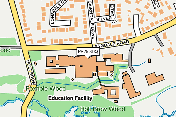
PR25 3DQ is located in the Buckshaw & Worden electoral ward, within the local authority district of South Ribble and the English Parliamentary constituency of South Ribble. The Sub Integrated Care Board (ICB) Location is NHS Lancashire and South Cumbria ICB - 00X and the police force is Lancashire. This postcode has been in use since June 2001.


GetTheData
Source: OS OpenMap – Local (Ordnance Survey)
Source: OS VectorMap District (Ordnance Survey)
Licence: Open Government Licence (requires attribution)
| Easting | 354549 |
| Northing | 420725 |
| Latitude | 53.680997 |
| Longitude | -2.689595 |
GetTheData
Source: Open Postcode Geo
Licence: Open Government Licence
| Country | England |
| Postcode District | PR25 |
➜ See where PR25 is on a map ➜ Where is Leyland? | |
GetTheData
Source: Land Registry Price Paid Data
Licence: Open Government Licence
Elevation or altitude of PR25 3DQ as distance above sea level:
| Metres | Feet | |
|---|---|---|
| Elevation | 40m | 131ft |
Elevation is measured from the approximate centre of the postcode, to the nearest point on an OS contour line from OS Terrain 50, which has contour spacing of ten vertical metres.
➜ How high above sea level am I? Find the elevation of your current position using your device's GPS.
GetTheData
Source: Open Postcode Elevation
Licence: Open Government Licence
| Ward | Buckshaw & Worden |
| Constituency | South Ribble |
GetTheData
Source: ONS Postcode Database
Licence: Open Government Licence
| Runshaw College Grounds (Langdale Road) | Bent Bridge | 16m |
| Runshaw College (Langdale Road) | Bent Bridge | 54m |
| Runshaw College (Langdale Road) | Bent Bridge | 62m |
| Runshaw Hall Lane | Runshaw Moor | 586m |
| Bleasdale Close (Langdale Road) | Leyland | 589m |
| Leyland Station | 2km |
| Buckshaw Parkway Station | 2.1km |
| Euxton Balshaw Lane Station | 2.6km |
GetTheData
Source: NaPTAN
Licence: Open Government Licence
GetTheData
Source: ONS Postcode Database
Licence: Open Government Licence


➜ Get more ratings from the Food Standards Agency
GetTheData
Source: Food Standards Agency
Licence: FSA terms & conditions
| Last Collection | |||
|---|---|---|---|
| Location | Mon-Fri | Sat | Distance |
| 93 Dalehead Road | 17:30 | 12:00 | 226m |
| 28 Langdale Road | 17:30 | 12:00 | 693m |
| Beechfield Road | 17:30 | 12:30 | 869m |
GetTheData
Source: Dracos
Licence: Creative Commons Attribution-ShareAlike
The below table lists the International Territorial Level (ITL) codes (formerly Nomenclature of Territorial Units for Statistics (NUTS) codes) and Local Administrative Units (LAU) codes for PR25 3DQ:
| ITL 1 Code | Name |
|---|---|
| TLD | North West (England) |
| ITL 2 Code | Name |
| TLD4 | Lancashire |
| ITL 3 Code | Name |
| TLD45 | Mid Lancashire |
| LAU 1 Code | Name |
| E07000126 | South Ribble |
GetTheData
Source: ONS Postcode Directory
Licence: Open Government Licence
The below table lists the Census Output Area (OA), Lower Layer Super Output Area (LSOA), and Middle Layer Super Output Area (MSOA) for PR25 3DQ:
| Code | Name | |
|---|---|---|
| OA | E00129085 | |
| LSOA | E01025435 | South Ribble 015C |
| MSOA | E02005301 | South Ribble 015 |
GetTheData
Source: ONS Postcode Directory
Licence: Open Government Licence
| PR25 3BX | Cairndale Drive | 155m |
| PR25 3BU | Lonsdale Close | 174m |
| PR25 3BY | Silverdale Close | 186m |
| PR25 3DU | Brookdale Close | 193m |
| PR25 3BW | Dalehead Road | 206m |
| PR25 3DE | Langdale Road | 279m |
| PR25 3DS | Kingsdale Close | 281m |
| PR7 6HH | Runshaw Hall Lane | 286m |
| PR25 3DT | Lyndale Close | 291m |
| PR25 3BN | Dovedale Close | 307m |
GetTheData
Source: Open Postcode Geo; Land Registry Price Paid Data
Licence: Open Government Licence