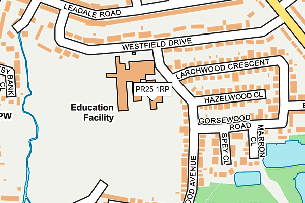
PR25 1RP is located in the Broadfield electoral ward, within the local authority district of South Ribble and the English Parliamentary constituency of South Ribble. The Sub Integrated Care Board (ICB) Location is NHS Lancashire and South Cumbria ICB - 00X and the police force is Lancashire. This postcode has been in use since September 2013.


GetTheData
Source: OS OpenMap – Local (Ordnance Survey)
Source: OS VectorMap District (Ordnance Survey)
Licence: Open Government Licence (requires attribution)
| Easting | 353074 |
| Northing | 422071 |
| Latitude | 53.692963 |
| Longitude | -2.712128 |
GetTheData
Source: Open Postcode Geo
Licence: Open Government Licence
| Country | England |
| Postcode District | PR25 |
➜ See where PR25 is on a map ➜ Where is Leyland? | |
GetTheData
Source: Land Registry Price Paid Data
Licence: Open Government Licence
Elevation or altitude of PR25 1RP as distance above sea level:
| Metres | Feet | |
|---|---|---|
| Elevation | 20m | 66ft |
Elevation is measured from the approximate centre of the postcode, to the nearest point on an OS contour line from OS Terrain 50, which has contour spacing of ten vertical metres.
➜ How high above sea level am I? Find the elevation of your current position using your device's GPS.
GetTheData
Source: Open Postcode Elevation
Licence: Open Government Licence
| Ward | Broadfield |
| Constituency | South Ribble |
GetTheData
Source: ONS Postcode Database
Licence: Open Government Licence
| Leadale Road | Broadfield | 233m |
| Westfield Drive (Broadfield Drive) | Broadfield | 304m |
| Westfield Drive (Broadfield Drive) | Broadfield | 324m |
| Daisy Bank Close (Leyland Lane) | The Straits | 341m |
| Cowling Lane (Leyland Lane) | The Straits | 357m |
| Leyland Station | 1.8km |
| Lostock Hall Station | 3.8km |
| Buckshaw Parkway Station | 4km |
GetTheData
Source: NaPTAN
Licence: Open Government Licence
GetTheData
Source: ONS Postcode Database
Licence: Open Government Licence


➜ Get more ratings from the Food Standards Agency
GetTheData
Source: Food Standards Agency
Licence: FSA terms & conditions
| Last Collection | |||
|---|---|---|---|
| Location | Mon-Fri | Sat | Distance |
| Westfield Drive | 17:15 | 12:00 | 301m |
| Cowling Lane | 17:30 | 12:00 | 353m |
| 169 Fox Lane | 17:15 | 11:30 | 477m |
GetTheData
Source: Dracos
Licence: Creative Commons Attribution-ShareAlike
The below table lists the International Territorial Level (ITL) codes (formerly Nomenclature of Territorial Units for Statistics (NUTS) codes) and Local Administrative Units (LAU) codes for PR25 1RP:
| ITL 1 Code | Name |
|---|---|
| TLD | North West (England) |
| ITL 2 Code | Name |
| TLD4 | Lancashire |
| ITL 3 Code | Name |
| TLD45 | Mid Lancashire |
| LAU 1 Code | Name |
| E07000126 | South Ribble |
GetTheData
Source: ONS Postcode Directory
Licence: Open Government Licence
The below table lists the Census Output Area (OA), Lower Layer Super Output Area (LSOA), and Middle Layer Super Output Area (MSOA) for PR25 1RP:
| Code | Name | |
|---|---|---|
| OA | E00129214 | |
| LSOA | E01025459 | South Ribble 017C |
| MSOA | E02005303 | South Ribble 017 |
GetTheData
Source: ONS Postcode Directory
Licence: Open Government Licence
| PR25 1GX | Westfield Drive | 150m |
| PR25 1RH | Hazelwood Close | 155m |
| PR25 1RU | Spey Close | 166m |
| PR25 1RE | Gorsewood Road | 173m |
| PR25 1RJ | Larchwood Crescent | 187m |
| PR25 1RN | Redwood Avenue | 194m |
| PR25 1RD | Briarwood Close | 202m |
| PR25 1QR | Leadale Road | 210m |
| PR25 1RX | Marron Close | 210m |
| PR25 1QQ | Leadale Road | 211m |
GetTheData
Source: Open Postcode Geo; Land Registry Price Paid Data
Licence: Open Government Licence