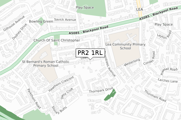
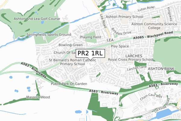
PR2 1RL lies on Lowood Grove in Lea, Preston. PR2 1RL is located in the Lea & Larches electoral ward, within the local authority district of Preston and the English Parliamentary constituency of Fylde. The Sub Integrated Care Board (ICB) Location is NHS Lancashire and South Cumbria ICB - 01E and the police force is Lancashire. This postcode has been in use since January 1980.


GetTheData
Source: OS Open Zoomstack (Ordnance Survey)
Licence: Open Government Licence (requires attribution)
Attribution: Contains OS data © Crown copyright and database right 2025
Source: Open Postcode Geo
Licence: Open Government Licence (requires attribution)
Attribution: Contains OS data © Crown copyright and database right 2025; Contains Royal Mail data © Royal Mail copyright and database right 2025; Source: Office for National Statistics licensed under the Open Government Licence v.3.0
| Easting | 349761 |
| Northing | 430176 |
| Latitude | 53.765496 |
| Longitude | -2.763615 |
GetTheData
Source: Open Postcode Geo
Licence: Open Government Licence
| Street | Lowood Grove |
| Locality | Lea |
| Town/City | Preston |
| Country | England |
| Postcode District | PR2 |
➜ See where PR2 is on a map ➜ Where is Preston? | |
GetTheData
Source: Land Registry Price Paid Data
Licence: Open Government Licence
Elevation or altitude of PR2 1RL as distance above sea level:
| Metres | Feet | |
|---|---|---|
| Elevation | 10m | 33ft |
Elevation is measured from the approximate centre of the postcode, to the nearest point on an OS contour line from OS Terrain 50, which has contour spacing of ten vertical metres.
➜ How high above sea level am I? Find the elevation of your current position using your device's GPS.
GetTheData
Source: Open Postcode Elevation
Licence: Open Government Licence
| Ward | Lea & Larches |
| Constituency | Fylde |
GetTheData
Source: ONS Postcode Database
Licence: Open Government Licence
| Daisycroft (Hawthorn Crescent) | Lea | 170m |
| The Pig & Whistle (Blackpool Road) | Lea | 182m |
| The Pig & Whistle (Blackpool Road) | Lea | 194m |
| Whitethorn Square | Lea | 197m |
| Hawthorn Cresent (Hawthorn Crescent) | Lea | 234m |
| Preston Station | 3.8km |
| Salwick Station | 3.9km |
| Lostock Hall Station | 6.8km |
GetTheData
Source: NaPTAN
Licence: Open Government Licence
| Percentage of properties with Next Generation Access | 100.0% |
| Percentage of properties with Superfast Broadband | 100.0% |
| Percentage of properties with Ultrafast Broadband | 100.0% |
| Percentage of properties with Full Fibre Broadband | 0.0% |
Superfast Broadband is between 30Mbps and 300Mbps
Ultrafast Broadband is > 300Mbps
| Median download speed | 45.6Mbps |
| Average download speed | 67.1Mbps |
| Maximum download speed | 350.00Mbps |
| Median upload speed | 9.8Mbps |
| Average upload speed | 8.8Mbps |
| Maximum upload speed | 19.39Mbps |
| Percentage of properties unable to receive 2Mbps | 0.0% |
| Percentage of properties unable to receive 5Mbps | 0.0% |
| Percentage of properties unable to receive 10Mbps | 0.0% |
| Percentage of properties unable to receive 30Mbps | 0.0% |
GetTheData
Source: Ofcom
Licence: Ofcom Terms of Use (requires attribution)
Estimated total energy consumption in PR2 1RL by fuel type, 2015.
| Consumption (kWh) | 353,450 |
|---|---|
| Meter count | 26 |
| Mean (kWh/meter) | 13,594 |
| Median (kWh/meter) | 12,327 |
| Consumption (kWh) | 79,425 |
|---|---|
| Meter count | 22 |
| Mean (kWh/meter) | 3,610 |
| Median (kWh/meter) | 3,711 |
GetTheData
Source: Postcode level gas estimates: 2015 (experimental)
Source: Postcode level electricity estimates: 2015 (experimental)
Licence: Open Government Licence
GetTheData
Source: ONS Postcode Database
Licence: Open Government Licence


➜ Get more ratings from the Food Standards Agency
GetTheData
Source: Food Standards Agency
Licence: FSA terms & conditions
| Last Collection | |||
|---|---|---|---|
| Location | Mon-Fri | Sat | Distance |
| Navigation Way, Ashton | 17:30 | 11:30 | 1,379m |
| Victoria Mansions | 17:00 | 11:00 | 1,574m |
| Morrisons | 16:30 | 11:00 | 1,871m |
GetTheData
Source: Dracos
Licence: Creative Commons Attribution-ShareAlike
The below table lists the International Territorial Level (ITL) codes (formerly Nomenclature of Territorial Units for Statistics (NUTS) codes) and Local Administrative Units (LAU) codes for PR2 1RL:
| ITL 1 Code | Name |
|---|---|
| TLD | North West (England) |
| ITL 2 Code | Name |
| TLD4 | Lancashire |
| ITL 3 Code | Name |
| TLD45 | Mid Lancashire |
| LAU 1 Code | Name |
| E07000123 | Preston |
GetTheData
Source: ONS Postcode Directory
Licence: Open Government Licence
The below table lists the Census Output Area (OA), Lower Layer Super Output Area (LSOA), and Middle Layer Super Output Area (MSOA) for PR2 1RL:
| Code | Name | |
|---|---|---|
| OA | E00128266 | |
| LSOA | E01025271 | Preston 013G |
| MSOA | E02005265 | Preston 013 |
GetTheData
Source: ONS Postcode Directory
Licence: Open Government Licence
| PR2 1RQ | Victoria Park Drive | 77m |
| PR2 1RS | The Avenue | 79m |
| PR2 1RR | The Crescent | 99m |
| PR2 1PJ | Thorntrees Avenue | 107m |
| PR2 1PL | Holmfield Crescent | 113m |
| PR2 1QR | Blackpool Road | 134m |
| PR2 1RN | Park Drive | 136m |
| PR2 1RP | Victoria Park Avenue | 167m |
| PR2 1XL | Blackpool Road | 203m |
| PR2 1RD | Hawthorn Crescent | 204m |
GetTheData
Source: Open Postcode Geo; Land Registry Price Paid Data
Licence: Open Government Licence