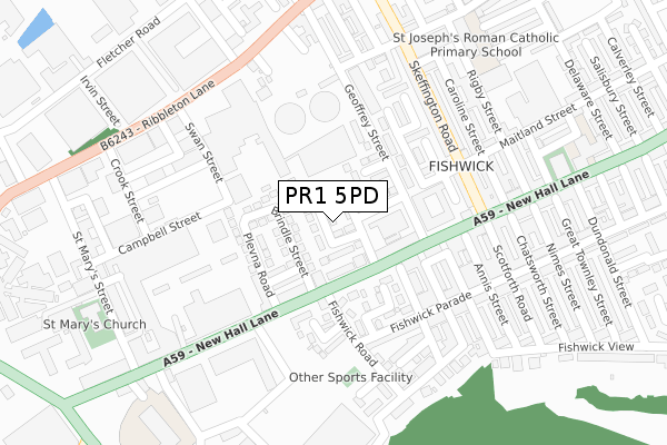
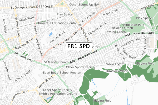
PR1 5PD maps, stats, and open data
PR1 5PD is located in the St Matthew's electoral ward, within the local authority district of Preston and the English Parliamentary constituency of Preston. The Sub Integrated Care Board (ICB) Location is NHS Lancashire and South Cumbria ICB - 01E and the police force is Lancashire. This postcode has been in use since September 2015.
PR1 5PD maps


Licence: Open Government Licence (requires attribution)
Attribution: Contains OS data © Crown copyright and database right 2025
Source: Open Postcode Geo
Licence: Open Government Licence (requires attribution)
Attribution: Contains OS data © Crown copyright and database right 2025; Contains Royal Mail data © Royal Mail copyright and database right 2025; Source: Office for National Statistics licensed under the Open Government Licence v.3.0
PR1 5PD geodata
| Easting | 355197 |
| Northing | 429821 |
| Latitude | 53.762819 |
| Longitude | -2.681102 |
Where is PR1 5PD?
| Country | England |
| Postcode District | PR1 |
PR1 5PD Elevation
Elevation or altitude of PR1 5PD as distance above sea level:
| Metres | Feet | |
|---|---|---|
| Elevation | 40m | 131ft |
Elevation is measured from the approximate centre of the postcode, to the nearest point on an OS contour line from OS Terrain 50, which has contour spacing of ten vertical metres.
➜ How high above sea level am I? Find the elevation of your current position using your device's GPS.
Politics
| Ward | St Matthew's |
|---|---|
| Constituency | Preston |
Transport
Nearest bus stops to PR1 5PD
| Centenary Mill (New Hall Lane) | Fishwick | 157m |
| Skeffington Road (New Hall Lane) | Fishwick | 179m |
| Skeffington Road (New Hall Lane) | Fishwick | 184m |
| Centenary Mill (New Hall Lane) | Fishwick | 239m |
| Swan Street (Ribbleton Lane) | Ribbleton Lane | 272m |
Nearest railway stations to PR1 5PD
| Preston Station | 1.9km |
| Bamber Bridge Station | 4.2km |
| Lostock Hall Station | 4.3km |
Broadband
Broadband access in PR1 5PD (2020 data)
| Percentage of properties with Next Generation Access | 100.0% |
| Percentage of properties with Superfast Broadband | 100.0% |
| Percentage of properties with Ultrafast Broadband | 100.0% |
| Percentage of properties with Full Fibre Broadband | 0.0% |
Superfast Broadband is between 30Mbps and 300Mbps
Ultrafast Broadband is > 300Mbps
Broadband speed in PR1 5PD (2019 data)
Download
| Median download speed | 55.0Mbps |
| Average download speed | 81.6Mbps |
| Maximum download speed | 350.00Mbps |
Upload
| Median upload speed | 10.0Mbps |
| Average upload speed | 8.9Mbps |
| Maximum upload speed | 19.53Mbps |
Broadband limitations in PR1 5PD (2020 data)
| Percentage of properties unable to receive 2Mbps | 0.0% |
| Percentage of properties unable to receive 5Mbps | 0.0% |
| Percentage of properties unable to receive 10Mbps | 0.0% |
| Percentage of properties unable to receive 30Mbps | 0.0% |
PR1 5PD gas and electricity consumption
Estimated total energy consumption in PR1 5PD by fuel type, 2015.
Gas
| Consumption (kWh) | 275,222 |
|---|---|
| Meter count | 35 |
| Mean (kWh/meter) | 7,863 |
| Median (kWh/meter) | 8,426 |
Electricity
| Consumption (kWh) | 44,243 |
|---|---|
| Meter count | 19 |
| Mean (kWh/meter) | 2,329 |
| Median (kWh/meter) | 2,389 |
- Consumption: The estimated total energy consumption, in kWh, across all meters in PR1 5PD, for 2015.
- Meter count: The total number of meters in PR1 5PD.
- Mean: The mean average consumption per meter, in kWh.
- Median: The median average consumption per meter, in kWh.
Source: Postcode level electricity estimates: 2015 (experimental)
Licence: Open Government Licence
Deprivation
93.9% of English postcodes are less deprived than PR1 5PD:Food Standards Agency
Three nearest food hygiene ratings to PR1 5PD (metres)


➜ Get more ratings from the Food Standards Agency
Nearest post box to PR1 5PD
| Last Collection | |||
|---|---|---|---|
| Location | Mon-Fri | Sat | Distance |
| New Hall Lane Post Office | 17:30 | 11:30 | 335m |
| Cemetery Post Office | 17:30 | 11:15 | 560m |
| 49 Newton Road, Ashton | 17:00 | 11:30 | 871m |
PR1 5PD ITL and PR1 5PD LAU
The below table lists the International Territorial Level (ITL) codes (formerly Nomenclature of Territorial Units for Statistics (NUTS) codes) and Local Administrative Units (LAU) codes for PR1 5PD:
| ITL 1 Code | Name |
|---|---|
| TLD | North West (England) |
| ITL 2 Code | Name |
| TLD4 | Lancashire |
| ITL 3 Code | Name |
| TLD45 | Mid Lancashire |
| LAU 1 Code | Name |
| E07000123 | Preston |
PR1 5PD census areas
The below table lists the Census Output Area (OA), Lower Layer Super Output Area (LSOA), and Middle Layer Super Output Area (MSOA) for PR1 5PD:
| Code | Name | |
|---|---|---|
| OA | E00171957 | |
| LSOA | E01025295 | Preston 014A |
| MSOA | E02005266 | Preston 014 |
Nearest postcodes to PR1 5PD
| PR1 5NY | New Hall Lane | 80m |
| PR1 5PB | New Hall Lane | 104m |
| PR1 5PL | Stefano Road | 118m |
| PR1 5NN | Wilbraham Street | 136m |
| PR1 4XN | St Marys Close | 138m |
| PR1 5PN | Plevna Road | 145m |
| PR1 4YR | Cromford Walk | 157m |
| PR1 5SU | Maitland Street | 163m |
| PR1 4XL | Lex Street | 174m |
| PR1 4DX | New Hall Lane | 184m |