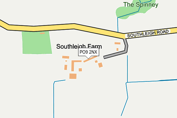
PO9 2NX is located in the St Faith's electoral ward, within the local authority district of Havant and the English Parliamentary constituency of Havant. The Sub Integrated Care Board (ICB) Location is NHS Hampshire and Isle of Wight ICB - D9Y0V and the police force is Hampshire. This postcode has been in use since January 1980.


GetTheData
Source: OS OpenMap – Local (Ordnance Survey)
Source: OS VectorMap District (Ordnance Survey)
Licence: Open Government Licence (requires attribution)
| Easting | 473795 |
| Northing | 107178 |
| Latitude | 50.859405 |
| Longitude | -0.952872 |
GetTheData
Source: Open Postcode Geo
Licence: Open Government Licence
| Country | England |
| Postcode District | PO9 |
➜ See where PO9 is on a map | |
GetTheData
Source: Land Registry Price Paid Data
Licence: Open Government Licence
Elevation or altitude of PO9 2NX as distance above sea level:
| Metres | Feet | |
|---|---|---|
| Elevation | 30m | 98ft |
Elevation is measured from the approximate centre of the postcode, to the nearest point on an OS contour line from OS Terrain 50, which has contour spacing of ten vertical metres.
➜ How high above sea level am I? Find the elevation of your current position using your device's GPS.
GetTheData
Source: Open Postcode Elevation
Licence: Open Government Licence
| Ward | St Faith's |
| Constituency | Havant |
GetTheData
Source: ONS Postcode Database
Licence: Open Government Licence
| Locks Farm (Southleigh Road) | Southleigh | 474m |
| Locks Farm | Southleigh | 492m |
| Cotton Drive (Spencer Road) | New Brighton | 578m |
| Cotton Drive (Spencer Road) | New Brighton | 590m |
| Helston Drive (Horndean Road) | New Brighton | 593m |
| Warblington Station | 1.2km |
| Emsworth Station | 1.3km |
| Havant Station | 2.1km |
GetTheData
Source: NaPTAN
Licence: Open Government Licence
| Percentage of properties with Next Generation Access | 100.0% |
| Percentage of properties with Superfast Broadband | 33.3% |
| Percentage of properties with Ultrafast Broadband | 0.0% |
| Percentage of properties with Full Fibre Broadband | 0.0% |
Superfast Broadband is between 30Mbps and 300Mbps
Ultrafast Broadband is > 300Mbps
| Percentage of properties unable to receive 2Mbps | 0.0% |
| Percentage of properties unable to receive 5Mbps | 0.0% |
| Percentage of properties unable to receive 10Mbps | 0.0% |
| Percentage of properties unable to receive 30Mbps | 66.7% |
GetTheData
Source: Ofcom
Licence: Ofcom Terms of Use (requires attribution)
GetTheData
Source: ONS Postcode Database
Licence: Open Government Licence


➜ Get more ratings from the Food Standards Agency
GetTheData
Source: Food Standards Agency
Licence: FSA terms & conditions
| Last Collection | |||
|---|---|---|---|
| Location | Mon-Fri | Sat | Distance |
| Rowan Road | 17:45 | 11:30 | 264m |
| Eastleigh Road | 16:15 | 11:30 | 660m |
| Nutwick Road | 16:15 | 11:30 | 841m |
GetTheData
Source: Dracos
Licence: Creative Commons Attribution-ShareAlike
The below table lists the International Territorial Level (ITL) codes (formerly Nomenclature of Territorial Units for Statistics (NUTS) codes) and Local Administrative Units (LAU) codes for PO9 2NX:
| ITL 1 Code | Name |
|---|---|
| TLJ | South East (England) |
| ITL 2 Code | Name |
| TLJ3 | Hampshire and Isle of Wight |
| ITL 3 Code | Name |
| TLJ35 | South Hampshire |
| LAU 1 Code | Name |
| E07000090 | Havant |
GetTheData
Source: ONS Postcode Directory
Licence: Open Government Licence
The below table lists the Census Output Area (OA), Lower Layer Super Output Area (LSOA), and Middle Layer Super Output Area (MSOA) for PO9 2NX:
| Code | Name | |
|---|---|---|
| OA | E00116641 | |
| LSOA | E01022958 | Havant 014F |
| MSOA | E02004775 | Havant 014 |
GetTheData
Source: ONS Postcode Directory
Licence: Open Government Licence
| PO9 2NY | Eastleigh Road | 427m |
| PO9 2PA | Southleigh Road | 509m |
| PO10 7XR | Spencer Road | 520m |
| PO10 7XZ | Neville Gardens | 539m |
| PO10 7TL | Horndean Road | 562m |
| PO9 2PY | Weavers Green | 576m |
| PO10 7XS | Spencer Road | 576m |
| PO10 7XN | Lisle Way | 576m |
| PO9 2PX | Spindle Close | 577m |
| PO9 2QB | Chartwell Drive | 595m |
GetTheData
Source: Open Postcode Geo; Land Registry Price Paid Data
Licence: Open Government Licence