PO5 4LX maps, stats, and open data
PO5 4LX lies on Somers Road in Southsea. PO5 4LX is located in the Charles Dickens electoral ward, within the unitary authority of Portsmouth and the English Parliamentary constituency of Portsmouth South. The Sub Integrated Care Board (ICB) Location is NHS Hampshire and Isle of Wight ICB - 10R and the police force is Hampshire. This postcode has been in use since January 1980.
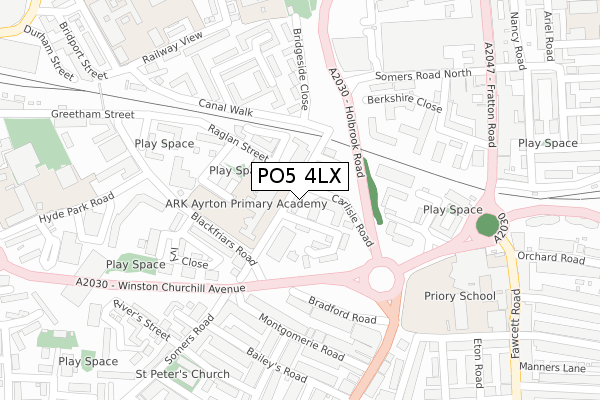
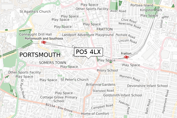
PO5 4LX maps


Licence: Open Government Licence (requires attribution)
Attribution: Contains OS data © Crown copyright and database right 2025
Source: Open Postcode Geo
Licence: Open Government Licence (requires attribution)
Attribution: Contains OS data © Crown copyright and database right 2025; Contains Royal Mail data © Royal Mail copyright and database right 2025; Source: Office for National Statistics licensed under the Open Government Licence v.3.0
PO5 4LX geodata
| Easting | 464831 |
| Northing | 100026 |
| Latitude | 50.796170 |
| Longitude | -1.081478 |
Where is PO5 4LX?
| Street | Somers Road |
| Town/City | Southsea |
| Country | England |
| Postcode District | PO5 |
PO5 4LX Elevation
Elevation or altitude of PO5 4LX as distance above sea level:
| Metres | Feet | |
|---|---|---|
| Elevation | 10m | 33ft |
Elevation is measured from the approximate centre of the postcode, to the nearest point on an OS contour line from OS Terrain 50, which has contour spacing of ten vertical metres.
➜ How high above sea level am I? Find the elevation of your current position using your device's GPS.
Politics
| Ward | Charles Dickens |
|---|---|
| Constituency | Portsmouth South |
Transport
Nearest bus stops to PO5 4LX
| Bradford Junction | Somers Town | 131m |
| Bradford Junction (Winston Churchill Avenue) | Somers Town | 142m |
| Somers Road (Winston Churchill Avenue) | Somers Town | 152m |
| Somers Road (Winston Churchill Avenue) | Somers Town | 215m |
| Bradford Junction (Victoria Road North) | Southsea | 286m |
Nearest railway stations to PO5 4LX
| Fratton Station | 0.5km |
| Portsmouth & Southsea Station | 0.7km |
| Southsea Hoverport | 1.8km |
Broadband
Broadband access in PO5 4LX (2020 data)
| Percentage of properties with Next Generation Access | 100.0% |
| Percentage of properties with Superfast Broadband | 100.0% |
| Percentage of properties with Ultrafast Broadband | 100.0% |
| Percentage of properties with Full Fibre Broadband | 0.0% |
Superfast Broadband is between 30Mbps and 300Mbps
Ultrafast Broadband is > 300Mbps
Broadband speed in PO5 4LX (2019 data)
Download
| Median download speed | 39.1Mbps |
| Average download speed | 36.2Mbps |
| Maximum download speed | 100.00Mbps |
Upload
| Median upload speed | 1.3Mbps |
| Average upload speed | 5.0Mbps |
| Maximum upload speed | 10.00Mbps |
Broadband limitations in PO5 4LX (2020 data)
| Percentage of properties unable to receive 2Mbps | 0.0% |
| Percentage of properties unable to receive 5Mbps | 0.0% |
| Percentage of properties unable to receive 10Mbps | 0.0% |
| Percentage of properties unable to receive 30Mbps | 0.0% |
PO5 4LX gas and electricity consumption
Estimated total energy consumption in PO5 4LX by fuel type, 2015.
Gas
| Consumption (kWh) | 95,650 |
|---|---|
| Meter count | 15 |
| Mean (kWh/meter) | 6,377 |
| Median (kWh/meter) | 6,538 |
Electricity
| Consumption (kWh) | 35,727 |
|---|---|
| Meter count | 13 |
| Mean (kWh/meter) | 2,748 |
| Median (kWh/meter) | 2,920 |
- Consumption: The estimated total energy consumption, in kWh, across all meters in PO5 4LX, for 2015.
- Meter count: The total number of meters in PO5 4LX.
- Mean: The mean average consumption per meter, in kWh.
- Median: The median average consumption per meter, in kWh.
Source: Postcode level electricity estimates: 2015 (experimental)
Licence: Open Government Licence
Deprivation
98.3% of English postcodes are less deprived than PO5 4LX:Food Standards Agency
Three nearest food hygiene ratings to PO5 4LX (metres)


➜ Get more ratings from the Food Standards Agency
Nearest post box to PO5 4LX
| Last Collection | |||
|---|---|---|---|
| Location | Mon-Fri | Sat | Distance |
| Raglan Street | 17:30 | 11:30 | 63m |
| Cumberland Business Centre | 17:30 | 11:30 | 230m |
| Cumberland Business Centre | 17:30 | 11:30 | 233m |
PO5 4LX ITL and PO5 4LX LAU
The below table lists the International Territorial Level (ITL) codes (formerly Nomenclature of Territorial Units for Statistics (NUTS) codes) and Local Administrative Units (LAU) codes for PO5 4LX:
| ITL 1 Code | Name |
|---|---|
| TLJ | South East (England) |
| ITL 2 Code | Name |
| TLJ3 | Hampshire and Isle of Wight |
| ITL 3 Code | Name |
| TLJ31 | Portsmouth |
| LAU 1 Code | Name |
| E06000044 | Portsmouth |
PO5 4LX census areas
The below table lists the Census Output Area (OA), Lower Layer Super Output Area (LSOA), and Middle Layer Super Output Area (MSOA) for PO5 4LX:
| Code | Name | |
|---|---|---|
| OA | E00086016 | |
| LSOA | E01017035 | Portsmouth 018A |
| MSOA | E02003541 | Portsmouth 018 |
Nearest postcodes to PO5 4LX
| PO5 4LB | Froddington Road | 87m |
| PO5 4NP | Port Royal Street | 126m |
| PO5 4PT | Somers Road | 156m |
| PO5 4LN | Blackfriars Road | 157m |
| PO5 1AF | Cumberland Road | 168m |
| PO5 4LY | Raglan Street | 170m |
| PO5 1AA | Bradford Road | 189m |
| PO5 4LR | Blackfriars Road | 206m |
| PO5 1ED | Montgomerie Road | 210m |
| PO1 1RH | Bridgeside Close | 226m |