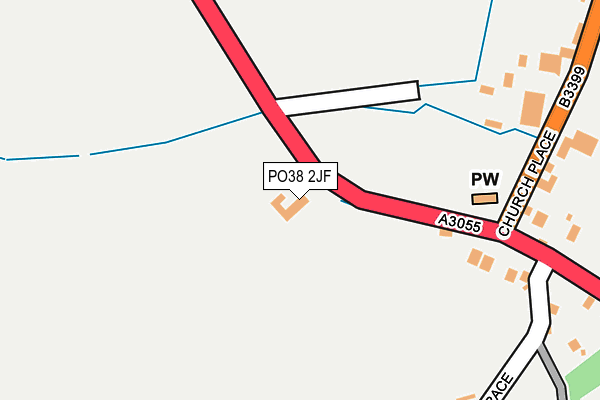
PO38 2JF is located in the Chale, Niton & Shorwell electoral ward, within the unitary authority of Isle of Wight and the English Parliamentary constituency of Isle of Wight. The Sub Integrated Care Board (ICB) Location is NHS Hampshire and Isle of Wight ICB - D9Y0V and the police force is Hampshire. This postcode has been in use since January 1980.


GetTheData
Source: OS OpenMap – Local (Ordnance Survey)
Source: OS VectorMap District (Ordnance Survey)
Licence: Open Government Licence (requires attribution)
| Easting | 448144 |
| Northing | 77565 |
| Latitude | 50.595833 |
| Longitude | -1.321160 |
GetTheData
Source: Open Postcode Geo
Licence: Open Government Licence
| Country | England |
| Postcode District | PO38 |
➜ See where PO38 is on a map | |
GetTheData
Source: Land Registry Price Paid Data
Licence: Open Government Licence
Elevation or altitude of PO38 2JF as distance above sea level:
| Metres | Feet | |
|---|---|---|
| Elevation | 80m | 262ft |
Elevation is measured from the approximate centre of the postcode, to the nearest point on an OS contour line from OS Terrain 50, which has contour spacing of ten vertical metres.
➜ How high above sea level am I? Find the elevation of your current position using your device's GPS.
GetTheData
Source: Open Postcode Elevation
Licence: Open Government Licence
| Ward | Chale, Niton & Shorwell |
| Constituency | Isle Of Wight |
GetTheData
Source: ONS Postcode Database
Licence: Open Government Licence
| Church (Military Road) | Chale | 130m |
| Church (Military Road) | Chale | 164m |
| Church (Church Place) | Chale | 211m |
| Church (Church Place) | Chale | 248m |
| Old Rectory (Chale Street) | Chale | 505m |
GetTheData
Source: NaPTAN
Licence: Open Government Licence
GetTheData
Source: ONS Postcode Database
Licence: Open Government Licence


➜ Get more ratings from the Food Standards Agency
GetTheData
Source: Food Standards Agency
Licence: FSA terms & conditions
| Last Collection | |||
|---|---|---|---|
| Location | Mon-Fri | Sat | Distance |
| Chale Post Office | 16:00 | 10:45 | 290m |
| Blackgang Chine | 16:00 | 10:30 | 1,031m |
| Bramstone | 16:00 | 09:30 | 1,385m |
GetTheData
Source: Dracos
Licence: Creative Commons Attribution-ShareAlike
The below table lists the International Territorial Level (ITL) codes (formerly Nomenclature of Territorial Units for Statistics (NUTS) codes) and Local Administrative Units (LAU) codes for PO38 2JF:
| ITL 1 Code | Name |
|---|---|
| TLJ | South East (England) |
| ITL 2 Code | Name |
| TLJ3 | Hampshire and Isle of Wight |
| ITL 3 Code | Name |
| TLJ34 | Isle of Wight |
| LAU 1 Code | Name |
| E06000046 | Isle of Wight |
GetTheData
Source: ONS Postcode Directory
Licence: Open Government Licence
The below table lists the Census Output Area (OA), Lower Layer Super Output Area (LSOA), and Middle Layer Super Output Area (MSOA) for PO38 2JF:
| Code | Name | |
|---|---|---|
| OA | E00087361 | |
| LSOA | E01017299 | Isle of Wight 017C |
| MSOA | E02003597 | Isle of Wight 017 |
GetTheData
Source: ONS Postcode Directory
Licence: Open Government Licence
| PO38 2HH | Blythe Shute | 181m |
| PO38 2HA | Church Place | 253m |
| PO38 2HL | The Terrace | 273m |
| PO38 2HB | Church Place | 384m |
| PO38 2HJ | Blythe Shute | 491m |
| PO38 2HE | Chale Street | 496m |
| PO38 2HD | Upper House Lane | 581m |
| PO38 2JE | Military Road | 771m |
| PO38 2HN | 773m | |
| PO38 2HF | Chale Street | 852m |
GetTheData
Source: Open Postcode Geo; Land Registry Price Paid Data
Licence: Open Government Licence