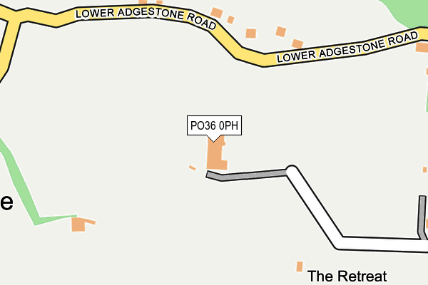
PO36 0PH is located in the Brading & St Helens electoral ward, within the unitary authority of Isle of Wight and the English Parliamentary constituency of Isle of Wight. The Sub Integrated Care Board (ICB) Location is NHS Hampshire and Isle of Wight ICB - D9Y0V and the police force is Hampshire. This postcode has been in use since February 1990.


GetTheData
Source: OS OpenMap – Local (Ordnance Survey)
Source: OS VectorMap District (Ordnance Survey)
Licence: Open Government Licence (requires attribution)
| Easting | 459957 |
| Northing | 86272 |
| Latitude | 50.673033 |
| Longitude | -1.152873 |
GetTheData
Source: Open Postcode Geo
Licence: Open Government Licence
| Country | England |
| Postcode District | PO36 |
➜ See where PO36 is on a map | |
GetTheData
Source: Land Registry Price Paid Data
Licence: Open Government Licence
Elevation or altitude of PO36 0PH as distance above sea level:
| Metres | Feet | |
|---|---|---|
| Elevation | 30m | 98ft |
Elevation is measured from the approximate centre of the postcode, to the nearest point on an OS contour line from OS Terrain 50, which has contour spacing of ten vertical metres.
➜ How high above sea level am I? Find the elevation of your current position using your device's GPS.
GetTheData
Source: Open Postcode Elevation
Licence: Open Government Licence
| Ward | Brading & St Helens |
| Constituency | Isle Of Wight |
GetTheData
Source: ONS Postcode Database
Licence: Open Government Licence
| Aylett Close (Morton Road) | Yarbridge | 478m |
| Aylett Close (Morton Road) | Yarbridge | 482m |
| Yarbridge Cross (Morton Road) | Yarbridge | 546m |
| Yarbridge Cross (New Road) | Yarbridge | 586m |
| New Road | Brading | 822m |
| Brading Station | 1.2km |
| Sandown Station | 1.9km |
| Lake (Isle of Wight) Station | 3.1km |
GetTheData
Source: NaPTAN
Licence: Open Government Licence
GetTheData
Source: ONS Postcode Database
Licence: Open Government Licence


➜ Get more ratings from the Food Standards Agency
GetTheData
Source: Food Standards Agency
Licence: FSA terms & conditions
| Last Collection | |||
|---|---|---|---|
| Location | Mon-Fri | Sat | Distance |
| Aylett Close | 16:30 | 10:30 | 471m |
| Yarbridge | 16:30 | 10:30 | 605m |
| Grove Farm | 14:45 | 11:00 | 712m |
GetTheData
Source: Dracos
Licence: Creative Commons Attribution-ShareAlike
The below table lists the International Territorial Level (ITL) codes (formerly Nomenclature of Territorial Units for Statistics (NUTS) codes) and Local Administrative Units (LAU) codes for PO36 0PH:
| ITL 1 Code | Name |
|---|---|
| TLJ | South East (England) |
| ITL 2 Code | Name |
| TLJ3 | Hampshire and Isle of Wight |
| ITL 3 Code | Name |
| TLJ34 | Isle of Wight |
| LAU 1 Code | Name |
| E06000046 | Isle of Wight |
GetTheData
Source: ONS Postcode Directory
Licence: Open Government Licence
The below table lists the Census Output Area (OA), Lower Layer Super Output Area (LSOA), and Middle Layer Super Output Area (MSOA) for PO36 0PH:
| Code | Name | |
|---|---|---|
| OA | E00087315 | |
| LSOA | E01017289 | Isle of Wight 014A |
| MSOA | E02003594 | Isle of Wight 014 |
GetTheData
Source: ONS Postcode Directory
Licence: Open Government Licence
| PO36 0HW | Lower Road | 173m |
| PO36 0PJ | Lower Adgestone Road | 320m |
| PO36 0ES | Upper Road | 372m |
| PO36 0EN | Morton Old Road | 373m |
| PO36 0HP | Hadrians Way | 411m |
| PO36 0EP | Morton Manor Road | 456m |
| PO36 0BH | Morton Road | 458m |
| PO36 0BJ | Morton Road | 461m |
| PO36 0EJ | Morton Road | 465m |
| PO36 0EW | Morton Old Road | 468m |
GetTheData
Source: Open Postcode Geo; Land Registry Price Paid Data
Licence: Open Government Licence