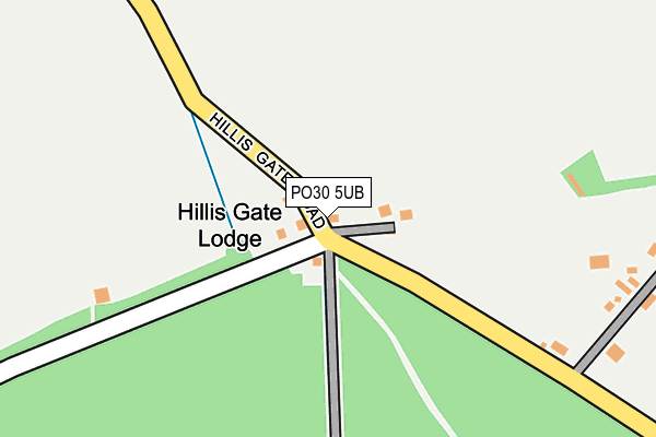
PO30 5UB lies on Hillis Gate Road in Newport. PO30 5UB is located in the Cowes South & Northwood electoral ward, within the unitary authority of Isle of Wight and the English Parliamentary constituency of Isle of Wight. The Sub Integrated Care Board (ICB) Location is NHS Hampshire and Isle of Wight ICB - D9Y0V and the police force is Hampshire. This postcode has been in use since January 1980.


GetTheData
Source: OS OpenMap – Local (Ordnance Survey)
Source: OS VectorMap District (Ordnance Survey)
Licence: Open Government Licence (requires attribution)
| Easting | 447483 |
| Northing | 92367 |
| Latitude | 50.728989 |
| Longitude | -1.328604 |
GetTheData
Source: Open Postcode Geo
Licence: Open Government Licence
| Street | Hillis Gate Road |
| Town/City | Newport |
| Country | England |
| Postcode District | PO30 |
➜ See where PO30 is on a map | |
GetTheData
Source: Land Registry Price Paid Data
Licence: Open Government Licence
Elevation or altitude of PO30 5UB as distance above sea level:
| Metres | Feet | |
|---|---|---|
| Elevation | 30m | 98ft |
Elevation is measured from the approximate centre of the postcode, to the nearest point on an OS contour line from OS Terrain 50, which has contour spacing of ten vertical metres.
➜ How high above sea level am I? Find the elevation of your current position using your device's GPS.
GetTheData
Source: Open Postcode Elevation
Licence: Open Government Licence
| Ward | Cowes South & Northwood |
| Constituency | Isle Of Wight |
GetTheData
Source: ONS Postcode Database
Licence: Open Government Licence
| Hillis Corner (Hillis Gate Road) | Hillisgate | 1,003m |
| Hillis Corner (Hillis Gate Road) | Hillisgate | 1,008m |
| Hillis Corner (Pallance Road) | Hillisgate | 1,106m |
| Hillis Corner (Rew Street) | Hillisgate | 1,131m |
| Pallance Road Bottom (Pallance Road) | Pallance Road | 1,191m |
GetTheData
Source: NaPTAN
Licence: Open Government Licence
| Percentage of properties with Next Generation Access | 100.0% |
| Percentage of properties with Superfast Broadband | 60.0% |
| Percentage of properties with Ultrafast Broadband | 0.0% |
| Percentage of properties with Full Fibre Broadband | 0.0% |
Superfast Broadband is between 30Mbps and 300Mbps
Ultrafast Broadband is > 300Mbps
| Median download speed | 25.0Mbps |
| Average download speed | 23.9Mbps |
| Maximum download speed | 39.45Mbps |
| Median upload speed | 2.7Mbps |
| Average upload speed | 3.7Mbps |
| Maximum upload speed | 6.59Mbps |
| Percentage of properties unable to receive 2Mbps | 0.0% |
| Percentage of properties unable to receive 5Mbps | 0.0% |
| Percentage of properties unable to receive 10Mbps | 0.0% |
| Percentage of properties unable to receive 30Mbps | 40.0% |
GetTheData
Source: Ofcom
Licence: Ofcom Terms of Use (requires attribution)
GetTheData
Source: ONS Postcode Database
Licence: Open Government Licence


➜ Get more ratings from the Food Standards Agency
GetTheData
Source: Food Standards Agency
Licence: FSA terms & conditions
| Last Collection | |||
|---|---|---|---|
| Location | Mon-Fri | Sat | Distance |
| Hillis Gate Road, Marks Corner | 16:00 | 07:00 | 15m |
| Pallance Road | 16:00 | 10:40 | 1,260m |
| Junction Newport Road Chawton | 16:00 | 10:15 | 1,665m |
GetTheData
Source: Dracos
Licence: Creative Commons Attribution-ShareAlike
The below table lists the International Territorial Level (ITL) codes (formerly Nomenclature of Territorial Units for Statistics (NUTS) codes) and Local Administrative Units (LAU) codes for PO30 5UB:
| ITL 1 Code | Name |
|---|---|
| TLJ | South East (England) |
| ITL 2 Code | Name |
| TLJ3 | Hampshire and Isle of Wight |
| ITL 3 Code | Name |
| TLJ34 | Isle of Wight |
| LAU 1 Code | Name |
| E06000046 | Isle of Wight |
GetTheData
Source: ONS Postcode Directory
Licence: Open Government Licence
The below table lists the Census Output Area (OA), Lower Layer Super Output Area (LSOA), and Middle Layer Super Output Area (MSOA) for PO30 5UB:
| Code | Name | |
|---|---|---|
| OA | E00087518 | |
| LSOA | E01017329 | Isle of Wight 002E |
| MSOA | E02003582 | Isle of Wight 002 |
GetTheData
Source: ONS Postcode Directory
Licence: Open Government Licence
| PO30 5UJ | Hillis Road | 40m |
| PO30 5UA | Pallance Gate | 269m |
| PO30 5UD | 610m | |
| PO30 5UH | Solent View | 780m |
| PO31 8NA | Hillis Gate Road | 834m |
| PO31 8LU | Pallance Lane | 971m |
| PO31 8LX | Pallance Road | 1106m |
| PO31 8LT | Pallance Lane | 1152m |
| PO31 8PX | Pallance Lane | 1202m |
| PO31 8PU | Wyatts Lane | 1302m |
GetTheData
Source: Open Postcode Geo; Land Registry Price Paid Data
Licence: Open Government Licence