PO20 7PZ maps, stats, and open data
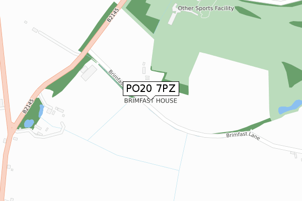
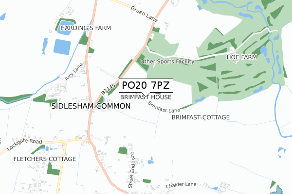
PO20 7PZ lies on Brimfast Lane in Sidlesham Common, Chichester. PO20 7PZ is located in the Sidlesham with Selsey North electoral ward, within the local authority district of Chichester and the English Parliamentary constituency of Chichester. The Sub Integrated Care Board (ICB) Location is NHS Sussex ICB - 70F and the police force is Sussex. This postcode has been in use since January 1980.
PO20 7PZ maps


Licence: Open Government Licence (requires attribution)
Attribution: Contains OS data © Crown copyright and database right 2025
Source: Open Postcode Geo
Licence: Open Government Licence (requires attribution)
Attribution: Contains OS data © Crown copyright and database right 2025; Contains Royal Mail data © Royal Mail copyright and database right 2025; Source: Office for National Statistics licensed under the Open Government Licence v.3.0
PO20 7PZ geodata
| Easting | 485520 |
| Northing | 99991 |
| Latitude | 50.793186 |
| Longitude | -0.788009 |
Where is PO20 7PZ?
| Street | Brimfast Lane |
| Locality | Sidlesham Common |
| Town/City | Chichester |
| Country | England |
| Postcode District | PO20 |
PO20 7PZ Elevation
Elevation or altitude of PO20 7PZ as distance above sea level:
| Metres | Feet | |
|---|---|---|
| Elevation | 10m | 33ft |
Elevation is measured from the approximate centre of the postcode, to the nearest point on an OS contour line from OS Terrain 50, which has contour spacing of ten vertical metres.
➜ How high above sea level am I? Find the elevation of your current position using your device's GPS.
Politics
| Ward | Sidlesham With Selsey North |
|---|---|
| Constituency | Chichester |
Transport
Nearest bus stops to PO20 7PZ
| Lockgate Road (Street End Road) | Sidlesham Common | 562m |
| Lockgate Road (Street End Road) | Sidlesham Common | 575m |
| Green Lane (B2145) | Hunston | 687m |
| Green Lane (B2145) | Hunston | 690m |
| The Anchor Ph (Street End Road) | Sidlesham Common | 915m |
Nearest railway stations to PO20 7PZ
| Chichester Station | 4.3km |
Broadband
Broadband access in PO20 7PZ (2020 data)
| Percentage of properties with Next Generation Access | 100.0% |
| Percentage of properties with Superfast Broadband | 20.0% |
| Percentage of properties with Ultrafast Broadband | 0.0% |
| Percentage of properties with Full Fibre Broadband | 0.0% |
Superfast Broadband is between 30Mbps and 300Mbps
Ultrafast Broadband is > 300Mbps
Broadband limitations in PO20 7PZ (2020 data)
| Percentage of properties unable to receive 2Mbps | 0.0% |
| Percentage of properties unable to receive 5Mbps | 0.0% |
| Percentage of properties unable to receive 10Mbps | 0.0% |
| Percentage of properties unable to receive 30Mbps | 80.0% |
Deprivation
55.7% of English postcodes are less deprived than PO20 7PZ:Food Standards Agency
Three nearest food hygiene ratings to PO20 7PZ (metres)


➜ Get more ratings from the Food Standards Agency
Nearest post box to PO20 7PZ
| Last Collection | |||
|---|---|---|---|
| Location | Mon-Fri | Sat | Distance |
| Sidlesham Common | 17:00 | 08:00 | 621m |
| Pelleys Lane Donnington | 16:00 | 07:15 | 1,889m |
| Highleigh Road Highleigh | 16:00 | 08:00 | 2,070m |
PO20 7PZ ITL and PO20 7PZ LAU
The below table lists the International Territorial Level (ITL) codes (formerly Nomenclature of Territorial Units for Statistics (NUTS) codes) and Local Administrative Units (LAU) codes for PO20 7PZ:
| ITL 1 Code | Name |
|---|---|
| TLJ | South East (England) |
| ITL 2 Code | Name |
| TLJ2 | Surrey, East and West Sussex |
| ITL 3 Code | Name |
| TLJ27 | West Sussex (South West) |
| LAU 1 Code | Name |
| E07000225 | Chichester |
PO20 7PZ census areas
The below table lists the Census Output Area (OA), Lower Layer Super Output Area (LSOA), and Middle Layer Super Output Area (MSOA) for PO20 7PZ:
| Code | Name | |
|---|---|---|
| OA | E00160808 | |
| LSOA | E01031529 | Chichester 013D |
| MSOA | E02006573 | Chichester 013 |
Nearest postcodes to PO20 7PZ
| PO20 7PY | Chichester Road | 498m |
| PO20 7QA | 511m | |
| PO20 7QE | Lockgate Road | 633m |
| PO20 7QD | Street End Road | 633m |
| PO20 7RG | Street End Lane | 660m |
| PO20 7PX | Jury Lane | 723m |
| PO20 7PU | Selsey Road | 784m |
| PO20 7RJ | Chalder Lane | 800m |
| PO20 1AX | 836m | |
| PO20 7RH | Church Lane | 888m |