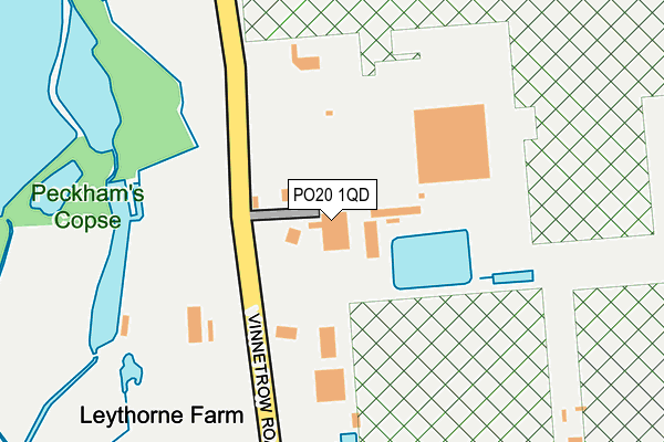
PO20 1QD is located in the North Mundham & Tangmere electoral ward, within the local authority district of Chichester and the English Parliamentary constituency of Chichester. The Sub Integrated Care Board (ICB) Location is NHS Sussex ICB - 70F and the police force is Sussex. This postcode has been in use since June 2002.


GetTheData
Source: OS OpenMap – Local (Ordnance Survey)
Source: OS VectorMap District (Ordnance Survey)
Licence: Open Government Licence (requires attribution)
| Easting | 488258 |
| Northing | 103169 |
| Latitude | 50.821338 |
| Longitude | -0.748390 |
GetTheData
Source: Open Postcode Geo
Licence: Open Government Licence
| Country | England |
| Postcode District | PO20 |
➜ See where PO20 is on a map | |
GetTheData
Source: Land Registry Price Paid Data
Licence: Open Government Licence
Elevation or altitude of PO20 1QD as distance above sea level:
| Metres | Feet | |
|---|---|---|
| Elevation | 10m | 33ft |
Elevation is measured from the approximate centre of the postcode, to the nearest point on an OS contour line from OS Terrain 50, which has contour spacing of ten vertical metres.
➜ How high above sea level am I? Find the elevation of your current position using your device's GPS.
GetTheData
Source: Open Postcode Elevation
Licence: Open Government Licence
| Ward | North Mundham & Tangmere |
| Constituency | Chichester |
GetTheData
Source: ONS Postcode Database
Licence: Open Government Licence
| Walnut Tree Inn (Lagness Road) | Runcton | 727m |
| Walnut Tree Inn (Lagness Road) | Runcton | 742m |
| Merston Turn (Marsh Lane) | Runcton | 805m |
| Merston Turn (Pagham Road) | Runcton | 820m |
| King's Head (Bognor Road) | Merston | 880m |
| Chichester Station | 2.6km |
| Fishbourne Station | 5.1km |
GetTheData
Source: NaPTAN
Licence: Open Government Licence
| Percentage of properties with Next Generation Access | 100.0% |
| Percentage of properties with Superfast Broadband | 100.0% |
| Percentage of properties with Ultrafast Broadband | 0.0% |
| Percentage of properties with Full Fibre Broadband | 0.0% |
Superfast Broadband is between 30Mbps and 300Mbps
Ultrafast Broadband is > 300Mbps
| Percentage of properties unable to receive 2Mbps | 0.0% |
| Percentage of properties unable to receive 5Mbps | 0.0% |
| Percentage of properties unable to receive 10Mbps | 0.0% |
| Percentage of properties unable to receive 30Mbps | 0.0% |
GetTheData
Source: Ofcom
Licence: Ofcom Terms of Use (requires attribution)
GetTheData
Source: ONS Postcode Database
Licence: Open Government Licence


➜ Get more ratings from the Food Standards Agency
GetTheData
Source: Food Standards Agency
Licence: FSA terms & conditions
| Last Collection | |||
|---|---|---|---|
| Location | Mon-Fri | Sat | Distance |
| Kings Head Pub | 16:00 | 07:15 | 835m |
| Brookside Runcton | 16:30 | 08:00 | 959m |
| Quarry Lane | 17:20 | 11:45 | 1,181m |
GetTheData
Source: Dracos
Licence: Creative Commons Attribution-ShareAlike
The below table lists the International Territorial Level (ITL) codes (formerly Nomenclature of Territorial Units for Statistics (NUTS) codes) and Local Administrative Units (LAU) codes for PO20 1QD:
| ITL 1 Code | Name |
|---|---|
| TLJ | South East (England) |
| ITL 2 Code | Name |
| TLJ2 | Surrey, East and West Sussex |
| ITL 3 Code | Name |
| TLJ27 | West Sussex (South West) |
| LAU 1 Code | Name |
| E07000225 | Chichester |
GetTheData
Source: ONS Postcode Directory
Licence: Open Government Licence
The below table lists the Census Output Area (OA), Lower Layer Super Output Area (LSOA), and Middle Layer Super Output Area (MSOA) for PO20 1QD:
| Code | Name | |
|---|---|---|
| OA | E00160719 | |
| LSOA | E01031513 | Chichester 012C |
| MSOA | E02006572 | Chichester 012 |
GetTheData
Source: ONS Postcode Directory
Licence: Open Government Licence
| PO20 1QH | Vinnetrow Road | 300m |
| PO20 1NW | Chichester Food Park | 442m |
| PO20 1QB | Vinnetrow Road | 563m |
| PO20 1LH | Green Lane | 605m |
| PO20 1LB | Peckhams Copse Lane | 675m |
| PO20 1QA | Lagness Road | 715m |
| PO20 1LD | Lagness Road | 724m |
| PO20 1LQ | Marsh Lane | 733m |
| PO20 1AA | Mill Lane | 756m |
| PO20 1EQ | Green Lane | 778m |
GetTheData
Source: Open Postcode Geo; Land Registry Price Paid Data
Licence: Open Government Licence