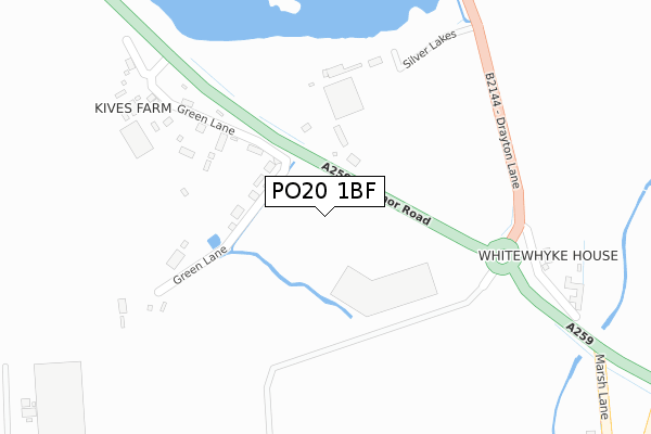
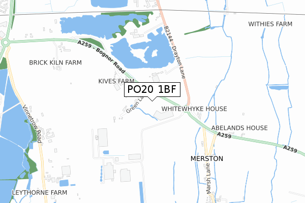
PO20 1BF is located in the North Mundham & Tangmere electoral ward, within the local authority district of Chichester and the English Parliamentary constituency of Chichester. The Sub Integrated Care Board (ICB) Location is NHS Sussex ICB - 70F and the police force is Sussex. This postcode has been in use since April 2019.


GetTheData
Source: OS Open Zoomstack (Ordnance Survey)
Licence: Open Government Licence (requires attribution)
Attribution: Contains OS data © Crown copyright and database right 2024
Source: Open Postcode Geo
Licence: Open Government Licence (requires attribution)
Attribution: Contains OS data © Crown copyright and database right 2024; Contains Royal Mail data © Royal Mail copyright and database right 2024; Source: Office for National Statistics licensed under the Open Government Licence v.3.0
| Easting | 489088 |
| Northing | 103542 |
| Latitude | 50.824565 |
| Longitude | -0.736519 |
GetTheData
Source: Open Postcode Geo
Licence: Open Government Licence
| Country | England |
| Postcode District | PO20 |
| ➜ PO20 open data dashboard ➜ See where PO20 is on a map | |
GetTheData
Source: Land Registry Price Paid Data
Licence: Open Government Licence
| Ward | North Mundham & Tangmere |
| Constituency | Chichester |
GetTheData
Source: ONS Postcode Database
Licence: Open Government Licence
| June 2022 | Violence and sexual offences | On or near Silver Lakes | 389m |
| May 2022 | Other theft | On or near Green Lane | 351m |
| May 2022 | Shoplifting | On or near Silver Lakes | 389m |
| ➜ Get more crime data in our Crime section | |||
GetTheData
Source: data.police.uk
Licence: Open Government Licence
| Corner (Chichester Road) | Merston | 319m |
| King's Head (Bognor Road) | Merston | 369m |
| Corner (Chichester Road) | Merston | 466m |
| King's Head (Bognor Road) | Merston | 523m |
| Wscc Depot (Drayton Lane) | Drayton | 982m |
| Chichester Station | 3.3km |
| Bognor Regis Station | 6km |
GetTheData
Source: NaPTAN
Licence: Open Government Licence
GetTheData
Source: ONS Postcode Database
Licence: Open Government Licence


➜ Get more ratings from the Food Standards Agency
GetTheData
Source: Food Standards Agency
Licence: FSA terms & conditions
| Last Collection | |||
|---|---|---|---|
| Location | Mon-Fri | Sat | Distance |
| Kings Head Pub | 16:00 | 07:15 | 496m |
| Merston House | 16:10 | 08:00 | 774m |
| Brookside Runcton | 16:30 | 08:00 | 1,548m |
GetTheData
Source: Dracos
Licence: Creative Commons Attribution-ShareAlike
| Facility | Distance |
|---|---|
| North Mundham Playing Field School Lane, North Mundham Grass Pitches, Outdoor Tennis Courts | 1.7km |
| Westbourne House Boarding School Coach Road, Shopwhyke, Chichester Sports Hall, Swimming Pool, Artificial Grass Pitch, Squash Courts, Studio, Grass Pitches, Outdoor Tennis Courts | 1.9km |
| Highfield Lane Recreation Ground (Closed) Highfield Lane, Oving, Chichester Grass Pitches | 1.9km |
GetTheData
Source: Active Places
Licence: Open Government Licence
| School | Phase of Education | Distance |
|---|---|---|
| North Mundham Primary School School Lane, North Mundham, Chichester, PO20 1LA | Primary | 1.9km |
| Westbourne House School Coach Road, Shopwyke, Chichester, PO20 2BH | Not applicable | 1.9km |
| Rumboldswhyke CofE Primary School Rumbolds Close, Chichester, PO19 7UA | Primary | 2.1km |
GetTheData
Source: Edubase
Licence: Open Government Licence
The below table lists the International Territorial Level (ITL) codes (formerly Nomenclature of Territorial Units for Statistics (NUTS) codes) and Local Administrative Units (LAU) codes for PO20 1BF:
| ITL 1 Code | Name |
|---|---|
| TLJ | South East (England) |
| ITL 2 Code | Name |
| TLJ2 | Surrey, East and West Sussex |
| ITL 3 Code | Name |
| TLJ27 | West Sussex (South West) |
| LAU 1 Code | Name |
| E07000225 | Chichester |
GetTheData
Source: ONS Postcode Directory
Licence: Open Government Licence
The below table lists the Census Output Area (OA), Lower Layer Super Output Area (LSOA), and Middle Layer Super Output Area (MSOA) for PO20 1BF:
| Code | Name | |
|---|---|---|
| OA | E00160721 | |
| LSOA | E01031513 | Chichester 012C |
| MSOA | E02006572 | Chichester 012 |
GetTheData
Source: ONS Postcode Directory
Licence: Open Government Licence
| PO20 1EQ | Green Lane | 261m |
| PO20 1EG | Bognor Road | 283m |
| PO20 1EF | 403m | |
| PO20 1EH | Bognor Road | 410m |
| PO20 1NW | Chichester Food Park | 529m |
| PO20 1DY | 572m | |
| PO20 1ED | 825m | |
| PO20 1EE | Manor Cottages | 895m |
| PO20 1QH | Vinnetrow Road | 1001m |
| PO20 2GL | 1022m |
GetTheData
Source: Open Postcode Geo; Land Registry Price Paid Data
Licence: Open Government Licence