Highfield Lane Recreation Ground (Closed) - Oving
Highfield Lane Recreation Ground (Closed) is located in Oving, Chichester (PO20).
| Address | Highfield Lane, Oving, Chichester, PO20 2DL |
| Car Park | Yes |
| Car Park Capacity | 11 |
| Management Type | Local Authority (in house) |
| Management Group | Local Authority |
| Owner Type | Local Authority |
| Owner Group | Local Authority |
| Education Phase | Not Known |
| Closure Date | 1st Jan 2005 |
| Closure Reason | Unclassified |
Facilities
| Closure Date | 1st Jan 2005 |
| Closure Reason | Unclassified |
| Accessibility | Free Public Access |
| Management Type | Not Known |
| Changing Rooms | No |
| Date Record Checked | 21st Feb 2011 |
| Opening Times | Detailed Timings |
Facility specifics
Contact
Where is Highfield Lane Recreation Ground (Closed)?
| Sub Building Name | |
| Building Name | |
| Building Number | 0 |
| Dependent Thoroughfare | |
| Thoroughfare Name | Highfield Lane |
| Double Dependent Locality | |
| Dependent Locality | Oving |
| PostTown | Chichester |
| Postcode | PO20 2DL |
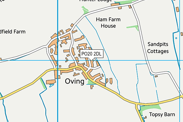
Highfield Lane Recreation Ground (Closed) on a map

Highfield Lane Recreation Ground (Closed) geodata
| Easting | 490364 |
| Northing | 104944 |
| Latitude | 50.836981 |
| Longitude | -0.718082 |
| Local Authority Name | Chichester |
| Local Authority Code | E07000225 |
| Parliamentary Constituency Name | Chichester |
| Parliamentary Constituency Code | E14000633 |
| Region Name | South East |
| Region Code | E15000008 |
| Ward Name | North Mundham & Tangmere |
| Ward Code | E05011680 |
| Output Area Code | E00160720 |
About this data
This data is open data sourced from Active Places Power and licenced under the Active Places Open Data Licence.
| Created On | 28th Sep 2005 |
| Audited On | 26th Jan 2015 |
| Checked On | 21st Feb 2011 |
