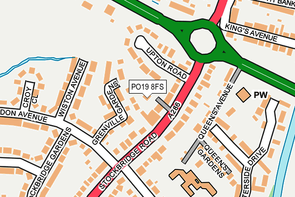
PO19 8FS is located in the Harbour Villages electoral ward, within the local authority district of Chichester and the English Parliamentary constituency of Chichester. The Sub Integrated Care Board (ICB) Location is NHS Sussex ICB - 70F and the police force is Sussex. This postcode has been in use since October 2016.


GetTheData
Source: OS OpenMap – Local (Ordnance Survey)
Source: OS VectorMap District (Ordnance Survey)
Licence: Open Government Licence (requires attribution)
| Easting | 485613 |
| Northing | 103725 |
| Latitude | 50.826734 |
| Longitude | -0.785801 |
GetTheData
Source: Open Postcode Geo
Licence: Open Government Licence
| Country | England |
| Postcode District | PO19 |
➜ See where PO19 is on a map ➜ Where is Chichester? | |
GetTheData
Source: Land Registry Price Paid Data
Licence: Open Government Licence
Elevation or altitude of PO19 8FS as distance above sea level:
| Metres | Feet | |
|---|---|---|
| Elevation | 10m | 33ft |
Elevation is measured from the approximate centre of the postcode, to the nearest point on an OS contour line from OS Terrain 50, which has contour spacing of ten vertical metres.
➜ How high above sea level am I? Find the elevation of your current position using your device's GPS.
GetTheData
Source: Open Postcode Elevation
Licence: Open Government Licence
| Ward | Harbour Villages |
| Constituency | Chichester |
GetTheData
Source: ONS Postcode Database
Licence: Open Government Licence
| Grosvenor Road (Stockbridge Road) | Stockbridge | 122m |
| Grosvenor Road (Stockbridge Road) | Stockbridge | 167m |
| South Bank (Stockbridge Road) | Chichester | 287m |
| South Bank (Stockbridge Road) | Chichester | 339m |
| Chichester Gate | Chichester | 353m |
| Chichester Station | 0.7km |
| Fishbourne Station | 2.5km |
| Bosham Station | 4.7km |
GetTheData
Source: NaPTAN
Licence: Open Government Licence
| Percentage of properties with Next Generation Access | 100.0% |
| Percentage of properties with Superfast Broadband | 100.0% |
| Percentage of properties with Ultrafast Broadband | 0.0% |
| Percentage of properties with Full Fibre Broadband | 0.0% |
Superfast Broadband is between 30Mbps and 300Mbps
Ultrafast Broadband is > 300Mbps
| Percentage of properties unable to receive 2Mbps | 0.0% |
| Percentage of properties unable to receive 5Mbps | 0.0% |
| Percentage of properties unable to receive 10Mbps | 0.0% |
| Percentage of properties unable to receive 30Mbps | 0.0% |
GetTheData
Source: Ofcom
Licence: Ofcom Terms of Use (requires attribution)
GetTheData
Source: ONS Postcode Database
Licence: Open Government Licence


➜ Get more ratings from the Food Standards Agency
GetTheData
Source: Food Standards Agency
Licence: FSA terms & conditions
| Last Collection | |||
|---|---|---|---|
| Location | Mon-Fri | Sat | Distance |
| Stockbridge Gardens | 18:30 | 12:40 | 153m |
| Birdham Road | 17:20 | 12:45 | 368m |
| Chichester Delivery Office | 19:00 | 12:45 | 565m |
GetTheData
Source: Dracos
Licence: Creative Commons Attribution-ShareAlike
The below table lists the International Territorial Level (ITL) codes (formerly Nomenclature of Territorial Units for Statistics (NUTS) codes) and Local Administrative Units (LAU) codes for PO19 8FS:
| ITL 1 Code | Name |
|---|---|
| TLJ | South East (England) |
| ITL 2 Code | Name |
| TLJ2 | Surrey, East and West Sussex |
| ITL 3 Code | Name |
| TLJ27 | West Sussex (South West) |
| LAU 1 Code | Name |
| E07000225 | Chichester |
GetTheData
Source: ONS Postcode Directory
Licence: Open Government Licence
The below table lists the Census Output Area (OA), Lower Layer Super Output Area (LSOA), and Middle Layer Super Output Area (MSOA) for PO19 8FS:
| Code | Name | |
|---|---|---|
| OA | E00160625 | |
| LSOA | E01031496 | Chichester 011C |
| MSOA | E02006571 | Chichester 011 |
GetTheData
Source: ONS Postcode Directory
Licence: Open Government Licence
| PO19 8XB | Grenville Gardens | 54m |
| PO19 8QF | Stockbridge Road | 55m |
| PO19 8QJ | Stockbridge Road | 72m |
| PO19 8QQ | Upton Road | 74m |
| PO19 8QE | Stockbridge Road | 93m |
| PO19 8QG | Stockbridge Road | 96m |
| PO19 8QB | Queens Avenue | 123m |
| PO19 8RJ | Wiston Avenue | 130m |
| PO19 8QW | Stockbridge Road | 131m |
| PO19 8RL | Stockbridge Gardens | 139m |
GetTheData
Source: Open Postcode Geo; Land Registry Price Paid Data
Licence: Open Government Licence